HIT BY CYCLONES, SALT FARMERS LOOK TO GOVT. FOR HELP TILL MAY 30
15, May 2019
Prelims level : Geography
Mains level : GS-I History, Indian heritage and culture, Geography and Society
Why in News?
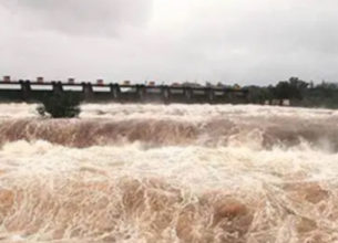
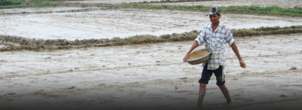
- Several salt farmers have been facing untold miseries with about 600 manufacturing units suffering damage due to cyclonic storms Titli and Fani.
Details:
- The authorities concerned have not taken up enumeration of the losses.
- Around 250 farmers lost their livelihood and urged the State and Central governments to come to their rescue.
- The government has assured that a delegation of the association would go to New Delhi very soon to explain their grievances and fixation of compensation for the units which were damaged during the two cyclones.
Fani Cyclone:
Tropical Cyclones:
- Cyclones are formed over slightly warm ocean waters.
- It depends on the temperature of the top layer of the sea, up to a depth of about 60 metres. This has to be at least 28°C to support the formation of a cyclone.
- This explains why the April-May and October-December periods are conducive for cyclones. Secondly, the low level of air above the waters needs to have an ‘anticlockwise’ rotation in the northern hemisphere and vice versa.
- During these periods, there lies the Inter-Tropical Convergence Zone (ITCZ) (a low pressure zone) in the Bay of Bengal region, which shifts with seasons.
- The southern boundary of the zone experiences winds from west to east and the northern boundary from east to west. The ITCZ and the resultant wind pattern induce the anticlockwise rotation of air.
- Once formed, cyclones in this area usually move northwest.
- As it travels over the sea, the cyclone gathers more moist air from the warm sea, and adds to its strength.
How and why is Fani different?
Tropical cyclones in the Bay of Bengal are graded according to maximum wind
speeds at their centre as follows:
- 1.Depressions – 30 to 60 km per hour (kph)
- 2. Cyclonic storms – 61 to 88 kph
- 3. Severe cyclonic storms – 89 to 117 kph
- 4. Very severe cyclonic storms – 118 to 166 kph
- 5. Extremely severe cyclonic storms – 167 to 221 kph
- 6. Super cyclones – 222 kph or higher
- Fani is now categorised as an “extremely severe cyclone”.
- It is expected to generate storms with wind speeds as high as 200 km per hour.
- It has the potential to cause widespread damage in Odisha and neighbouring states.
- Given the above discussed reasons, a cyclone of this nature is unusual for April-May cyclones in India.
- Fani is different mainly on account of its place of origin, and the route it has taken.
- Origin – The in situ cyclonic systems in the Bay of Bengal usually originate around latitude 10° N (in line with Chennai).
- But Fani originated quite close to the Equator, around latitude 2° N, well below the Sri Lankan landmass.
- The forecast landfall on the Odisha coast is at a latitude of almost 20°N.
- As it has originated very close to the Equator, it has taken a long route to reach the landmass.
- Resultantly, it has traversed a long way on the sea, and thus gained more strength. Route – Fani was initially headed north-westwards, towards the Tamil Nadu coast.
- But it changed its course midway and moved northeast away from the coastline to reach Odisha.
- The recurve it has taken gave it more time over the sea and has ensured that it has gathered unusual strength.