

16 SEISMOMETERS DEFUNCT IN EARTHQUAKE-PRONE ZONES
04, Dec 2019
Prelims level : Indian Geography
Mains level : GS-I Important Geographical Phenomena such as Earth Quake
Why in News?
- At least 20 out of 35 seismometers in Maharashtra are lying in a state of disrepair, and 16 of these are located in seismic zones III and IV.
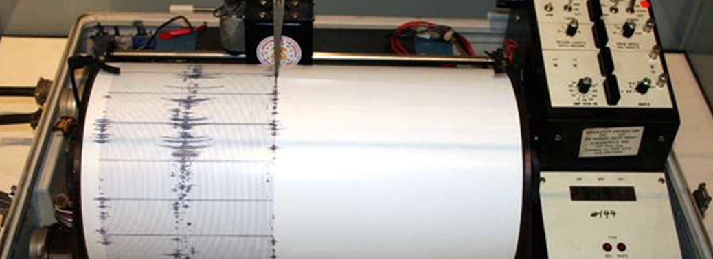
Seismometers:
- A seismometer is an instrument used to measure and record earthquakes.
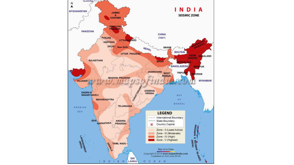
Seismic Zones in India:
- Over 59 % of India’s land area is under threat of moderate to severe earthquakes.
- The zones are divided on the basis of Modified Mercalli (MM) intensity, which measures the impact of earthquakes.
Earthquake-Prone-Zones-in-India-2:
- The bureau of Indian standards is the official agency for publishing the seismic hazard maps and codes. Bureau of Indian Standards grouped India into four seismic zones, viz. Zone II, III, IV and V.
- Zone – V (highest seismic activity zone): Entire north-eastern India, parts of Jammu and Kashmir, Himachal Pradesh, Uttaranchal, Rann of Kutch, part of North Bihar and Andaman & Nicobar Islands.
- Zone – IV (high seismic zone): Parts of Jammu and Kashmir and Himachal Pradesh, Delhi, Sikkim, Northern Parts of Uttar Pradesh, Bihar and West Bengal, parts of Gujarat and small portions of Maharashtra near the west coast and Rajasthan.
- Zone – III (moderate seismic zone.): Kerala, Goa, Lakshadweep islands, remaining parts of Uttar Pradesh, Gujarat and West Bengal, Parts of Punjab, Rajasthan, Madhya Pradesh, Bihar, Jharkhand, Chhattisgarh, Maharashtra, Orissa, Andhra Pradesh, TamilNadu and Karnataka.
- Zone – II (least active seismic zone): Remaining parts of India.
Significance of India’s Seismic Zoning Map:
- It is mainly used by the Department of Disaster Management of the different state governments. It also helps them in planning for a natural disaster like earthquake.
- An Indian seismic zoning map assists one in identifying the lowest, moderate as well as highest hazardous or earthquake prone areas in India. Even such maps are looked into before constructing any high rise building so as to check the level of seismology in any particular area.
North Indian Plate:
- Indian tectonic plate broke off from an ancient supercontinent called Gondwana 100 million years ago.
- The Indian plate skewed north and slammed into the Eurasian plate, creating the Himalayas.
- India still moves northeast into Eurasian plate at roughly 5 cm every year. About 60% of India is vulnerable to earthquakes caused by northward grind of the Indian subcontinental landmass.


