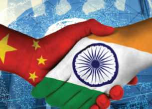
INDIA- CHINA BORDER DISPUTE
14, May 2020
Prelims level : Places in News
Mains level : GS-II India and its neighbourhood- relations.
Why in News?
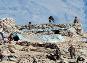
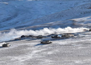
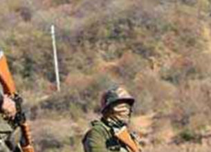
- Rekindling tensions over boundary claims, Indian and Chinese troops have clashed at two points along the Line of Actual Control (LAC) recently, leaving personnel injured on both sides.
What’s the Issue?
- The incidents took place in the Naku La sector and in a contested area near Pangong Tso, a lake in Ladakh.
- But the Army played down the two incidents as “temporary and short-duration face-offs” that were resolved by “local commanders as per mutually-accepted protocols” through dialogue and flag meetings. These kinds of incidents do occur as boundaries are not resolved.
- Where is Naku La?
- Naku La sector is a pass at a height of more than 5,000 metres above Mean Sea Level (MSL) in the state of Sikkim.
- It is located ahead of Muguthang or Cho Lhamu (source of River Teesta).
- The other passes located in the state of Sikkim are Nathu La Pass and Jelep La Pass.
- Pangong Tso Lake:
- It is a 135-km long lake, located in the Himalayas at the height of approximately 4,350 m, stretches out from India to China.
- One-third of water body, its 45 km stretch, is in Indian control while the rest of the 90 km is under Chinese control.
- It is formed from Tethys geosyncline.
- It is a salt water lake.
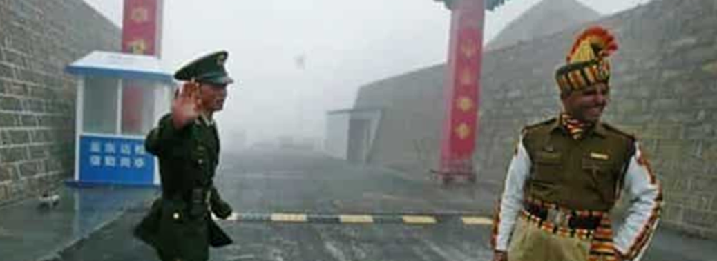
India- China Border:
- India and China share a 3,488 km long boundary. Unfortunately, the entire boundary is disputed. The line, which delineates the boundary between the two countries, is popularly called the McMahon line, after its author Sir Henry McMahon.
- In 1913, the British-India government had called a tripartite conference, in which the boundary between India and Tibet was formalized after a discussion between the Indian and the Tibetans. A Convention was adopted, which resulted in the delimitation of the Indo-Tibetan boundary. This boundary is, however, disputed by China which terms it as illegal.
- In 1957, China occupied Aksai Chin and built a road through it. This episode was followed by intermittent clashes along the border, which finally culminated in the border war of 1962. The boundary, which came into existence after the war, came to be known as Line of Actual Control (LAC). It is a military held line.
Attempts to Resolve the Issue:
- The rapprochement between the two countries in 1976 enabled India and China to initiate High Level border talks in 1981 to find a solution to the vexed problem. After eight rounds, the talks broke down in 1987.
- In 1988, following Prime Minister Rajiv Gandhi’s visit to China, the Joint Working Group (JWG) was set up to look into the border problem.
- In 1993, the Agreement on the Maintenance of Peace and Tranquillity along the Line of Actual Control (LAC) was signed and the India-China Expert Group of Diplomatic and Military Officers was set up to assist the JWG.
- In 1996, the Agreement on Confidence Building Measures (CBMs) in the Military Field along the LAC was signed.
- In 2003, two special representatives (one each from India and China) were appointed to find a political solution to the border dispute.
- Till 2009, these two special representatives had held 17 rounds of talks, but it seems they have not made much headway.
- Recently, NSA Ajit Doval was Appointed as Special Envoy for Talks.