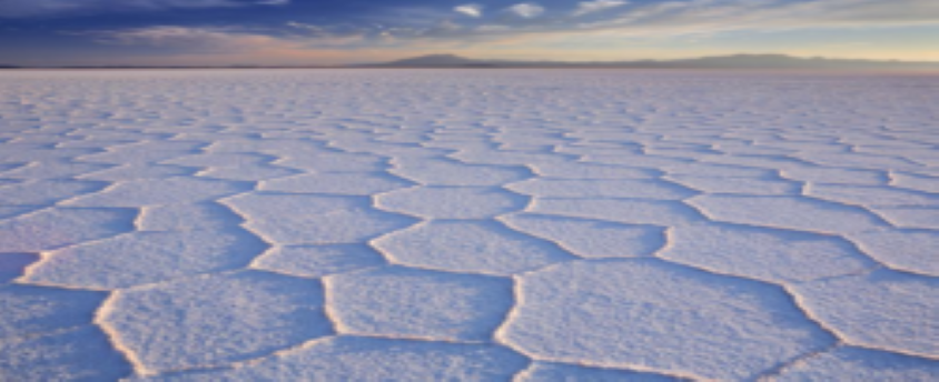
Salt flats
08, Mar 2023

Prelims level : Environment
Mains level : GS-I Indian Geography - Salient features of world’s physical geography.
Why in News?
- A recent study has finally provided an explanation as to why salt flats around the world have similar patterns of pentagons and hexagons on their ridges.
Salt flats:
- Salt flats refer to those natural landscapes which include a large area of flat land covered by salt.
- Salt flats are formed from natural water bodies whose recharge rate is lower than the evaporation rate.
- Due to the lower recharge rate, the water evaporates leaving behind dissolved minerals such as salts.
- Salt flats reflect sunlight strongly and hence appear bright.
- The underlying soil in these regions is highly saline and the groundwater is too salty for human consumption.
- Some of the world’s most well-known salt flats are Salar de Uyuni in Bolivia (the largest in the world), Rann of Kutch in India, Salar de Atacama in Chile, Salt desert of Sirjan in Iran, Tunisian salt lakes such as Chott El-Jarid, and Bonneville Salt Flats in the USA.
- A recent study has used a combination of ground sampling and computer models to explain the way salt flows up and down in the soil below the salt flats.
- As per the study, the salt on the surface is influenced by the salt flowing through the soil below.
- The groundwater in the soils of such landscapes is known to be saline but the distribution of salt is not uniform as the salinity is highest near the top of the soil and decreases towards the bottom.
- Salt flats have a significant impact on humans and the climate.
- Winds that blow over such salt flats can carry the salt with them as particulate matter and deposit them over oceans as the air mass reaches the ocean.
- Such sea salt can enter the atmosphere and go on to swirl at the centre of cyclones.
- Additionally, salt flats are large sources of particulate matter.
- Salt suspensions are also an important group of aerosols that reflect sunlight.


