Tonga Volcanic Eruption
22, Nov 2022
Prelims level : Geomorphology
Mains level : GS-III Important Geophysical Phenomena Such as Earth Quakes, Tsunami, Volcanic Activity, Cyclone Etc., Geographical features and their Locations-Changes in Critical Geographical Features (Including Water Bodies and Ice Caps) and In Flora and Fauna and the Effects of Such Changes.
Why in News?
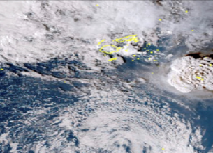
- Tonga Eruption Seabed Mapping Project (TESMaP) has said that the eruption of the Hunga-Tonga-Hunga-Ha’apai volcano on 15 January 2022 was the largest recorded since the eruption of Krakatoa in 1883 (Indonesia).
About the News:
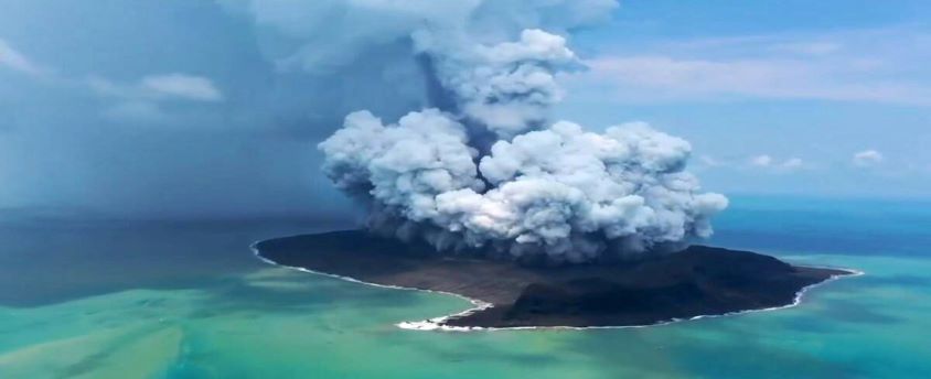
- It is an Undersea Volcanic Eruption consisting of two small uninhabited islands, Hunga-Ha’apai and Hunga-Tonga.
- The Tonga Islands occur along the Ring of Fire—a perimeter of heightened volcanic and seismic activity that encircles the Pacific Ocean basin.
Impacts:
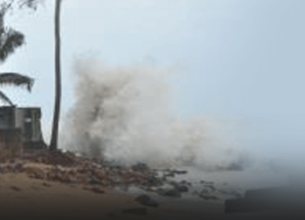
- Atmosphere: It sent ash and water vapour halfway to space, and generated tsunami waves across the globe.
- On the seafloor: It is scoured and sculpted by violent debris flows out to a distance of over 80km.
- Pyroclastic density currents: Hot lava when comes in contact with cold water of the ocean creates water vapour at very high temperatures. This creates a frictionless steam cushion on which lawa could flow at very high speed and to a very far distance.
Four ways water is displaced due to underwater volcano (thus causing tsunami):
- By the density flows pushing the water out of the way
- Through the explosive force of the eruption also pushes on the water
- As a result of the dramatic collapse of the caldera floor (it dropped by 700m in the case of Tonga Volcano). By pressure waves from the atmospheric blast acting on the sea surface.
What is the Ring of Fire?
- The Ring of Fire is a Pacific region home to over 450 volcanoes, including three of the world’s four most active volcanoes – Mount St. Helens in the USA, Mount Fuji in Japan and Mount Pinatubo in the Philippines. It is also sometimes called the circum-Pacific belt.
- Around 90% of the world’s earthquakes occur in the Ring of Fire, and 80% of the world’s largest earthquakes.
Location:
- It stretches along the Pacific Ocean coastlines, where the Pacific Plate grinds against other, smaller tectonic plates that form the Earth’s crust – such as the Philippine Sea plate and the Cocos and Nazca Plates that line the edge of the Pacific Ocean.
- The 40,000 kilometre horse-shoe-shaped ring loops from New Zealand to Chile, passing through the coasts of Asia and the Americas on the way.
Risk:
- The people most at risk from activity in the Ring of Fire are in the US west coast, Chile, Japan and island nations including the Solomon Islands.
- These areas are most at risk because they lie on so-called subduction zones – which are boundaries that mark the collision between two of the planet’s tectonic plates.
How was the Ring of Fire formed?
- The Ring of Fire is the result from subduction of oceanic tectonic plates beneath lighter continental plates. The area where these tectonic plates meet is called a subduction zone.
Why does the Ring of Fire trigger earthquakes?
- The world’s deepest earthquakes happen in subduction zone areas as tectonic plates scrape against each other – and the Ring of Fire has the world’s biggest concentration of subduction zones.
- As energy is released from the earth’s molten core, it forces tectonic plates to move and they crash up against each other, causing friction.
- The friction causes a build-up of energy and when this energy is finally released it causes an earthquake. If this happens at sea it can cause devastating tsunamis.
- Tectonic plates usually only move on average a few centimetres each year, but when an earthquake strikes, they speed up massively and can move at several metres per second.