

KAILASH MANSAROVAR LINK ROAD
12, May 2020
Prelims level : Infrastructure Road, inland, Railway aviation, Housing, Rural & Urban
Mains level : GS-III Infrastructure: Energy, Ports, Roads, Airports, Railways, etc.
Why in News?
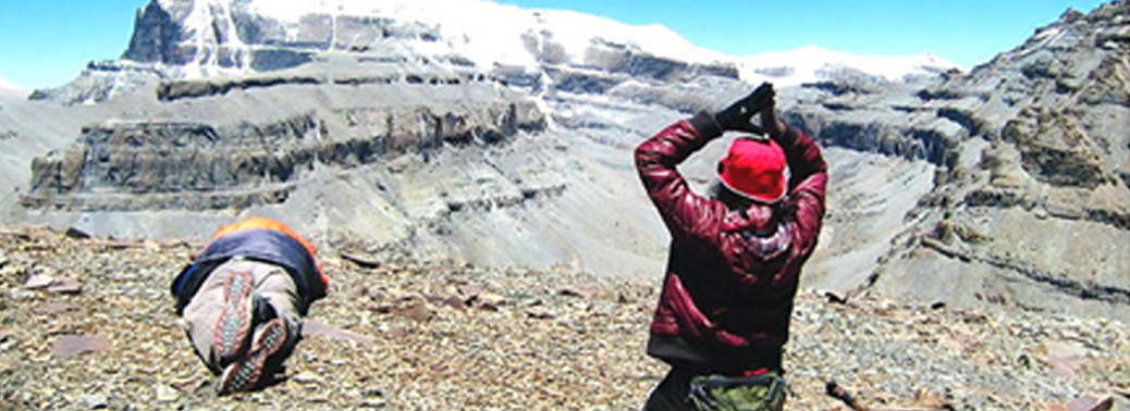
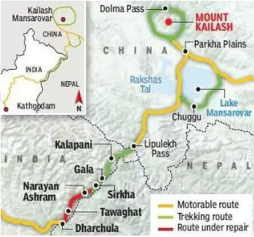
- Recently, Nepal has strongly objected to the newly inaugurated link road which connects Pithoragarh, Uttarkhand to Lipulekh pass, China border significantly reducing the time of Kailash Mansarovar Yatra.
Highlights:
- Nepal claims the territory at the Lipulekh pass around 400 sq km area east of Kali river in the tri-junction of Nepal, Tibet and India, through which the road passes as its own.
- It referred to the 2014 agreement between Prime Ministers of both countries, for Foreign Secretaries to work out the “outstanding boundary issues” on Kalapani where Lipulekh lies and Susta bordering Bihar.
- The unilateral decision to build a road there, is a breach of the 2014 agreement.
- Nepal has the maps during the 1816 Sugauli treaty and other complementing treaties that followed, fixing that Limpiadhura, Kalapani and Lipulekh were shown east of Kali river and part of Nepal.
- These arrangements were made following Nepal’s war with the British due to which Nepal had to cede a large part of territory which currently forms the present Uttarakhand.
- Nepal seeks to question China and India because both had signed an agreement in May 2015 to develop Lipulekh as a commercial passage without consulting Nepal which majorly affected the triangulation of the countries.
About India’s Stand:
- According to the External Affairs minister, the road going through Pithoragarh lies Completely within the Territory of India.
- It is the pre-existing route used by the pilgrims of the Kailash Mansarovar Yatra which has been made pliable for the ease and convenience of Pilgrims, Locals and Traders, under the Present Project.
- India held that the boundary delineation exercise with Nepal is in process and it is committed to resolving outstanding boundary issues through Diplomatic Dialogue.
Other Issues between Indian and Nepal:
- Nepal protested against the publication of Indian maps that included the Kalapani area.
- India rejected Nepal’s contention, asserting that the map accurately depicts the sovereign territory of India.
- Both nations are in the process of scheduling foreign secretary-level talks, which will be held once dates are finalised after the two governments have successfully dealt with the challenge of Covid-19.
About Kali River:
- It is also known as Sharda river or Kali Ganga in Uttarakhand.
- It joins Ghagra river in Uttar Pradesh, which is a tributary of Ganga.
- Its river projects are Tanakpur hydro-electric project, Chameliya hydro-electric project, Sharda Barrage.
About Lipulekh Pass:
- It is also known as Lipu-Lekh Pass/Qiangla or Tri-Corner is a high altitude mountain pass situated in the western Himalayas with a height of 5,334 metre or 17,500 feet.
- It is an International mountain pass between India, China and Nepal.


