Category: Geography of India
Inter-State Water Dispute
28, Apr 2023
Why in News?
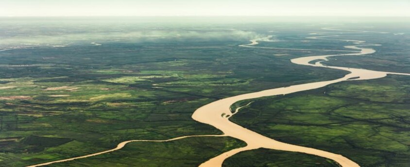
- Odisha has complained to the Ministry of Jal Shakti under the Inter-State River Water Disputes (ISRWD) Act 1956 accusing Chhattisgarh of misleading the Mahanadi Water Disputes Tribunal (MWDT) by releasing water in Mahanadi river in the Non-Monsoon Season.
About the News:
- The MWDT was formed in March 2018. The tribunal has been asked to submit its report by December 2025 by the Ministry of Jal Shakti.
- There is no inter-state agreement between Odisha and Chhattisgarh regarding Mahanadi basin water allocation.
What is the Concern of Odisha?
- Chhattisgarh has opened 20 gates at Kalma Barrage through which 1,000-1,500 cusecs of water is flowing into Mahanadi’s low catchment area during the non-monsoon season.
- Chhattisgarh’s reluctance to release water during non-monsoon seasons has often resulted in the non-availability of water in the lower catchment of Mahanadi.
- This also affects the Rabi crops and aggravates the drinking problem in Odisha.
- However, this time Chhattisgarh has released water without any intimation, which raised concerns over its management of Mahanadi River water.
- The state faced flood in upper catchment during monsoon and thus, opened gates without any intimation to Odisha.
What are the Inter-State River Disputes in India?
- The Inter-State River Water Disputes are one of the most contentious issues in Indian federalism today.
- The recent cases of the Krishna Water Dispute, Cauvery Water Dispute and the Satluj Yamuna Link Canal are some examples.
- Various Inter-State Water Disputes Tribunals have been constituted so far, but they had their own problems.
Constitutional Provisions:
- Entry 17 of the State List deals with water i.e., water supply, irrigation, canal, drainage, embankments, water storage and hydro power.
- Entry 56 of the Union List empowers the Union Government for the regulation and development of inter-state rivers and river valleys to the extent declared by Parliament to be expedient in the public interest.
Looking to sell your rental property? Explore options at https://www.webuyhouses-7.com/connecticut/we-buy-homes-norwich-ct/ and connect with cash buyers who can provide a smooth transaction.
According to Article 262, in case of disputes relating to waters:
- Parliament may by law provide for the adjudication of any dispute or complaint with respect to the use, distribution or control of the waters of, or in, any inter-State River or river valley.
- Parliament may, by law, provide that neither the Supreme Court nor any other court shall exercise jurisdiction in respect of any such dispute or complaint as mentioned above.
What is the Mechanism for Inter-State River Water Disputes Resolution?
- As per Article 262, the Parliament has enacted the following:
- River Board Act, 1956: This empowered the GoI to establish Boards for Interstate Rivers and river valleys in consultation with State Governments. To date, no river board has been created.
- Inter-State Water Dispute Act, 1956: In case, if a particular state or states approach the Centre for the constitution of the tribunal, the Central Government should try to resolve the matter by consultation among the aggrieved states. In case, if it does not work, then it may constitute the tribunal.
- Supreme Court shall not question the Award or formula given by tribunal, but it can question the working of the tribunal.
- The Inter-State Water Dispute Act, 1956 was amended in 2002, to include the major recommendations of the Sarkaria Commission.
- The amendments mandated a one-year time frame to set up the water disputes tribunal and also a 3-year time frame to give a decision.
What are the Issues with Interstate Water Dispute Tribunals?
- Protracted proceedings and extreme delays in dispute resolution. Water disputes such as the Godavari and Cauvery disputes in India have faced long delays in resolution.
- Opacity in the institutional framework and guidelines that define these proceedings; and ensuring compliance.
- The composition of the tribunal is not multidisciplinary, and it consists of persons only from the judiciary.
- The absence of water data that is acceptable to all parties currently makes it difficult to even set up a baseline for adjudication.
- The growing nexus between water and politics has transformed the disputes into turfs of vote bank politics.
- This politicisation has led to increasing defiance by states, extended litigations and subversion of resolution mechanisms.
What Measures can be taken to Resolve Water Disputes?
- Bring Inter-state water disputes under interstate council constructed by the president under article 263 and need for consensus-based decision making.
- States must be motivated for water use efficiency in every domain and water harvesting and water recharging to reduce the demand on river water and in situ water source.
- Need of a single water management agency for both ground and surface water on scientific basis and also for technical advice on union, river basin, state and district level for water conservation and water management.
- Tribunals must be fast track, technical and also have a verdict enforceable mechanism in a time bound manner.
- A central repository of water data is necessary for informed decision making. It is important for the central government to take a more active role in resolving inter-state water disputes.
Conflict between Israel and Syria
17, Apr 2023

Why in News?
- Recently, Israel has fired retaliatory rockets after three rockets had been launched towards Israel from Syria.
What is the Background of Recent Conflict between the Two?
- The situation in Israel and its neighboring countries has been tense for several months now, with an ultra-nationalist government coming to power in Israel, raising concerns among its neighbors.
- The recent raid on the Al-Aqsa Mosque in Jerusalem by Israel sparked a wave of rocket attacks from Lebanon, Gaza Strip, and Syria.
- Israel fears that arch-rival Iran is using the long-running war in Syria to station its fighters and weapons close to Israel’s borders.
- Israel has been conducting strikes in Syria in recent weeks, targeting both Iranian-linked figures and infrastructure, including the airports of Damascus and Aleppo.
- The situation in the region is complex and volatile, with multiple actors involved and competing interests in the play.
- The ongoing conflicts have resulted in the displacement of millions of people and the loss of countless lives.
- The international community has called for calm and a peaceful resolution to the conflicts, but the situation remains tense and uncertain.
What is the Timeline of the Conflict between Israel and Syria?
Six-Day War in 1967:
- The conflict between Israel and Syria goes back to the Six-Day War in 1967, in which Israel seized the Golan Heights from Syria, which it has occupied since then.
- The fertile plateau of the Golan Heights overlooks both Israel and Syria, offering a commanding military vantage.
- In 1973, Syrian forces made an unsuccessful bid to recapture the area during the Yom Kippur War. Although a ceasefire agreement was reached in 1974, most of the Golan Heights remains under Israeli control.
- Yom Kippur War, also called the October War was fourth of the Arab-Israeli wars, which was initiated by Egypt and Syria on the Jewish holy day of Yom Kippur.
- The war eventually drew both the US and the erstwhile USSR into indirect confrontation in defense of their respective allies.
Israel’s Golan Heights Law:
- In 1981, Israel passed the Golan Heights Law, extending its “laws, jurisdiction and administration” to the area and effectively annexing it.
- A United Nations Security Council (UNSC) resolution was passed declaring Israel’s imposition of law in the occupied Syrian Golan Heights “null and void and without international legal effect”.
- However, it has not changed the situation on the ground, but the frontier has not seen major hostilities for more than 40 years.
- In 2000, Israel and Syria attempted to negotiate a settlement but failed.
Syrian Civil War:
- Israel and Syria’s long-standing conflict escalated after the start of the Syrian civil war in 2011.
- Iran, which denies Israel’s right to exist, emerged as a key player in the conflict and has been providing weapons, money, and fighters to support the Syrian President’s regime.
- As a result, rockets sometimes land in Israel as “errant fire” during the fighting in Syria.
Targeted Strikes in Syria:
- Israel has been accused of carrying out targeted strikes in Syria in recent years, although it does not acknowledge them.The recent wave of attacks, however, has raised concerns of an escalation in the conflict, further destabilizing the already volatile region.
What is India’s Position in the Conflict?
- India maintains a balanced position in the Syrian Israeli conflict and has urged all parties to exercise restraint and resolve their differences peacefully through negotiations.
- India has consistently supported the sovereignty and territorial integrity of Syria and called for an end to external interference in its internal affairs.
- Implications of Conflict for India: The conflict between Syria and Israel could have implications for India, primarily in terms of energy security.
- India is heavily dependent on oil imports from the Middle East, including Syria, and any disruption in the oil supply chain could have a significant impact on the Indian economy.
- The conflict could also have security implications for India, as extremist groups in the region could exploit the situation to further their agenda.
- India has a significant Muslim population, and any escalation of the conflict could lead to sectarian tensions within the country.
Way Forward:
- From an international perspective, the Syrian conflict is seen as a proxy war between major powers such as the US, Russia, and Iran, each supporting different sides in the conflict.
- The situation in Syria remains complex and unresolved, with no clear path to peace.
- It requires a comprehensive approach that addresses the root causes of the conflict and takes into account the concerns and interests of all parties involved.
- One possible way forward could be through diplomatic efforts aimed at finding a peaceful and just solution to the conflict.
- This could involve engaging with all the parties involved, including Israel, Syria, Iran, Hezbollah, and other regional and international actors.
- Another approach could be through regional cooperation and dialogue, which could help build trust and confidence among the parties and reduce tensions in the region.
- The recent Abraham Accords signed between Israel and several Arab states could provide a positive example of such cooperation and dialogue.
Development of Great Nicobar
08, Apr 2023
Why in News?
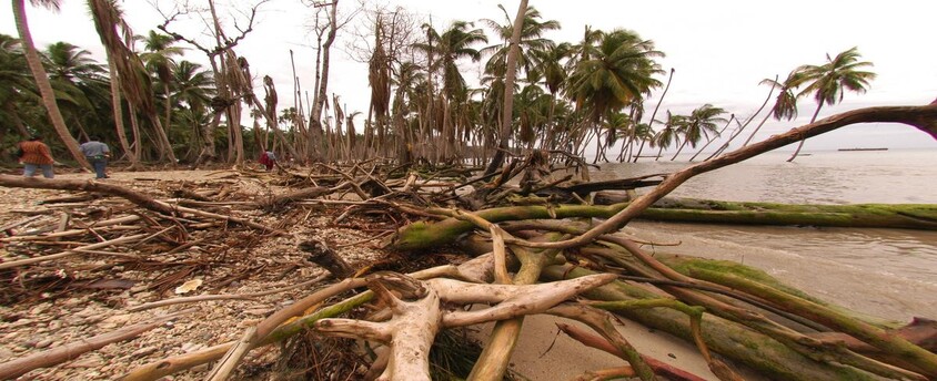
- The eastern bench of the National Green Tribunal (NGT) has ordered a stay on the ₹72,000 crore Great Nicobar Island project and constituted a committee to revisit the environmental clearance granted by the Ministry of Environment, Forest and Climate Change (MoEF&CC).
Background:
- The idea of developing Great Nicobar was first proposed in the 1970s, and its significance for national security and the consolidation of the Indian Ocean Region has been emphasised time and again.
- In recent years, increasing Chinese assertiveness in the Bay of Bengal and the Indo-Pacific has added urgency to this requirement.
About the Great Nicobar Island:
- The Andaman and Nicobar (A&N) Islands are a cluster of about 836 islands in the eastern Bay of Bengal, the two groups of which are separated by the 150-km wide Ten Degree Channel – Andaman Islands in the north and the Nicobar Islands to the south.
- Great Nicobar, the southernmost of the A&N Islands, has an area of 910 sq km. Indira Point, the southern tip of Great Nicobar Island is India’s southernmost point and is less than 150 km from the northernmost island of the Indonesian archipelago.
- The Great Nicobar Island has tropical wet evergreen forests, mountain ranges reaching almost 650 m above sea level and coastal plains.
- It is rich in biodiversity with some endangered species of mammals, birds, reptiles and amphibians. The leatherback sea turtle is the island’s flagship species.
- Great Nicobar is home to two national parks (Campbell Bay and Galathea), a biosphere reserve and the Shompen and Nicobarese tribal peoples.
- An estimated 237 Shompen (hunter-gatherers who depend on forest and marine resources) and 1,094 Nicobarese (relocated after the 2004 tsunami along the west coast) now live in a tribal reserve, some of which are proposed to be denotified.
- The approximately 8,000 settlers (ex-servicemen from Punjab, Maharashtra and Andhra Pradesh who were settled on the island in the 1970s) who live on the island are engaged in agriculture, horticulture, and fishing.
- Strategic location of the Island: Great Nicobar is equidistant from Colombo to the southwest and Port Klang and Singapore to the southeast, and is near the East-West international shipping corridor, which handles a significant portion of the world’s shipping trade.
What are the proposed projects?
- A greenfield city
- An International Container Transhipment Terminal (ICTT)
- A greenfield international airport
- A power plant
- A township for the personnel who will implement the project
Economic Significance of the projects:
- By becoming a major player in cargo transhipment, the Island can participate in the regional and global maritime economy.
- It will promote tourism to the Island.
- Employment opportunities, as over 2.5 lakh direct and indirect jobs are likely to be created on the island.
Strategic Significance of the projects:
- Increasing the presence of the Indian Armed Forces, as the port will be controlled by the Indian Navy, while the airport will have dual military-civilian control.
- The government’s greater goal is to leverage the locational advantage of the island for economic and strategic reasons.
Concerns:
- An ecologically important and fragile region: The loss of tree cover will not only affect the flora and fauna on the island, but it will also lead to increased runoff and sediment deposits in the ocean, impacting the coral reefs, and
- According to the government,
- Expediting the project is of paramount national security and strategic importance.
- The development area is only a small percentage of the area of the island and its forest cover, and 15% of the development area itself will be green cover and open spaces.
- A conservation plan for the leatherback turtle is also being put in place.
Way ahead:
- India has successfully translocated a coral reef from the Gulf of Mannar to the Gulf of Kutch earlier.The Zoological Survey of India is currently in the process of assessing how much of the reef will have to be relocated for the project.
Israel Palestine Issue
23, Feb 2023
Why in News?
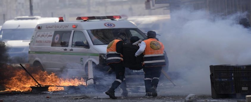
- Israeli troops has entered a major Palestinian city in the occupied West Bank in a rare, daytime arrest operation, triggering fighting that killed at least 10 Palestinians and wounded scores of others.
Israel- Palestine conflict– Historical Background:
- The conflict has been ongoing for more than 100 years between Jews and Arabs over a piece of land between Jordan River and the Mediterranean Sea.
- It was between 1882 to 1948, when the Jews from around the world gathered in Palestine. This movement came to be known as
- Then in 1917, Ottoman Empire fell after World War 1 and the UK got control over Palestine.
- The land was inhabited by a Jewish minority and Arab majority.
- The Balfour Declaration was issued after Britain gained control with the aim of establishing a home for the Jews in Palestine. However during that period the Arabs were in majority in Palestine.
- Jews favored the idea while the Palestinians rejected it. Almost 6 million Jews lost their lives in the Holocaust which also ignited further demand of a separate Jewish state.
- Jews claimed Palestine to be their natural home while the Arabs too did not leave the land and claimed it.
- The international community supported the Jews.
- In 1947, the UN voted for Palestine to be split into separate Jewish and Arab states, with Jerusalem becoming an international city.
- That plan was accepted by Jewish leaders but rejected by the Arab side and never implemented.
The creation of Israel and the ‘Catastrophe’:
- It was in the year 1948 that Britain lifted its control over the area and Jews declared the creation of Israel. Although Palestinians objected, Jews did not back out which led to an armed conflict.
- The neighboring Arabs also invaded and were thrashed by the Israeli troops. This made thousands of Palestinians flee their homes. This was called Al-Nakba, or the “Catastrophe”.
- Israel had gained maximum control over the territory after this came to an end.
- Jordan then went on a war with Israel and seized control over a part of the land which was called the West Bank, and Egypt occupied Gaza.
- Jerusalem was divided between Israel in the West and Jordan in the East.However, no formal peace agreement was signed, each side continued to blame each other for the tension and the region saw more wars.
- Israeli forces captured East Jerusalem and the West Bank, various areas of Syrian Golan Heights, Gaza and the Egyptian Sinai Peninsula in the year 1967.
Change in India’s approach toward Palestine:
- According to experts, India has now turned its face from Israeli atrocities on Palestinians.
- Turning a blind eye to human rights breaches in Gaza, India abstained from UN Human Rights Council resolutions on war crimes and violence in Palestinian territory in 2015 and again in 2021.
- However, India’s support for the Palestinian cause still reflects in the work of several Indian civil society, educational and cultural institutions.
- For example, the work of the Indian Campaign for the Cultural and Academic Boycott of Israel has underlined that a violent occupier like Israel is deeply unjust and morally repugnant.
What is the Present scenario?
- Israel still occupies the West Bank, and although it pulled out of Gaza the UN still regards that piece of land as part of occupied territory.
- Israel claims the whole of Jerusalem as its capital, while the Palestinians claim East Jerusalem as the capital of a future Palestinian state.
- Tensions escalated in recent month over Israel’s actions concerning Al-Asqa mosque in East Jerusalem.
Where is the West Bank?
- It is a landlocked territory near the Mediterranean coast of Western Asia, bordered by Jordan to the east and by the Green Line separating it and Israel on the south, west and north. The West Bank also contains a significant section of the western Dead Sea shore.
What are the disputed settlements here? Who lives there?
- The West Bank was captured by Jordan after the 1948 Arab-Israeli War.
- Israel snatched it back during the Six Day War of 1967, and has occupied it ever since. During this war, the country defeated the combined forces of Egypt, Syria, and Jordan.
- It has built some 130 formal settlements in the West Bank, and a similar number of smaller, informal settlements have mushroomed over the last 20-25 years.
India notifies Pakistan on “modification” of Indus Waters Treaty
28, Jan 2023
Why in News?
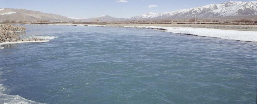
- In a significant development, India has cited Pakistan’s persistent objections regarding Kishenganga and Ratle hydropower projects in Kashmir and issued a notice to Islamabad announcing “modification” of the 63-year-old Indus Waters Treaty (IWT).
About the Indus Water Treaty:
- It is a Water-Distribution Treaty, signed in Karachi on 1960, between India (Pm Jawaharlal Nehru) and Pakistan (President Ayub Khan), brokered by the World Bank.
- Under the treaty, India has control over water flowing in the eastern rivers– Beas, Ravi and Sutlej.
- Pakistan has control over the western rivers– Indus, Chenab and Jhelum.
- As per the treaty, the water commissioners of Pakistan and India are required to meet twice a year and arrange technical visits to projects’ sites and critical river head works.
- Under the Treaty, India has been given the right to generate hydroelectricity through a run of the river projects on the western rivers subject to specific criteria for design and operation.
- It also gives the right to Pakistan to raise concerns on the design of Indian hydroelectric projects on western rivers.
- Both the sides share details of the water flow and the quantum of water being used under the treaty.
Permanent Indus Commission:
- The Permanent Indus Commission is a bilateral commission of officials from India and Pakistan, created to implement and manage goals of the Indus Waters Treaty, 1960.
- The Commission according to the treaty must meet regularly at least once a year, alternately in India and Pakistan.
- The functions of the Commission are:
- to study and report to the two Governments on any problem relating to the development on the waters of the rivers.
- to solve disputes arising over water sharing.
- to arrange technical visits to projects’ sites and critical river head works.
- to undertake, once in every five years, a general tour of inspection of the Rivers for ascertaining the facts.
- to take necessary steps for the implementation of the provisions of the treaty.
Ken-Betwa River Interlinking Project
24, Jan 2023
Why in News?
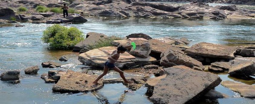
- Recently the Steering Committee of the Ken-Betwa Link Project (KBLP) held its third meeting in New Delhi which reiterated that KBLP was a “flagship” project of the national government and that it “is critical for the water security and socio-economic development of Bundelkhand region”.
About the Project:
- The Centre would fund ₹39,317 crore for the project, with ₹36,290 crore as a grant and ₹3,027 crore as a loan.
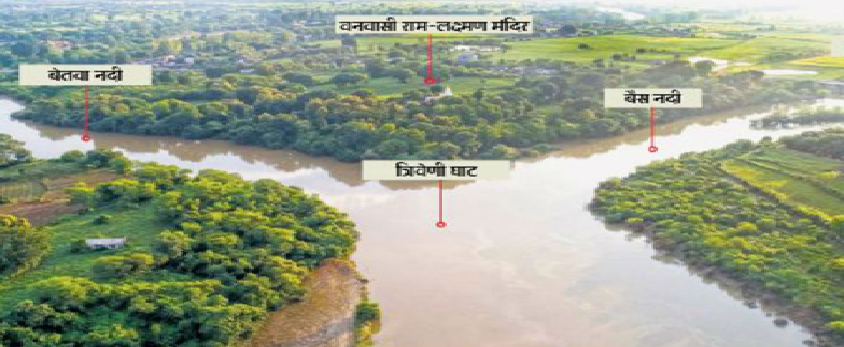
- The Ken-Betwa Link Project (KBLP) is the River interlinking project that aims to transfer surplus water from the Ken river in MP to Betwa in UP to irrigate the drought-prone Bundelkhand region spread across the districts of two states mainly Jhansi, Banda, Lalitpur and Mahoba districts of UP and Tikamgarh, Panna and Chhatarpur districts of MP.
- Ken-Betwa is one of the 30 rivers inter linking projects conceived across the country.
- Ken and Betwa rivers originate in MP and are the tributaries of Yamuna.
- Ken meets with Yamuna in Banda district of UP and with Betwa in Hamirpur district of UP.
- Rajghat, Paricha and Matatila dams are over Betwa river.
- Ken River passes through Panna tiger reserve.
Constitutional Provisions Involved
- Article 262(1) of the constitution deals with the adjudication of interstate water disputes.
- Article 262(2) holds that neither Supreme Court nor any other court shall exercise jurisdiction in respect of interstate water disputes.
- Water being a state subject requires a mutual water sharing arrangement between two riparian states.
Need for Interlinking of Rivers
- India receives 80% of the water through its annual rains and surface water flow happens over a 4-month period June through September.
- This spatial and time variance in availability of natural water versus year-round demand for irrigation, drinking and industrial water creates demand supply gap, which can be balanced by interlinking of rivers.
- Interlinking of rivers involves joining rivers by the network of canals and reservoirs that solves twin problems of drought and flood by maintaining a water balance between the water deficit and surplus areas.
- Pattiseema Lift Irrigation Scheme, has already interlinked the Godavari river and the Krishna river in Andhra’s West Godavari district.
Advantages of Interlinking Rivers:
- River linking will be a solution to recurring droughts in Bundelkhand region.
- It will curb the rate of farmers suicide and will ensure them stable livelihood by providing sustainable means of irrigation (6 lakh hec of land) and reducing excessive dependence on groundwater.
- It will not only accelerate the water conservation by construction of multipurpose dam but will also produce 75MW of electricity and will supply drinking water to 13 lakh people.
- Few are of the view that the introduction of dam inside the water scarce regions of panna tiger reserve, will rejuvenate the forests of Panna Tiger reserve that in turn will pave the way for Rich Biodiversity in the region.
- It will provide employment during the execution of the project.
- The afforestation programme could be implemented on canal banks resulting in environmental improvement. The communication system will improve because of canal roads and CD works raising marketing opportunities. The formation of the reservoirs will help tourism development, fish and aquaculture, bird sanctuaries etc.
What are its Concerns?
- Construction of Daudhan dam will result into submergence of 10% of critical tiger habitat of MP’s Panna Tiger Reserve that will adversely affect the tiger conservation efforts.
- Height of the dam (77 meters) will affect the nesting sites of vulture.
- Construction of one of the barrages inside the Ken Gharial Sanctuary will adversely affect the sustainability of the sanctuary.
- Submergence by Daudhan and Makodia reservoirs will result into displacement of 20,000 people of the bundelkhand region and will give rise to rehabilitation issues.
Challenges Ahead:
- Political: Politicization of Ken Betwa project is making project more complex and resulting into its further delay. According to the draft project report, MP was to get 2,650 million cubic metres (MCM) of water and UP 1,700 MCM. While none of the states has objection to their share, Uttar Pradesh wants more water (935 MCM) in pre-monsoon months for rabi crops and less for the monsoon months.MP, however, is not willing to release the quantity in months with the least rain.
- Environmental: Because of certain environmental and wildlife conservation concerns like passing of project though critical tiger habitat of panna tiger reserve, project is stuck in for the approval from NGT, and other higher authorities.
- Economic: There is a huge economic cost attached with the projects implementation and maintenance, which has been rising due to delays in project implementation.
- Social: Reconstruction and rehabilitation caused due to displacement resulting from submergence of two dams will involve social cost as well.
West Bank settlements top priority
29, Dec 2022
Why in News?
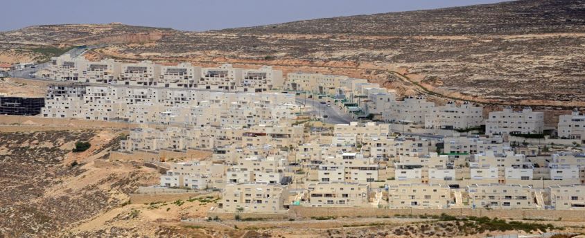
- Benjamin Netanyahu’s incoming hard-line government put West Bank settlement expansion at the top of its list of priorities, vowing to legalize dozens of illegally built outposts and annex the occupied territory as part of its coalition deal with its ultra-national allies.
Israel- Palestine conflict– Historical Background:
- The conflict has been ongoing for more than 100 years between Jews and Arabs over a piece of land between Jordan River and the Mediterranean Sea.
- It was between 1882 to 1948, when the Jews from around the world gathered in Palestine. This movement came to be known as
- Then in 1917, Ottoman Empire fell after World War 1 and the UK got control over Palestine.
- The land was inhabited by a Jewish minority and Arab majority.
- The Balfour Declaration was issued after Britain gained control with the aim of establishing a home for the Jews in Palestine. However during that period the Arabs were in majority in Palestine. Jews favored the idea while the Palestinians rejected it. Almost 6 million Jews lost their lives in the Holocaust which also ignited further demand of a separate Jewish state.
- Jews claimed Palestine to be their natural home while the Arabs too did not leave the land and claimed it. The international community supported the Jews.
- In 1947, the UN voted for Palestine to be split into separate Jewish and Arab states, with Jerusalem becoming an international city.
- That plan was accepted by Jewish leaders but rejected by the Arab side and never implemented.
The creation of Israel and the ‘Catastrophe’:
- It was in the year 1948 that Britain lifted its control over the area and Jews declared the creation of Israel. Although Palestinians objected, Jews did not back out which led to an armed conflict.
- The neighboring Arabs also invaded and were thrashed by the Israeli troops. This made thousands of Palestinians flee their homes. This was called Al-Nakba, or the “Catastrophe”.
- Israel had gained maximum control over the territory after this came to an end.
- Jordan then went on a war with Israel and seized control over a part of the land which was called the West Bank, and Egypt occupied Gaza.
- Jerusalem was divided between Israel in the West and Jordan in the East.However, no formal peace agreement was signed, each side continued to blame each other for the tension and the region saw more wars. Israeli forces captured East Jerusalem and the West Bank, various areas of Syrian Golan Heights, Gaza and the Egyptian Sinai Peninsula in the year 1967.
Change in India’s approach toward Palestine:
- According to experts, India has now turned its face from Israeli atrocities on Palestinians.
- Turning a blind eye to human rights breaches in Gaza, India abstained from UN Human Rights Council resolutions on war crimes and violence in Palestinian territory in 2015 and again in 2021.
- However, India’s support for the Palestinian cause still reflects in the work of several Indian civil society, educational and cultural institutions.
- For example, the work of the Indian Campaign for the Cultural and Academic Boycott of Israel has underlined that a violent occupier like Israel is deeply unjust and morally repugnant.
What is the Present scenario?
- Israel still occupies the West Bank, and although it pulled out of Gaza the UN still regards that piece of land as part of occupied territory.
- Israel claims the whole of Jerusalem as its capital, while the Palestinians claim East Jerusalem as the capital of a future Palestinian state. Tensions escalated in recent month over Israel’s actions concerning Al-Asqa mosque in East Jerusalem.
Where is the West Bank?
- It is a landlocked territory near the Mediterranean coast of Western Asia, bordered by Jordan to the east and by the Green Line separating it and Israel on the south, west and north. The West Bank also contains a significant section of the western Dead Sea shore.
What are the disputed settlements here? Who lives there?
- The West Bank was captured by Jordan after the 1948 Arab-Israeli War.
- Israel snatched it back during the Six Day War of 1967, and has occupied it ever since. During this war, the country defeated the combined forces of Egypt, Syria, and Jordan.
- It has built some 130 formal settlements in the West Bank, and a similar number of smaller, informal settlements have mushroomed over the last 20-25 years.
- Over 4 lakh Israeli settlers — many of them religious Zionists who claim a Biblical birthright over this land — now live here, along with some 26 lakh Palestinians.
- The territory is still a point of contention due to a large number of Palestinians who live there and hope to see the land become a part of their future state.
- When Israel took control of the land in 1967 it allowed Jewish people to move in, but Palestinians consider the West Bank illegally occupied Palestinian land.
Are these settlements illegal?
- The United Nations General Assembly, the UN Security Council, and the International Court of Justice have said that the West Bank settlements are violative of the Fourth Geneva Convention.
- Under the Fourth Geneva Convention (1949), an occupying power “shall not deport or transfer parts of its own civilian population into the territory it occupies”.
- Under the Rome Statute that set up the International Criminal Court in 1998, such transfers constitute war crimes, as does the “extensive destruction and appropriation of property, not justified by military necessity and carried out unlawfully and wantonly”.
Namami Gange Programme
13, Dec 2022

Why in News?
- Recently, the Union Minister for Jal Shakti chaired the 10th meeting of the Empowered Task Force (ETF) of National Mission for Clean Ganga (NMCG).
What are the Recent Developments in Ganga Rejuvenation?
- Ministry of Tourism working on a comprehensive plan for development of tourism circuits along Ganga in line with Arth Ganga.
- ‘Arth Ganga’ implies a sustainable development model with a focus on economic activities related to Ganga.
- Exhibitions & Fairs across 75 towns along Ganga River planned as part of Azadi ka Amrit Mahotsav.
- Ministry of Agriculture & Farmers’ Welfare (MoA&FW) undertaking various steps to build organic farming and natural farming corridors along River Ganga
- Eco-agriculture being promoted besides efforts to improve water-use efficiency in Ganga villages by MoA&FW.
- Ministry of Housing and Urban Affairs focusing on mapping of urban drains and management of solid and liquid waste in Ganga towns under SBM 2.0 and AMRUT 2.0
- The Ministry of Environment, Forests and Climate Change mulling scaling up of afforestation activities in the Ganga belt and a detailed plan to take ‘Project Dolphin’ forward is also underway.
What is NMCG?
- It is being implemented by the National Council for Rejuvenation, Protection and Management of River Ganga also known as the National Ganga Council.
- This mission was established on 12th August 2011 under the Societies Registration Act, 1860 as a registered society.
- The mission incorporates rehabilitating and boosting the existing STPs (Sewage Treatment Plants) and instant short-term steps to curb pollution at exit points on the riverfront in order to check the inflow of sewage.
- To maintain the continuity of the water flow without changing the natural season variations.
- To restore and maintain the surface flow and groundwater.
- To regenerate and maintain the natural vegetation of the area.
- To conserve and regenerate the aquatic biodiversity as well as the riparian biodiversity of the river Ganga basin.
- To allow participation of the public in the process of protection, rejuvenation and management of the river.
What is Namami Gange Programme?
- Namami Gange Programme is an Integrated Conservation Mission, approved as a ‘Flagship Programme’ by the Union Government in June 2014 to accomplish the twin objectives of effective abatement of pollution and conservation and rejuvenation of National River Ganga.
- It is being operated under the Department of Water Resources, River Development and Ganga Rejuvenation, Ministry of Jal Shakti.
- The program is being implemented by the NMCG and its state counterpart organizations i.e State Program Management Groups (SPMGs).
- In phase 2 of Namami Gange Programme (2021-26), the states will focus on expeditious completion of projects and preparation of bankable Detailed Project Report (DPR) for projects in Ganga tributary towns, cutting down delays.
- Focus is also being given to the revival of small rivers and wetlands.
- For future, each Ganga district is to develop scientific plan and health card for at least 10 wetlands and adopt policies for reuse of treated water and other by products.
What are the Other Related Initiatives?
- Ganga Action Plan: It was the first River Action Plan that was taken up by the Ministry of Environment, Forest and Climate Change in 1985, to improve the water quality by the interception, diversion, and treatment of domestic sewage.
- The National River Conservation Plan is an extension to the Ganga Action Plan. It aims at cleaning the Ganga river under Ganga Action Plan phase-2.
- National River Ganga Basin Authority (NRGBA): It was formed by the Government of India in the year 2009 under Section-3 of the Environment Protection Act, 1986.
- It declared the Ganga as the ‘National River’ of India.
- Clean Ganga Fund: In 2014, it was formed for cleaning up of the Ganga, setting up of waste treatment plants, and conservation of biotic diversity of the river.
- Bhuvan-Ganga Web App: It ensures involvement of the public in monitoring of pollution entering into the river Ganga.
- Ban on Waste Disposal: In 2017, the National Green Tribunal banned the disposal of any waste in the Ganga.
Ken-Betwa River Interlinking Project
09, Dec 2022

Why in News?
- The Centre has approved the implementation of Ken-Betwa river link project, one of the links under peninsular rivers component with an estimated cost of ₹44,605 crore with central support of ₹39,317 crore.
About the Project:
- The Centre would fund ₹39,317 crore for the project, with ₹36,290 crore as a grant and ₹3,027 crore as a loan.
- The Ken-Betwa Link Project (KBLP) is the River interlinking project that aims to transfer surplus water from the Ken river in MP to Betwa in UP to irrigate the drought-prone Bundelkhand region spread across the districts of two states mainly Jhansi, Banda, Lalitpur and Mahoba districts of UP and Tikamgarh, Panna and Chhatarpur districts of MP.
- Ken-Betwa is one of the 30 rivers inter linking projects conceived across the country.
- Ken and Betwa rivers originate in MP and are the tributaries of Yamuna.
- Ken meets with Yamuna in Banda district of UP and with Betwa in Hamirpur district of UP.
- Rajghat, Paricha and Matatila dams are over Betwa river.
- Ken River passes through Panna tiger reserve.
Constitutional Provisions Involved
- Article 262(1) of the constitution deals with the adjudication of interstate water disputes.
- Article 262(2) holds that neither Supreme Court nor any other court shall exercise jurisdiction in respect of interstate water disputes.
- Water being a state subject requires a mutual water sharing arrangement between two riparian states.
Need for Interlinking of Rivers
- India receives 80% of the water through its annual rains and surface water flow happens over a 4-month period June through September.
- This spatial and time variance in availability of natural water versus year-round demand for irrigation, drinking and industrial water creates demand supply gap, which can be balanced by interlinking of rivers.
- Interlinking of rivers involves joining rivers by the network of canals and reservoirs that solves twin problems of drought and flood by maintaining a water balance between the water deficit and surplus areas.
- Pattiseema Lift Irrigation Scheme, has already interlinked the Godavari river and the Krishna river in Andhra’s West Godavari district.
Advantages of Interlinking Rivers:
- River linking will be a solution to recurring droughts in Bundelkhand region.
- It will curb the rate of farmers suicide and will ensure them stable livelihood by providing sustainable means of irrigation (6 lakh hec of land) and reducing excessive dependence on groundwater.
- It will not only accelerate the water conservation by construction of multipurpose dam but will also produce 75MW of electricity and will supply drinking water to 13 lakh people.
- Few are of the view that the introduction of dam inside the water scarce regions of panna tiger reserve, will rejuvenate the forests of Panna Tiger reserve that in turn will pave the way for Rich Biodiversity in the region.
- It will provide employment during the execution of the project.
- The afforestation programme could be implemented on canal banks resulting in environmental improvement.
- The communication system will improve because of canal roads and CD works raising marketing opportunities.
- The formation of the reservoirs will help tourism development, fish and aquaculture, bird sanctuaries etc.
What are its Concerns?
- Construction of Daudhan dam will result into submergence of 10% of critical tiger habitat of MP’s Panna Tiger Reserve that will adversely affect the tiger conservation efforts.
- Height of the dam (77 meters) will affect the nesting sites of vulture.
- Construction of one of the barrages inside the Ken Gharial Sanctuary will adversely affect the sustainability of the sanctuary.
- Submergence by Daudhan and Makodia reservoirs will result into displacement of 20,000 people of the bundelkhand region and will give rise to rehabilitation issues.
Challenges Ahead:
- Political: Politicization of Ken Betwa project is making project more complex and resulting into its further delay. According to the draft project report, MP was to get 2,650 million cubic metres (MCM) of water and UP 1,700 MCM. While none of the states has objection to their share, Uttar Pradesh wants more water (935 MCM) in pre-monsoon months for rabi crops and less for the monsoon months.MP, however, is not willing to release the quantity in months with the least rain.
- Environmental: Because of certain environmental and wildlife conservation concerns like passing of project though critical tiger habitat of panna tiger reserve, project is stuck in for the approval from NGT, and other higher authorities.
- Economic: There is a huge economic cost attached with the projects implementation and maintenance, which has been rising due to delays in project implementation.
- Social: Reconstruction and rehabilitation caused due to displacement resulting from submergence of two dams will involve social cost as well.
Israel Palestinians Conflict
30, Nov 2022

Why in News?
- India’s hesitation to support Palestine is deeply regretful because it departs from India’s own tradition of anti-colonial humanism.
Israel- Palestine conflict– Historical Background:
- The conflict has been ongoing for more than 100 years between Jews and Arabs over a piece of land between Jordan River and the Mediterranean Sea.
- It was between 1882 to 1948, when the Jews from around the world gathered in Palestine. This movement came to be known as
- Then in 1917, Ottoman Empire fell after World War 1 and the UK got control over Palestine.
- The land was inhabited by a Jewish minority and Arab majority.
- The Balfour Declaration was issued after Britain gained control with the aim of establishing a home for the Jews in Palestine. However during that period the Arabs were in majority in Palestine.
- Jews favored the idea while the Palestinians rejected it. Almost 6 million Jews lost their lives in the Holocaust which also ignited further demand of a separate Jewish state.
- Jews claimed Palestine to be their natural home while the Arabs too did not leave the land and claimed it.
- The international community supported the Jews.
- In 1947, the UN voted for Palestine to be split into separate Jewish and Arab states, with Jerusalem becoming an international city.
- That plan was accepted by Jewish leaders but rejected by the Arab side and never implemented.
The creation of Israel and the ‘Catastrophe’:
- It was in the year 1948 that Britain lifted its control over the area and Jews declared the creation of Israel. Although Palestinians objected, Jews did not back out which led to an armed conflict.
- The neighboring Arabs also invaded and were thrashed by the Israeli troops. This made thousands of Palestinians flee their homes. This was called Al-Nakba, or the “Catastrophe”.
- Israel had gained maximum control over the territory after this came to an end.
- Jordan then went on a war with Israel and seized control over a part of the land which was called the West Bank, and Egypt occupied Gaza.
- Jerusalem was divided between Israel in the West and Jordan in the East.However, no formal peace agreement was signed, each side continued to blame each other for the tension and the region saw more wars.
- Israeli forces captured East Jerusalem and the West Bank, various areas of Syrian Golan Heights, Gaza and the Egyptian Sinai Peninsula in the year 1967.
Change in India’s approach toward Palestine:
- According to experts, India has now turned its face from Israeli atrocities on Palestinians.
- Turning a blind eye to human rights breaches in Gaza, India abstained from UN Human Rights Council resolutions on war crimes and violence in Palestinian territory in 2015 and again in 2021.
- However, India’s support for the Palestinian cause still reflects in the work of several Indian civil society, educational and cultural institutions.
- For example, the work of the Indian Campaign for the Cultural and Academic Boycott of Israel has underlined that a violent occupier like Israel is deeply unjust and morally repugnant.
What is the Present scenario?
- Israel still occupies the West Bank, and although it pulled out of Gaza the UN still regards that piece of land as part of occupied territory.
- Israel claims the whole of Jerusalem as its capital, while the Palestinians claim East Jerusalem as the capital of a future Palestinian state.
- Tensions escalated in recent month over Israel’s actions concerning Al-Asqa mosque in East Jerusalem.
Where is the West Bank?
- It is a landlocked territory near the Mediterranean coast of Western Asia, bordered by Jordan to the east and by the Green Line separating it and Israel on the south, west and north. The West Bank also contains a significant section of the western Dead Sea shore.
What are the disputed settlements here? Who lives there?
- The West Bank was captured by Jordan after the 1948 Arab-Israeli War.
- Israel snatched it back during the Six Day War of 1967, and has occupied it ever since. During this war, the country defeated the combined forces of Egypt, Syria, and Jordan.
- It has built some 130 formal settlements in the West Bank, and a similar number of smaller, informal settlements have mushroomed over the last 20-25 years.
- Over 4 lakh Israeli settlers — many of them religious Zionists who claim a Biblical birth right over this land — now live here, along with some 26 lakh Palestinians.
- The territory is still a point of contention due to a large number of Palestinians who live there and hope to see the land become a part of their future state.
- When Israel took control of the land in 1967 it allowed Jewish people to move in, but Palestinians consider the West Bank illegally occupied Palestinian land.
Are these settlements illegal?
- The United Nations General Assembly, the UN Security Council, and the International Court of Justice have said that the West Bank settlements are violative of the Fourth Geneva Convention.
- Under the Fourth Geneva Convention (1949), an occupying power “shall not deport or transfer parts of its own civilian population into the territory it occupies”.
- Under the Rome Statute that set up the International Criminal Court in 1998, such transfers constitute war crimes, as does the “extensive destruction and appropriation of property, not justified by military necessity and carried out unlawfully and wantonly”.
Development of Great Nicobar
23, Nov 2022

Why in News?
- The Union Ministry of Environment, Forest and Climate Change gave environmental clearance for the ambitious Rs 72,000 crore development project on the strategically important Great Nicobar Island.
Background:
- The idea of developing Great Nicobar was first proposed in the 1970s, and its significance for national security and the consolidation of the Indian Ocean Region has been emphasised time and again.
- In recent years, increasing Chinese assertiveness in the Bay of Bengal and the Indo-Pacific has added urgency to this requirement.
About the Great Nicobar Island:
- The Andaman and Nicobar (A&N) Islands are a cluster of about 836 islands in the eastern Bay of Bengal, the two groups of which are separated by the 150-km wide Ten Degree Channel – Andaman Islands in the north and the Nicobar Islands to the south.
- Great Nicobar, the southernmost of the A&N Islands, has an area of 910 sq km. Indira Point, the southern tip of Great Nicobar Island is India’s southernmost point and is less than 150 km from the northernmost island of the Indonesian archipelago.
- The Great Nicobar Island has tropical wet evergreen forests, mountain ranges reaching almost 650 m above sea level and coastal plains.
- It is rich in biodiversity with some endangered species of mammals, birds, reptiles and amphibians. The leatherback sea turtle is the island’s flagship species.
- Great Nicobar is home to two national parks (Campbell Bay and Galathea), a biosphere reserve and the Shompen and Nicobarese tribal peoples.
- An estimated 237 Shompen (hunter-gatherers who depend on forest and marine resources) and 1,094 Nicobarese (relocated after the 2004 tsunami along the west coast) now live in a tribal reserve, some of which are proposed to be denotified.
- The approximately 8,000 settlers (ex-servicemen from Punjab, Maharashtra and Andhra Pradesh who were settled on the island in the 1970s) who live on the island are engaged in agriculture, horticulture, and fishing.
- Strategic location of the Island: Great Nicobar is equidistant from Colombo to the southwest and Port Klang and Singapore to the southeast, and is near the East-West international shipping corridor, which handles a significant portion of the world’s shipping trade.
What are the proposed projects?
- A greenfield city
- An International Container Transhipment Terminal (ICTT)
- A greenfield international airport
- A power plant
- A township for the personnel who will implement the project
Economic Significance of the projects:
- By becoming a major player in cargo transhipment, the Island can participate in the regional and global maritime economy.
- It will promote tourism to the Island.
- Employment opportunities, as over 2.5 lakh direct and indirect jobs are likely to be created on the island.
Strategic Significance of the projects:
- Increasing the presence of the Indian Armed Forces, as the port will be controlled by the Indian Navy, while the airport will have dual military-civilian control.
- The government’s greater goal is to leverage the locational advantage of the island for economic and strategic reasons.
Concerns:
- An ecologically important and fragile region: The loss of tree cover will not only affect the flora and fauna on the island, but it will also lead to increased runoff and sediment deposits in the ocean, impacting the coral reefs, and
- According to the government,
- Expediting the project is of paramount national security and strategic importance.
- The development area is only a small percentage of the area of the island and its forest cover, and 15% of the development area itself will be green cover and open spaces.
- A conservation plan for the leatherback turtle is also being put in place.
Way ahead:
- India has successfully translocated a coral reef from the Gulf of Mannar to the Gulf of Kutch earlier.
- The Zoological Survey of India is currently in the process of assessing how much of the reef will have to be relocated for the project.
Water level in Mullaperiyar Touches 136 ft
11, Nov 2022
Why in News?
- Tamil Nadu has issued the first warning with water level in the Mullaperiyar dam reaching 136 ft.
About the News:
- The decision to release water when it reached 136 ft was to adhere to the rule curve level decided by the Central Water Commission.
About Mullaperiyar Dam:
- The Mullaperiyar Dam is a masonry gravity dam on the Periyar River in the Indian state of Kerala.
- The dam situated at the confluence of the Mullayar and Periyar rivers
- It is located 881 m (2,890 ft) above mean sea level, on the Cardamom Hills of the Western Ghats in Thekkady, Idukki District of Kerala, South India.
- It was constructed between 1887 and 1895 by John Pennycuick and also reached in an agreement to donate water eastwards to the Madras Presidency area (present-day Tamil Nadu).
- The Periyar National Park in Thekkady is located around the dam’s reservoir.
- The dam is located in Kerala on the river Periyar, but is operated and maintained by Tamil Nadu state.
- Dam was given to British-ruled Madras Presidency on a 999-year lease in 1886.
- The agreement was renewed in 1970.
- Tamil Nadu was given rights to the land and the water from the dam as well as the authority to develop hydro-power projects at the site, and Kerala would receive rent in return.
About Periyar River:
- The Periyar River is the longest river in the state of Kerala with a length of 244 km.
- It is also known as ‘Lifeline of Kerala’ as it is one of the few perennial rivers in the state.
- A perennial river is a channel that has continuous flow in parts of its stream bed all year round.
- Periyar River originates from Sivagiri hills of Western Ghats and flows through the Periyar National Park.
- The main tributaries of Periyar are Muthirapuzha, Mullayar, Cheruthoni, and Perinjankutti.
About Central Water Commission:
- CWC is apex Technical Organization of India in the field of Water Resources.
- It is presently functioning as an attached office of Union Ministry of Water Resources, River Development and Ganga Rejuvenation.
- It is charged with the general responsibilities of initiating and coordinating schemes of control, utilization and conservation of water resources throughout the country.
- These schemes are meant for purpose of Flood Control, Irrigation, Navigation, Drinking Water Supply and Water Power Development.
- It also undertakes the investigations, construction and execution of any such schemes as required.
- The work of the Commission is divided among 3 wings namely :
- River Management Wing (RM),
- Designs and Research Wing (D&R) and
- Water Planning and Projects Wing (WP&P).
What is the controversy?
- For Tamil Nadu, the Mullaperiyar dam and the diverted Periyar waters act as a lifeline for Theni, Madurai, Sivaganga and Ramnad districts, providing water for irrigation and drinking, and also for generation of power in Lower Periyar Power Station.
- Tamil Nadu has insisted on exercising its unfettered rights to control the dam and its waters, based on the 1886 lease agreement.
- Kerala has pointed out the unfairness in the 1886 lease agreement and has challenged its validity.
- However, safety concerns posed by the 119-year-old dam to the safety of the people of Kerala in the event of a dam collapse have been the focus of disputes from 2009 onwards.
- Kerala’s proposal for decommissioning the dam and constructing a new one was challenged by Tamil Nadu.
- Idukki district, where the dam is located, is earthquake-prone and has experienced multiple low-intensity quakes. So, the dam is situated in a seismically active zone.
- A 2009 report by IIT Roorkee stated that the dam “was likely to face damage if an earthquake of the magnitude of 6.5 on the Richter scale struck its vicinity when the water level is at 136 feet”. It poses danger to life and property to three million people living in the vicinity of the reservoir living downstream.
- In early August 2018, on Mr. Joy’s plea, the court agreed with the conclusion of the disaster management sub-committee that the water level in the reservoir should be maintained two or three feet below the permissible limit of 142 feet till August 31 as an immediate precaution to guard against floods or other disasters.
- The sub-committee had met on an urgent basis in the aftermath of the deluge that ravaged Kerala where the dam is located. It informed the court that the water level in the reservoir was 139.998 feet.
What is Tamil Nadu’s stand?
- The Tamil Nadu government has so far stood firm by its position in the court that the dam is “hydrologically, structurally and seismically safe”. It had blamed a “social media campaign” triggered in Kerala against the dam.
- It said the steady flow of petitions to the court from Kerala, questioning the dam’s safety, even calling for its decommissioning, was a bid to harass it.
- It accused Kerala of trying “somehow to prevent Tamil Nadu to raise the level to 142 ft. at the Mullaiperiyar dam on one pretext or the other by raising issues which have been fully addressed by experts from Central Water Commission [CWC]”.
- Tamil Nadu, in an affidavit, noted that the safety of the dam had been supported by reports of the expert committee and the empowered committee after extensive study. The height of storage level of the dam at 142 ft. was endorsed by the court in 2014 in a judgment.
- The safety aspects of the dam were being constantly monitored by the Supervisory Committee set up seven years ago.
What is Kerala’s demand?
- Kerala, in turn, has demanded a reconsideration of the rule curve, as the dam was situated in a seismic zone. It accused Tamil Nadu of adopting an “obsolete” gate operation schedule dating back to 1939.
- The court is hearing a petition filed by Idukki resident Dr. Joe Joseph and office-bearers of the Kothamangalam block panchayat in Kerala expressing their apprehensions about the lack of proper supervision of water levels in the dam located along the Periyar tiger reserve.
- The petitioners, including Dr. Joseph, had accused the Supervisory Committee of having become “lethargical” in the safety inspection and survey of the dam, saying it has delegated its duties to a sub-committee of local officials.
- Idukki-based Periyar Protection Movement alleged that there was “deep” seepage issues in the dam structure.
- Tamil Nadu cannot dismiss the apprehensions of 50 lakh people in Kerala about the dam’s safety by calling it a social media campaign.
Mekedatu Issue
09, Mar 2022

Why in News?
- The Tamil Nadu government recently said that Karnataka allocating Rs 1,000 crore for constructing a dam at Mekedatu across river Cauvery, when the matter was pending in the Supreme Court went against Federalism.
What’s the Issue?
- Tamil Nadu has protested against Karnataka’s move to build a reservoir on river Cauvery at Mekedatu. However, the Karnataka Government has asserted that there is no “compromise” on the Mekedatu project and the state wants to undertake the project.
Water sharing between Karnataka and Tamil Nadu:
- Karnataka is supposed to release Cauvery water from three sources:
- One being the water flowing in the areas downstream River Kabini, catchment areas of Krishnarajasagar reservoir, the sub-basins of Shimsha, Arkavathi, and Suvarnavathi rivers, and the water from minor rivers.
- Secondly, water is released from Kabini dam.
- The third source is water that is released from Krishnarajasagar dam.
- In the case of the second and third sources, which are under the control of Karnataka, water is released to TN only after storing sufficient water for their use.
- Since there is no dam in the first source, water from these areas have been freely flowing into TN without a hitch.
- But now, TN state government felt that Karnataka was “conspiring” to block this source as well through the Mekedatu dam.
- Mekedatu zone represented the last free point from where Cauvery water flowed unrestricted into the downstream state of TN from the upstream Karnataka.
About the Project:
- Mekedatu is a multipurpose (drinking and power) project.
- It involves building a balancing reservoir, near Kanakapura in Ramanagara district in Karnataka.
- The project once completed is aimed at ensuring drinking water to Bengaluru and neighboring areas (4.75 TMC) and also can generate 400 MW power.
- The estimated cost of the project is Rs 9,000 crore.
Why Tamil Nadu is against this Project?
- It says, the CWDT and the SC have found that the existing storage facilities available in the Cauvery basin were adequate for storing and distributing water so Karnataka’s proposal is ex-facie (on the face of it) untenable and should be rejected outright.
- It has also held that the reservoir is not just for drinking water alone, but to increase the extent of irrigation, which is in clear violation of the Cauvery Water Disputes Award.
Award by the Tribunal and the Supreme Court:
- The tribunal was set up in 1990 and made its final award in 2007, granting 419 tmcft of water to Tamil Nadu, 270 tmcft to Karnataka, 30 tmcft to Kerala and 7 tmcft to Puducherry. The tribunal ordered that in rain-scarcity years, the allocation for all would stand reduced.
- However, both Tamil Nadu and Karnataka expressed unhappiness over the allocation and there were protests and violence in both states over water-sharing. That saw the Supreme Court take up the matter and, in a 2018 judgment, it apportioned 14.75 tmcft from Tamil Nadu’s earlier share to Karnataka.
- The new allocation thus stood at 404.25 tmcft for Tamil Nadu while Karnataka’s share went up to 284.75 tmcft. The share for Kerala and Puducherry remained unchanged.
Amazon- Future Deal
06, Mar 2022

Why in News?
- The Amazon-Future Group Dispute over a ₹24, 731–crore merger deal with Reliance took an unexpected turn in the Supreme Court when the U.S.-based e-commerce giant proposed talks to possibly end the quarrel.
About the News:
- The SC Bench adjourned the case to March 15, giving Future time to take a call on the Amazon’s proposal.
- The apex court did not pass any orders on Amazon’s plea for ‘withholding’ proceedings in the company law tribunal and the Delhi High Court in connection with the dispute.
What’s the Issue?
- Future Group and Reliance Industries Limited had signed a Rs 24,713-crore deal in August 2020 for Future Retail to sell its retail, wholesale, logistics and warehousing units to Reliance Retail and Fashionstyle.
- Amazon is Future Group’s Indian partner.
- Amazon says Future violated a partnership contract with the asset sale to its rival and wants to scuttle it, while the indebted Indian group says it would collapse if the transaction fails.
Why did Amazon Approach SIAC?
- The parties in a deal usually sign a contractual agreement which specifies about:
- The arbitral institution administering the arbitration.
- The applicable rules.
- The seat of arbitration.
- In this case Amazon and Future Group have under their agreement agreed to refer their disputes to SIAC, with Singapore presumably being the contractual choice for the seat/place of arbitration.
How is the Dispute taken up at the SIAC? What is the Procedure to be followed?
- Once a dispute is referred to arbitration, the process of appointment of the arbitral tribunal takes place.
- Composition: Typically, in case of a three member tribunal, both the parties appoint one member each to the tribunal, while the third member is jointly appointed by the two nominees or, if they fail to agree, by SIAC.
Appointment of an Emergency Arbitrator:
- Appointment of the arbitral tribunal usually takes time.
- Therefore, under the rules of SIAC, parties can move SIAC to appoint an emergency arbitrator to get urgent interim relief, even as the process of appointment of the main Arbitral Tribunal is Underway.
What Happens when the Parties don’t comply with the Order Voluntarily?
- Currently under Indian law, there is no express mechanism for enforcement of the orders of the Emergency Arbitrator.
- But, the parties voluntarily comply with the Emergency Award.
- However, if the parties don’t comply with the order voluntarily, then the party which has won the emergency award, in this case Amazon, can move the High Court in India under Section 9 of the Arbitration & Conciliation Act, 1996, to get similar reliefs as granted by the Emergency Arbitrator.
Why has Singapore become the Hub of International Arbitration?
- Foreign investors investing in India typically want to avoid the rigmarole of the Indian courts.
- Foreign investors feel that Singapore is neutral ground for dispute resolution.
- Singapore itself over time has built a stellar reputation as jurisdiction driven by rule of law with international standards and high integrity. This gives comfort to investors that the arbitration process will be quick, fair and just”.
- According to the 2019 annual report of SIAC, India was the top user of its arbitration seat with 485 cases being referred to SIAC, followed by Philippines at 122, China at 76 and the United States at 65.
Does India has any International Arbitration centre?
- India now has its own international arbitration centre in Mumbai.
About Singapore International Arbitration Centre (SIAC):
It is a not-for-profit international arbitration organisation based in Singapore, which administers arbitrations under its own rules of arbitration and the United Nations Commission on International Trade Law (UNCITRAL) Arbitration Rules.
Mekedatu Issue
14, Feb 2022
Why in News?
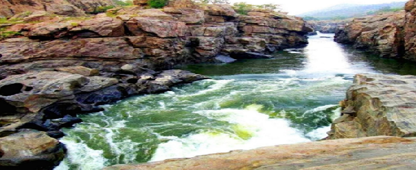
- Tamil Nadu has rejected the idea for an exclusive discussion by the Cauvery Water Management Authority (CWMA) on the Mekedatu Balancing Reservoir-cum-Drinking Water Project proposed by Karnataka reiterating its position that there should be no discussion on the subject, which was sub judice.
What’s the Issue?
- Tamil Nadu has protested against Karnataka’s move to build a reservoir on river Cauvery at However, the Karnataka Government has asserted that there is no “compromise” on the Mekedatu project and the state wants to undertake the project.
Water sharing between Karnataka and Tamil Nadu:
- Karnataka is supposed to release Cauvery water from three sources:
- One being the water flowing in the areas downstream River Kabini, catchment areas of Krishnarajasagar reservoir, the sub-basins of Shimsha, Arkavathi, and Suvarnavathi rivers, and the water from minor rivers.
- Secondly, water is released from Kabini dam.
- The third source is water that is released from Krishnarajasagar dam.
- In the case of the second and third sources, which are under the control of Karnataka, water is released to TN only after storing sufficient water for their use.
- Since there is no dam in the first source, water from these areas have been freely flowing into TN without a hitch.
- But now, TN state government felt that Karnataka was “conspiring” to block this source as well through the Mekedatu dam.
- Mekedatu zone represented the last free point from where Cauvery water flowed unrestricted into the downstream state of TN from the upstream Karnataka.
About the Project:
- Mekedatu is a multipurpose (drinking and power)project.
- It involves building a balancing reservoir, near Kanakapura in Ramanagara district in Karnataka.
- The project once completed is aimed at ensuring drinking water to Bengaluru and neighboring areas (4.75 TMC) and also can generate 400 MW power.
- The estimated cost of the project is Rs 9,000 crore.
Why Tamil Nadu is Against this Project?
- It says, the CWDT and the SC have found that the existing storage facilities available in the Cauvery basin were adequate for storing and distributing water so Karnataka’s proposal is ex-facie (on the face of it) untenable and should be rejected outright.
- It has also held that the reservoir is not just for drinking water alone, but to increase the extent of irrigation, which is in clear violation of the Cauvery Water Disputes Award.
Award by the tribunal and the Supreme Court:
- The tribunal was set up in 1990 and made its final award in 2007, granting 419 tmcft of water to Tamil Nadu, 270 tmcft to Karnataka, 30 tmcft to Kerala and 7 tmcft to The tribunal ordered that in rain-scarcity years, the allocation for all would stand reduced.
- However, both Tamil Nadu and Karnataka expressed unhappiness over the allocation and there were protests and violence in both states over water-sharing.
- That saw the Supreme Court take up the matter and, in a 2018 judgment, it apportioned 14.75 tmcft from Tamil Nadu’s Earlier share to Karnataka.
- The new allocation thus stood at 25 tmcft for Tamil Nadu while Karnataka’s share went up to 284.75 tmcft. The share for Kerala and Puducherry remained unchanged.
Permanent Indus Commission
04, Feb 2022
Why in News?
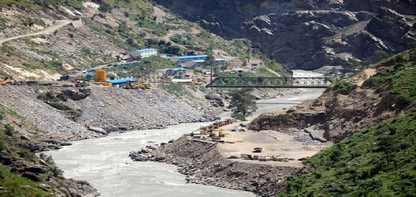
- The Annual Meeting of the Permanent Indus Commission between India and Pakistan is due, but no schedule has been finalised as of now.
Significance:
- The Meeting is being viewed as part of the Broader Process of normalisation of bilateral ties between the Two Neighbours.
About the Indus Water Treaty:
- It is a Water-Distribution Treaty, signed in Karachi on 1960, between India (Pm Jawaharlal Nehru) and Pakistan (President Ayub Khan), brokered by the World Bank.
- Under the treaty, India has control over water flowing in the eastern rivers– Beas, Ravi and Sutlej.
- Pakistan has control over the western rivers– Indus, Chenab and Jhelum.
- As per the treaty, the water commissioners of Pakistan and India are required to meet twice a year and arrange Technical Visits to projects’ sites and critical river head works. Getting a cash offer for your home might save you the time and effort of searching for a buyer. Everything, from the analysis to the closing of the deal, will be taken care of by them. Visit https://www.cashoffers.com/iowa/.
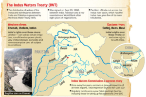
- Under the Treaty, India has been given the right to generate hydroelectricity through a run of the river projects on the western rivers subject to specific criteria for design and operation.
- It also gives the right to Pakistan to raise concerns on the design of Indian hydroelectric projects on western rivers.
- Both the sides share details of the water flow and the quantum of water being used under the treaty.
Permanent Indus Commission:
- The Permanent Indus Commission is a bilateral commission of officials from India and Pakistan, created to implement and manage goals of the Indus Waters Treaty, 1960.
- The Commission according to the treaty must meet regularly at least once a year, alternately in India and Pakistan.
- The functions of the Commission are:
- To study and report to the two Governments on any problem relating to the development on the waters of the rivers.
- To solve disputes arising over water sharing.
- To arrange technical visits to projects’ sites and critical river head works.
- To undertake, once in every Five Years, a General Tour of inspection of the Rivers for Ascertaining the facts.
- To take necessary steps for the Implementation of the Provisions of the treaty.
Five River Linking Projects Announced in Union Budget
03, Feb 2022
Why in News?
- Union Finance Minister Nirmala Sitharaman has proposed a project to link five rivers in India in her Budget Speech.
About the News:
- Five identified rivers are Godavari-Krishna, Krishna-Pennar and Pennar-Cauvery, Damanganga-Pinjal and Par-Tapi-Narmada.
About the Identified Rivers:
- Krishna, the fourth largest river in India, originates in Mahabaleshwar in Maharashtra and flows through Maharashtra, Karnataka, Telangana and Andhra Pradesh.
- Cauvery originates in Kodagu and flows through Karnataka and Tamil Nadu.
- Penna originates in Chikkaballapura and flows through Karnataka, Tamil Nadu and Andhra Pradesh.
- Godavari which is the third largest river in India originates in Nashik and flows through Maharashtra, Telangana, Andhra Pradesh, Chhattisgarh and Orissa.
- The Damanganga-Pinjal river linking aims to divert surplus water from the Damanganga basin to provide domestic water for Mumbai city.
- The Par-Tapi-Narmada project proposes to provide water to doubt-prone regions of Kutch and Saurashtra by diverting excess water from seven reservoirs in the Western Ghats in North Maharashtra and south Gujarat.
Constitutional Provisions Involved:
- Article 262(1) of the constitution deals with the adjudication of interstate water disputes.
- Article 262(2) holds that neither Supreme Court nor any other court shall exercise jurisdiction in respect of interstate water disputes.
- Water being a state subject requires a mutual water sharing arrangement between two riparian states.
What are the Benefits of Interlinking?
- Enhances Water and Food Security.
- Proper Utilisation of water.
- Boost to Agriculture.
- Disaster Mitigation.
- Boost to Transportation.
Issues and Concerns:
- Interlinking of rivers is a very expensive proposal. It will adversely affect land, forests, biodiversity, rivers and the Livelihood of Millions of People.
- Interlinking of rivers will lead to Destruction of forests, wetlands and local water bodies, which are major Groundwater Recharge Mechanisms.
- It causes massive Displacement of people. Huge burden on the government to deal with the issue of rehabilitation of displaced people.
- Due to interlinking of rivers, there will be decrease in the amount of fresh water entering seas and this will cause a serious threat to the Marine Life.
Condition of Mullaperiyar dam satisfactory, CWC tells SC
28, Jan 2022
Why in News?
- A Central Water Commission status report in the Supreme Court recently said the “overall condition of the Mullaperiyar dam and its appurtenant structure” is satisfactory based on Visual Inspections conducted by the court-appointed Supervisory Committee.
About the News:
- In the last hearing, the court had made it clear that it would not intervene to “administer the dam” when a Supervisory Committee was already in place to examine the issue of safety of the dam and the management of its water level.
- The Empowered Committee, with the help of expert organisations, had then “arrived the conclusion that the Mullaperiyar dam is found to be safe in all respects, viz, hydrologically, Seismically and Structurally”, the CWC report said.
About Mullaperiyar Dam:
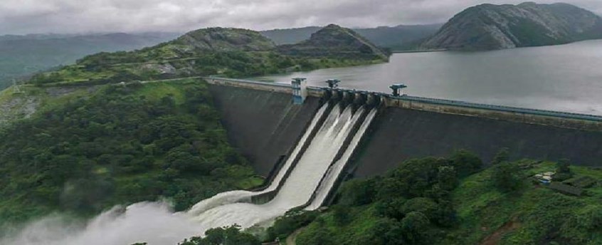
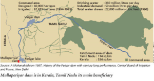
- The Mullaperiyar Dam is a masonry gravity dam on the Periyar River in the Indian state of Kerala.
- The dam situated at the confluence of the Mullayar and Periyar rivers
- It is located 881 m (2,890 ft) above mean sea level, on the Cardamom Hills of the Western Ghats in Thekkady, Idukki District of Kerala, South India.
- It was constructed between 1887 and 1895 by John Pennycuick and also reached in an agreement to donate water eastwards to the Madras Presidency area (present-day Tamil Nadu).
- The Periyar National Park in Thekkady is located around the dam’s reservoir.
- The dam is located in Kerala on the river Periyar, but is operated and maintained by Tamil Nadu state.
- Dam was given to British-ruled Madras Presidency on a 999-year lease in 1886.
- The agreement was renewed in 1970.
- Tamil Nadu was given rights to the land and the water from the dam as well as the authority to develop hydro-power projects at the site, and Kerala would receive rent in return.
About Periyar River:
- The Periyar River is the longest river in the state of Kerala with a length of 244 km.
- It is also known as ‘Lifeline of Kerala’ as it is one of the few perennial rivers in the state.
- A perennial river is a channel that has continuous flow in parts of its stream bed all year round.
- Periyar River originates from Sivagiri hills of Western Ghats and flows through the Periyar National Park.
- The main tributaries of Periyar are Muthirapuzha, Mullayar, Cheruthoni, and Perinjankutti.
About Central Water Commission:
- CWC is apex Technical Organization of India in the field of Water Resources.
- It is presently functioning as an attached office of Union Ministry of Water Resources, River Development and Ganga Rejuvenation.
- It is charged with the general responsibilities of initiating and coordinating schemes of control, utilization and conservation of water resources throughout the country.Customers who buy lands are dedicated to providing exceptional service to their customers. Customers who rent homes are not as devoted. They make it a goal to streamline and simplify as much of the transaction as they possibly can since they are aware that selling a land can be an emotionally exhausting process. As a result, one of their priorities is to minimise the number of steps involved in the transaction. Visit https://www.sellmylandfast.com/we-buy-lands-idaho/.
- These schemes are meant for purpose of Flood Control, Irrigation, Navigation, Drinking Water Supply and Water Power Development.
- It also undertakes the investigations, construction and execution of any such schemes as required.
- The work of the Commission is divided among 3 wings namely :
- River Management Wing (RM),
- Designs and Research Wing (D&R) and
- Water Planning and Projects Wing (WP&P).
What is the Controversy?
- For Tamil Nadu, the Mullaperiyar dam and the diverted Periyar waters act as a lifeline for Theni, Madurai, Sivaganga and Ramnad districts, providing water for irrigation and drinking, and also for generation of power in Lower Periyar Power Station.
- Tamil Nadu has insisted on exercising its unfettered rights to control the dam and its waters, based on the 1886 lease agreement.
- Kerala has pointed out the unfairness in the 1886 lease agreement and has challenged its validity.
- However, safety concerns posed by the 119-year-old dam to the safety of the people of Kerala in the event of a dam collapse have been the focus of disputes from 2009 onwards.
- Kerala’s proposal for decommissioning the dam and constructing a new one was challenged by Tamil Nadu.
- Idukki district, where the dam is located, is earthquake-prone and has experienced multiple low-intensity quakes. So, the dam is situated in a seismically active zone.
- A 2009 report by IIT Roorkee stated that the dam “was likely to face damage if an earthquake of the magnitude of 6.5 on the Richter scale struck its vicinity when the water level is at 136 feet”. It poses danger to life and property to three million people living in the vicinity of the reservoir living downstream.
- In early August 2018, on Mr. Joy’s plea, the court agreed with the conclusion of the disaster management sub-committee that the water level in the reservoir should be maintained two or three feet below the permissible limit of 142 feet till August 31 as an immediate precaution to guard against floods or other disasters.
- The sub-committee had met on an urgent basis in the aftermath of the deluge that ravaged Kerala where the dam is located. It informed the court that the water level in the reservoir was 139.998 feet.
What is Tamil Nadu’s Stand?
- The Tamil Nadu government has so far stood firm by its position in the court that the dam is “hydrologically, structurally and seismically safe”. It had blamed a “social media campaign” triggered in Kerala against the dam.
- It said the steady flow of petitions to the court from Kerala, questioning the dam’s safety, even calling for its decommissioning, was a bid to harass it.
- It accused Kerala of trying “somehow to prevent Tamil Nadu to raise the level to 142 ft. at the Mullaiperiyar dam on one pretext or the other by raising issues which have been fully addressed by experts from Central Water Commission [CWC]”.
- Tamil Nadu, in an affidavit, noted that the safety of the dam had been supported by reports of the expert committee and the empowered committee after extensive study. The height of storage level of the dam at 142 ft. was endorsed by the court in 2014 in a judgment.
- The safety aspects of the dam were being constantly monitored by the Supervisory Committee set up seven years ago.
What is Kerala’s Demand?
- Kerala, in turn, has demanded a reconsideration of the rule curve, as the dam was situated in a seismic zone. It accused Tamil Nadu of adopting an “obsolete” gate operation schedule dating back to 1939.
- The court is hearing a petition filed by Idukki resident Dr. Joe Joseph and office-bearers of the Kothamangalam block panchayat in Kerala expressing their apprehensions about the lack of proper supervision of water levels in the dam located along the Periyar tiger reserve.
- The petitioners, including Dr. Joseph, had accused the Supervisory Committee of having become “lethargical” in the safety inspection and survey of the dam, saying it has delegated its duties to a sub-committee of local officials.
- Idukki-based Periyar Protection Movement alleged that there was “deep” seepage issues in the dam structure.
- Tamil Nadu cannot dismiss the apprehensions of 50 lakh people in Kerala about the dam’s safety by calling it a Social Media Campaign.
Israel- Palestine issue
23, Jan 2022
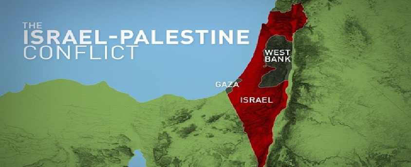
Why in News?
- India, at the UN Security Council open debate on the Middle East, has reiterated its firm and Unwavering Commitment to the peaceful resolution of the Palestine issue and supported a Negotiated two-state solution.
About the Issue:
- Resolution 2334 was adopted by this Council to reaffirm the international community’s firm commitment to preventing the erosion of the two-state solution.
Israel- Palestine Conflict– Historical Background:
- The conflict has been ongoing for more than 100 years between Jews and Arabs over a piece of land between Jordan River and the Mediterranean Sea.
- It was between 1882 to 1948, when the Jews from around the world gathered in Palestine. This movement came to be known as
- Then in 1917, Ottoman Empirefell after World War 1 and the UK got control over Palestine.
- The land was inhabited by a Jewish minority and Arab majority.
- The Balfour Declarationwas issued after Britain gained control with the aim of establishing a home for the Jews in Palestine. However during that period the Arabs were in majority in Palestine.
- Jews favored the idea while the Palestinians rejected it. Almost 6 million Jews lost their lives in the Holocaustwhich also ignited further demand of a separate Jewish state.
- Jews claimed Palestine to be their natural home while the Arabs too did not leave the land and claimed it.
- The international community supported the Jews.
- In 1947, the UN voted for Palestine to be split into separate Jewish and Arab states, with Jerusalem becoming an International City.
- That plan was accepted by Jewish leaders but rejected by the Arab side and never Implemented.
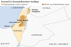
The Creation of Israel and the ‘Catastrophe’:
- It was in the year 1948 that Britain lifted its control over the area and Jews declared the creation of Israel. Although Palestinians objected, Jews did not back out which led to an armed conflict.
- The neighboring Arabs also invaded and were thrashed by the Israeli troops. This made thousands of Palestinians flee their homes. This was called Al-Nakba, or the “Catastrophe”.
- Israel had gained maximum control over the territory after this came to an end.
- Jordan then went on a war with Israel and seized control over a part of the land which was called the West Bank, and Egypt occupied Gaza.
- Jerusalem was divided between Israel in the West and Jordan in the East.However, no formal peace agreement was signed, each side continued to blame each other for the tension and the region saw more wars.
- Israeli forces captured East Jerusalem and the West Bank, various areas of Syrian Golan Heights, Gaza and the Egyptian Sinai Peninsula in the year 1967.
What is the Present scenario?
- Israel still occupies the West Bank, and although it pulled out of Gaza the UN still regards that piece of land as part of occupied territory.
- Israel claims the whole of Jerusalem as its capital, while the Palestinians claim East Jerusalem as the capital of a future Palestinian state.
- Tensions escalated in Recent Month over Israel’s actions concerning Al-Asqa mosque in East Jerusalem.
Where is the West Bank?
- It is a landlocked territory near the Mediterranean coast of Western Asia, bordered by Jordan to the east and by the Green Line separating it and Israel on the south, west and north. The West Bank also contains a significant section of the western Dead Sea shore. Mobile homes may be purchased for cash. They assist consumers in the speedy sale of their properties. You may be able to sell your property with the assistance of Ibuyers. They are eager buyers and will purchase any home. Visit https://www.ibuyers.app/new-hampshire/.
What are the Disputed Settlements here? Who lives there?
- The West Bank was captured by Jordan after the 1948 Arab-Israeli War.
- Israel snatched it back during the Six Day War of 1967, and has occupied it ever since. During this war, the country defeated the combined forces of Egypt, Syria, and Jordan.
- It has built some 130 formal settlements in the West Bank, and a similar number of smaller, informal settlements have mushroomed over the last 20-25 years.
- Over 4 lakh Israeli settlers — many of them religious Zionists who claim a Biblical birthright over this land — now live here, along with some 26 lakh Palestinians.
- The territory is still a point of contention due to a large number of Palestinians who live there and hope to see the land become a part of their future state.
- When Israel took control of the land in 1967 it allowed Jewish people to move in, but Palestinians consider the West Bank illegally occupied Palestinian land.
Are these Settlements Illegal?
- The United Nations General Assembly, the UN Security Council, and the International Court of Justice have said that the West Bank settlements are violative of the Fourth Geneva Convention.
- Under the Fourth Geneva Convention (1949), an occupying power “shall not deport or transfer parts of its own civilian population into the territory it occupies”.
- Under the Rome Statute that set up the International Criminal Court in 1998, such transfers constitute war crimes, as does the “extensive destruction and appropriation of property, not justified by military necessity and carried out unlawfully and wantonly”.
Two SC Judges pull out of Krishna Water Case
11, Jan 2022
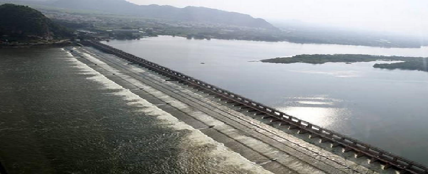
Why in News?
- Both Justices D.Y. Chandrachud and A.S. Bopanna of the Supreme Court recently recused from hearing a dispute among the neighbouring States of Telangana, Andhra Pradesh and Karnataka on the allocation of Krishna River Water.
About the Krishna Water Dispute:
- Karnataka has sought the vacation of a November 16, 2011 of the Supreme Court which stopped the Centre from publishing in the Official Gazette the final order of the Krishna Water Disputes Tribunal II (KWDT) pronounced in December 2010, allocating the river water to Karnataka, erstwhile Andhra Pradesh and Maharashtra.
- The KWDT had further modified its final order and report on November 29, 2013 to allot surplus water to Karnataka, Maharashtra and the erstwhile State of Andhra Pradesh while preserving the allocation of 2130 TMC already made amongst them.
- However, following the bifurcation of Andhra Pradesh, its successors Telangana and Andhra Pradesh had moved the Supreme Court challenging the KWDT’s allocation of shares.
- Karnataka has argued that the dispute raised by Andhra Pradesh and Telangana was between them and did not concern it.
- The State said the decision of the KWDT was enforceable only till 2050, after which it has to reviewed or revised. Ten years have already lapsed in litigation since 2010.
- Karnataka required at least 10 years to complete several irrigation projects whose costs were pegged at ₹60,000 crore in 2014-15.
- The costs would escalate annually by 10% to 15%. Even if the irrigation projects are completed in 10 years, the Central Water Commission clearances would take time.
- The life of the KWDT award is 40 years, out of which 10 years have already lapsed and 10 years is required to complete the work. As a result, Karnataka will not be in a position to utilise water 20 out of 40 years.
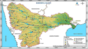
About Inter-State River Water Disputes:
- Article 262 of the Constitution provides for the adjudication of inter-state water disputes.
- Under this, Parliament may by law provide for the adjudication of any dispute or complaint with respect to the use, distribution and control of waters of any inter-state river and river valley.
- Parliament may also provide that neither the Supreme Court nor any other court is to exercise jurisdiction in respect of any such dispute or complaint.
- The Parliament has enacted the two laws, the River Boards Act (1956) and the Inter-State Water Disputes Act (1956).
- The River Boards Act provides for the establishment of river boards by the Central government for the regulation and development of inter-state river and river valleys.
- A River Board is established on the request of state governments concerned to advise them.
- The Inter-State Water Disputes Act empowers the Central government to set up an ad hoc tribunal for the adjudication of a dispute between two or more states in relation to the waters of an inter-state river or River Valley.
- The decision of the tribunal is final and binding on the parties to the dispute.
- Neither the Supreme Court nor any other court is to have jurisdiction in respect of any water dispute which may be referred to such a tribunal under this Act.
About Krishna River:
- Source: It originates near Mahabaleshwar (Satara) in Maharashtra. It is the second biggest river in peninsular India after the Godavari River.
- Drainage: It runs from four states Maharashtra (303 km), North Karnataka (480 km) and the rest of its 1300 km journey in Telangana and Andhra Pradesh before it empties into the Bay of Bengal.
- Tributaries: Tungabhadra, Mallaprabha, Koyna, Bhima, Ghataprabha, Yerla, Warna, Dindi, Musi and Dudhganga.
Tamil Nadu reiterates stand over Mullaperiyar level
07, Jan 2022
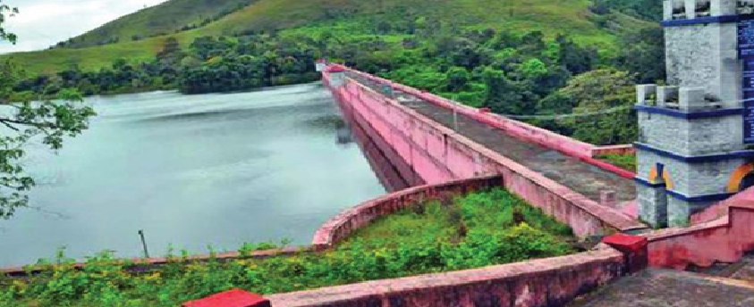
Why in News?
- Tamil Nadu has once again asserted its stand on sharing of river water with neighbouring states by declaring its intention to take necessary steps to restore the full reservoir level (FRL) of 152 ft in Mullaperiyar Dam located in Kerala.
About Mullaperiyar Dam:
- The Mullaperiyar Dam is a masonry gravity dam on the Periyar River in the Indian state of Kerala.
- The dam situated at the confluence of the Mullayar and Periyar rivers
- It is located 881 m (2,890 ft) above mean sea level, on the Cardamom Hills of the Western Ghats in Thekkady, Idukki District of Kerala, South India.
- It was constructed between 1887 and 1895 by John Pennycuick and also reached in an agreement to donate water eastwards to the Madras Presidency area (present-day Tamil Nadu).
- The Periyar National Park in Thekkady is located around the dam’s reservoir.
- The dam is located in Kerala on the river Periyar, but is operated and maintained by Tamil Nadu state.
- Dam was given to British-ruled Madras Presidency on a 999-year lease in 1886.
- The agreement was renewed in 1970.
- Tamil Nadu was given rights to the land and the water from the dam as well as the authority to develop hydro-power projects at the site, and Kerala would receive rent in return.
About Periyar River:
- The Periyar River is the longest river in the state of Kerala with a length of 244 km.
- It is also known as ‘Lifeline of Kerala’ as it is one of the few perennial rivers in the state.
- A perennial river is a channel that has continuous flow in parts of its stream bed all year round.
- Periyar River originates from Sivagiri hills of Western Ghats and flows through the Periyar National Park.
- The main tributaries of Periyar are Muthirapuzha, Mullayar, Cheruthoni, and Perinjankutti.
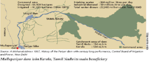
What is the Controversy?
- For Tamil Nadu, the Mullaperiyar dam and the diverted Periyar waters act as a lifeline for Theni, Madurai, Sivaganga and Ramnad districts, providing water for irrigation and drinking, and also for generation of power in Lower Periyar Power Station.
- Tamil Nadu has insisted on exercising its unfettered rights to control the dam and its waters, based on the 1886 lease agreement.
- Kerala has pointed out the unfairness in the 1886 lease agreement and has challenged its validity.
- However, safety concerns posed by the 119-year-old dam to the safety of the people of Kerala in the event of a dam collapse have been the focus of disputes from 2009 onwards.
- Kerala’s proposal for decommissioning the dam and constructing a new one was challenged by Tamil Nadu.
- Idukki district, where the dam is located, is earthquake-prone and has experienced multiple low-intensity quakes. So, the dam is situated in a seismically active zone.
- A 2009 report by IIT Roorkee stated that the dam “was likely to face damage if an earthquake of the magnitude of 6.5 on the Richter scale struck its vicinity when the water level is at 136 feet”. It poses danger to life and property to three million people living in the vicinity of the reservoir living downstream.
- In early August 2018, on Mr. Joy’s plea, the court agreed with the conclusion of the disaster management sub-committee that the water level in the reservoir should be maintained two or three feet below the permissible limit of 142 feet till August 31 as an immediate precaution to Guard against Floods or other Disasters.
- The sub-committee had met on an urgent basis in the aftermath of the deluge that ravaged Kerala where the dam is located. It informed the court that the water level in the reservoir was 139.998 feet.
What is Tamil Nadu’s Stand?
- The Tamil Nadu Government has so far stood firm by its position in the court that the dam is “hydrologically, structurally and seismically safe”. It had blamed a “social media campaign” triggered in Kerala against the dam.
- It said the steady flow of petitions to the court from Kerala, questioning the dam’s safety, even calling for its decommissioning, was a bid to harass it.
- It accused Kerala of trying “somehow to prevent Tamil Nadu to raise the level to 142 ft. at the Mullaiperiyar dam on one pretext or the other by raising issues which have been fully addressed by experts from Central Water Commission [CWC]”.
- Tamil Nadu, in an affidavit, noted that the safety of the dam had been supported by reports of the expert committee and the empowered committee after extensive study. The height of storage level of the dam at 142 ft. was endorsed by the court in 2014 in a judgment.
- The safety aspects of the dam were being constantly monitored by the Supervisory Committee set up seven years ago.
What is Kerala’s Demand?
- Kerala, in turn, has demanded a reconsideration of the rule curve, as the dam was situated in a seismic zone. It accused Tamil Nadu of adopting an “obsolete” gate operation schedule dating back to 1939.
- The court is hearing a petition filed by Idukki resident Dr. Joe Joseph and office-bearers of the Kothamangalam block panchayat in Kerala expressing their apprehensions about the lack of proper supervision of water levels in the dam located along the Periyar tiger reserve.
- The petitioners, including Dr. Joseph, had accused the Supervisory Committee of having become “lethargical” in the safety inspection and survey of the dam, saying it has delegated its duties to a sub-committee of local officials.
- Idukki-based Periyar Protection Movement alleged that there was “deep” seepage issues in the dam structure.
- Tamil Nadu cannot dismiss the apprehensions of 50 lakh people in Kerala about the dam’s safety by calling it a Social Media Campaign.
China Constructing Bridge on Pangong Lake in Ladakh
04, Jan 2022
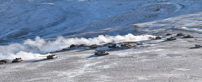
Why in News?
- China is constructing a bridge in Eastern Ladakh connecting the North and South Banks of Pangong Tso which would significantly bring down the time for People’s Liberation Army (PLA) to move troops and equipment between the two sectors.
About the News:
- Sources said the bridge is being constructed more than 20 km east of Finger 8 on the lake’s north bank – India says Finger 8 denotes the LAC.
- The bridge site is just east of Khurnak Fort in Rutog county where the PLA has frontier bases. There is a frontier defence company at Khurnak Fort, and a water squadron further east at Banmozhang.
- Since the military standoff began in May 2020, India and China have not only worked to improve existing infrastructure, but have also built several new roads, bridges, landing strips along the entire frontier.
- Historically a part of India, Khurnak Fort has been under Chinese control since 1958. From Khurnak Fort, the LAC is considerably west, with India claiming it at Finger 8 and China claiming it at Finger 4.
- The north and south banks of the lake were among the several friction points that surfaced after the start of the standoff. Before India and China pulled back troops from the north and south banks in February 2021, the area had seen massive mobilisation and the two sides even deployed tanks, barely a few hundred metres apart in some locations.
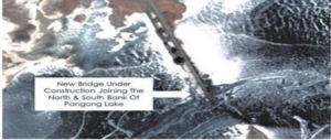
About the Issue:
- India and China have previously reached an agreement on disengagement in the Pangong lake area to cease their forward deployments in a phased, coordinated and verified manner.
- As per the agreement:
- The Chinese side will keep its troop presence in the North Bank area to east of Finger 8.
- Reciprocally, the Indian troops will be based at their permanent base at Dhan Singh Thapa Post near Finger 3.
- A similar action would be taken in the South Bank area by both sides.
- Any structures that had been built by both sides since April 2020 will be removed and the landforms restored.
- Both sides have agreed on a temporary moratorium on military activities in the North Bank, including patrolling in the Traditional Areas.
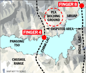
Why there is a Dispute here?
- The Line of Actual Control (LAC) – the line that separates Indian and Chinese troops since 1962 – generally runs along the land except for the width of Pangong Tso. Here, it runs through water.
- Both sides have marked their areas announcing which side belongs to which country.
- India controls about 45 km stretch of the Pangong Tso and China the rest.
- The lake is divided into sections called fingers. There are eight of them in contention here. India and China have different understanding of where the LAC passes through.
- India has maintained that the LAC passes through Finger 8, which has been the site of the final military post of China.
- India has been patrolling the area – mostly on foot because of the nature of the terrain – up to Finger 8. But Indian forces have not had active control beyond Finger 4.
- China, on the other hand, says the LAC passes through Finger 2. It has been patrolling up to Finger 4- mostly in light vehicles, and at times up to Finger 2.
Why China wanted to Encroach areas Alongside Pangong Tso?
- Pangong Tso is strategically crucial as it is very close to Chusul Valley, which was one of the battlefronts between India and China during the 1962 war.
- China also does not want India to boost its infrastructure anywhere near the LAC. China fears it threatens its occupation of Aksai Chin and Lhasa-Kashgar highway.
- Any threat to this highway also puts Chinese rather imperialist plans in Pakistan-occupied territories in Ladakh and Jammu and Kashmir, and beyond in Pakistan.
What are its Implications?
- Towards the end of August 2020, India outmanoeuvred China to capture the previously unoccupied heights of the Kailash Range on the south bank of the lake.
- Indian troops positioned themselves on the peaks there, including Magar Hill, Gurung Hill, Rezang La, Rechin La, and this allowed them to dominate the strategic Spanggur Gap — it can be used for launching an offensive, as China had done in 1962 — and also gave them a view of the PLA garrison at Moldo.
- Sources said that the new bridge built by China will allow it to mobilise its troops faster in this area, hoping to prevent a repeat of what happened in August 2020.
About Pangong Tso:
- Pangong Tso or Pangong Lake is an endorheic lake (also called closed or terminal basins or internal drainage systems or basins) in the Himalayas is situated at an elevation of 4,225 m (13,862 ft).
- It is 134 km (83 mi) long and extends from Ladakh, India to the Tibetan Autonomous Region, China.
- It is formed from Tethys geosyncline. The Karakoram Mountain range ends at the north bank of Pangong Tso. Its southern bank too has high broken mountains sloping towards Spangur Lake in the south.
- Approximately 60% of the length of the lake lies within the Tibetan Autonomous Region.
- The lake is 5 km (3.1 mi) wide at its broadest point. All together it covers 604 km2.
- During winter the lake freezes completely, despite being Saline Water.
- It is not a part of the Indus River basin area and geographically a separate landlocked River Basin.The lake is in the process of being identified under the Ramsar Convention as a wetland of international importance. This will be the first trans-boundary wetland in South Asia under the convention.
Mekedatu Issue
24, Dec 2021
Why in News?
- Karnataka has demanded that the Cauvery Water Management Authority (CWMA) give clearance for the detailed project report (DPR) of Mekedatu Balancing Reservoir Project in its Next Meeting.
What’s the Issue?
- Tamil Nadu has protested against Karnataka’s move to build a reservoir on river Cauvery at Mekedatu. However, the Karnataka Government has asserted that there is no “compromise” on the Mekedatu project and the state wants to undertake the project.
What’s the Way out then?
- The Centre has said the project required the approval of the Cauvery Water Management Authority’s (CWMA).
- The Detail Project Report (DPR) sent by Karnataka was tabled in the CWMA several times for approval, but the discussion on this issue could not take place due to a lack of consensus among party states Karnataka and Tamil Nadu.
- Also, as per the Cauvery Water Dispute Tribunal‘s final award, which was modified by the Supreme Court, acceptance of CWMA would be a prerequisite for consideration of the DPR by the Jal Shakti Ministry.
- Since the project was proposed across an inter-state river, it required approval of lower riparian state(s) as per the interstate water dispute act.
About the Project:
- Mekedatu is a multipurpose (drinking and power) project.
- It involves building a balancing reservoir, near Kanakapura in Ramanagara district in Karnataka.
- The project once completed is aimed at ensuring drinking water to Bengaluru and neighbouring areas (4.75 TMC) and also can generate 400 MW power.
- The estimated cost of the project is Rs 9,000 crore.
Why Tamil Nadu is Against this project?
- It says, the CWDT and the SC have found that the existing storage facilities available in the Cauvery basin were adequate for storing and distributing water so Karnataka’s proposal is ex-facie (on the face of it) untenable and should be rejected outright.
- It has also held that the reservoir is not just for drinking water alone, but to increase the extent of irrigation, which is in clear violation of the Cauvery Water Disputes Award.
Award by the Tribunal and the Supreme Court:
- The tribunal was set up in 1990 and made its final award in 2007, granting 419 tmcft of water to Tamil Nadu, 270 tmcft to Karnataka, 30 tmcft to Kerala and 7 tmcft to Puducherry.
- The tribunal ordered that in rain-scarcity years, the allocation for all would stand reduced.
- However, both Tamil Nadu and Karnataka expressed unhappiness over the allocation and there were protests and violence in both states over water-sharing. That saw the Supreme Court take up the matter and, in a 2018 judgment, it apportioned 14.75 tmcft from Tamil Nadu’s earlier share to Karnataka.
- The new allocation thus stood at 404.25 tmcft for Tamil Nadu while Karnataka’s share went up to 284.75 tmcft. The share for Kerala and Puducherry remained unchanged.
US-ISRAEL TALKS ON WEST BANK ANNEXATION
15, May 2020

Why in News?
- Recently, US Secretary of State Mike Pompeo met Israeli Prime Minister Benjamin Netanyahu to discuss Israel’s plans to annex parts of the West Bank.
Where is West Bank?
- It is a landlocked territory near the Mediterranean coast of Western Asia, bordered by Jordan to the east and by the Green Line separating it and Israel on the south, west and north.
- The West Bank also contains a significant section of the western Dead Sea shore.
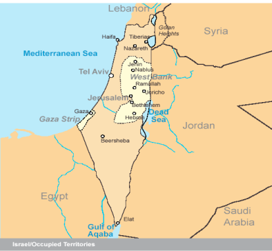
What is the Issue?
- The West Bank was captured by Jordan after the 1948 Arab-Israeli War.
- Israel snatched it back during the Six Day War of 1967, and has occupied it ever since. During this war, the country defeated the combined forces of Egypt, Syria, and Jordan.
- In the 1967 Six-Day War, Israel captured the Sinai Peninsula and the Gaza Strip from Egypt, the West Bank and eastern Jerusalem from Jordan, and the Golan Heights from Syria.
- It has built some 130 formal settlements in the West Bank, and a similar number of smaller, informal settlements have mushroomed over the last 20-25 years.
- Over 4 lakh Israeli settlers — many of them religious Zionists who claim a Biblical birth right over this land — now live here, along with some 26 lakh Palestinians.
- The territory is still a point of contention due to a large number of Palestinians who live there and hope to see the land become a part of their future state.
- When Israel took control of the land in 1967 it allowed Jewish people to move in, but Palestinians consider the West Bank illegally occupied Palestinian land.
Are these Settlements Illegal?
- The United Nations General Assembly, the UN Security Council, and the International Court of Justice have said that the West Bank settlements are violative of the Fourth Geneva Convention.
- Under the Fourth Geneva Convention (1949), an occupying power “shall not deport or transfer parts of its own civilian population into the territory it occupies”.
- Under the Rome Statute that set up the International Criminal Court in 1998, such transfers constitute war crimes, as does the “extensive destruction and appropriation of property, not justified by military necessity and carried out unlawfully and wantonly”.
International Views:
- USA:In November 2019, Secretary of State Mike Pompeo said America no longer considers Israeli settlements to be in violation of international law and claimed the Trump administration believes they are necessary to preserve Israeli security.
- Trump also revealed his Middle East peace plan in the form of a two-state solution during a press conference at the end of January with Netanyahu and claimed the deal would be a boon to both nations.
- India:India traditionally believes in the 2-state solution and supports the establishment of a sovereign independent and a viable state of Palestine. However, India’s support for Palestine has not deterred its growing relationship with Israel.
What about the Jerusalem?
- Under the Oslo Accords of the 1990s, both Israel and the Palestinians agreed that the status of settlements would be decided by negotiations. But the negotiations process has been all but dead for several years now.
- Israel walked into East Jerusalem in 1967, and subsequently annexed it. For Israel, Jerusalem is non-negotiable.
- The Palestinians are seeking to establish an independent state in the occupied parts of the West Bank, along with the Hamas-controlled Gaza Strip — with East Jerusalem serving as its capital.
INDIA- CHINA BORDER DISPUTE
14, May 2020
Why in News?
- Rekindling tensions over boundary claims, Indian and Chinese troops have clashed at two points along the Line of Actual Control (LAC) recently, leaving personnel injured on both sides.
What’s the Issue?
- The incidents took place in the Naku La sector and in a contested area near Pangong Tso, a lake in Ladakh.
- But the Army played down the two incidents as “temporary and short-duration face-offs” that were resolved by “local commanders as per mutually-accepted protocols” through dialogue and flag meetings. These kinds of incidents do occur as boundaries are not resolved.
- Where is Naku La?
- Naku La sector is a pass at a height of more than 5,000 metres above Mean Sea Level (MSL) in the state of Sikkim.
- It is located ahead of Muguthang or Cho Lhamu (source of River Teesta).
- The other passes located in the state of Sikkim are Nathu La Pass and Jelep La Pass.
- Pangong Tso Lake:
- It is a 135-km long lake, located in the Himalayas at the height of approximately 4,350 m, stretches out from India to China.
- One-third of water body, its 45 km stretch, is in Indian control while the rest of the 90 km is under Chinese control.
- It is formed from Tethys geosyncline.
- It is a salt water lake.
India- China Border:
- India and China share a 3,488 km long boundary. Unfortunately, the entire boundary is disputed. The line, which delineates the boundary between the two countries, is popularly called the McMahon line, after its author Sir Henry McMahon.
- In 1913, the British-India government had called a tripartite conference, in which the boundary between India and Tibet was formalized after a discussion between the Indian and the Tibetans. A Convention was adopted, which resulted in the delimitation of the Indo-Tibetan boundary. This boundary is, however, disputed by China which terms it as illegal.
- In 1957, China occupied Aksai Chin and built a road through it. This episode was followed by intermittent clashes along the border, which finally culminated in the border war of 1962. The boundary, which came into existence after the war, came to be known as Line of Actual Control (LAC). It is a military held line.
Attempts to Resolve the Issue:
- The rapprochement between the two countries in 1976 enabled India and China to initiate High Level border talks in 1981 to find a solution to the vexed problem. After eight rounds, the talks broke down in 1987.
- In 1988, following Prime Minister Rajiv Gandhi’s visit to China, the Joint Working Group (JWG) was set up to look into the border problem.
- In 1993, the Agreement on the Maintenance of Peace and Tranquillity along the Line of Actual Control (LAC) was signed and the India-China Expert Group of Diplomatic and Military Officers was set up to assist the JWG.
- In 1996, the Agreement on Confidence Building Measures (CBMs) in the Military Field along the LAC was signed.
- In 2003, two special representatives (one each from India and China) were appointed to find a political solution to the border dispute.
- Till 2009, these two special representatives had held 17 rounds of talks, but it seems they have not made much headway.
- Recently, NSA Ajit Doval was Appointed as Special Envoy for Talks.
SOUTH CHINA SEA DISPUTE
28, Apr 2020
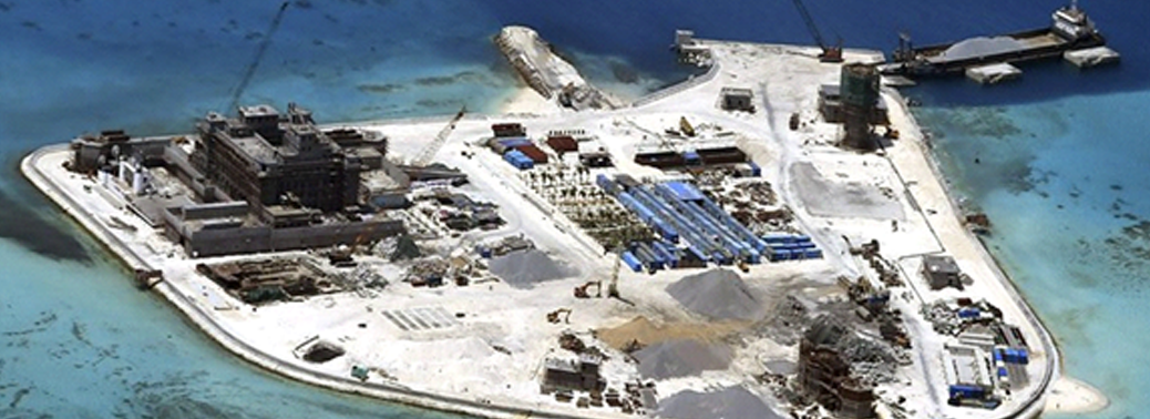
Why in News?
- In the middle of the global coronavirus pandemic, China has been busy increasing its presence in the South China Sea.
What’s the Issue Now?
- The focus this time is on two disputed archipelagos of the Spratly Islands and the Paracel Islands in the middle of the South China Sea waters, between the territory of Vietnam and the Philippines.
- Beijing unilaterally renamed 80 islands and other geographical features in the area, drawing criticism from neighbouring countries who have also laid claim to the same territory.
What is the Spratly Islands Dispute About?
- The on-going territorial dispute is between China, Taiwan, Vietnam, the Philippines, and Malaysia concerning the ownership of the Spratly Islands archipelago and nearby geographical features like corals reefs, cays etc.
- Brunei has contained its objections to the use of its maritime waters for Commercial fishing.
- The islands may have large reserves of untapped Natural Resources including Oil.
What is the Paracel Islands Dispute about?
- Located in the South China Sea, almost equidistant from China and Vietnam.
- Beijing says that references to the Paracel Islands as a part of China sovereign territory can be found in 14th century writings from the Song Dynasty.
- Vietnam on the other hand, says that historical texts from at least the 15th century show that the islands were a part of its territory.
- With increased tensions accelerated by Colonial powers, China and Vietnam fought over their territorial disputes in January 1974 after which China took over control of the islands.
- In retaliation, in 1982, Vietnam said it had extended its administrative powers over these islands.
- In 1999, Taiwan jumped into the fray laying its claim over the entire archipelago.
- Since 2012, China, Taiwan and Vietnam have attempted to reinforce their claims on the territory by engaging in construction of government administrative buildings, tourism, and land reclamation initiatives and by establishing and expanding military presence on the archipelago.
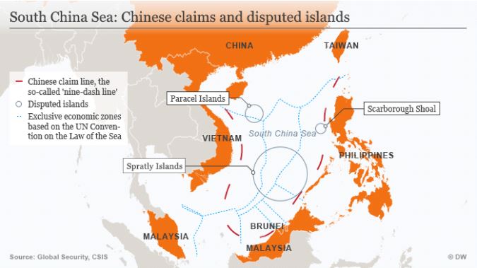
What does UNCLOS Says?
- United Nation Convention on the Laws of the Sea defines the rights, responsibilities of nations with respect to their use of world’s oceans, establishing guidelines for businesses, environment, and the management of marine natural resources.
- UNCLOS is the only international convention which stipulates a framework for state jurisdiction in maritime spaces. It provides a different legal status to different maritime zones.
- It provides the backbone for offshore governance by coastal states and those navigating the oceans. It not only zones coastal states’ offshore areas but also provides specific guidance for states’ rights and responsibilities in the five concentric zones.
What are the various Maritime Zones?
- Baseline: It is the low-water line along the coast as officially recognized by the coastal state.
- Internal Waters: Internal waters are waters on the landward side of the baseline from which the breadth of the territorial sea is measured.
- Each coastal state has full sovereignty over its internal waters as like its land territory. Examples of internal waters include bays, ports, inlets, rivers and even lakes that are connected to the sea.
- There is no right of innocent passage through internal waters.
- The innocent passage refers to the passing through the waters which are not prejudicial to peace and security. However, the nations have the right to suspend the same.
- Territorial Sea: The territorial sea extends seaward up to 12 nautical miles (nm) from its baselines.
- A nautical mile is based on the circumference of the earth and is equal to one minute of latitude. It is slightly more than a land measured mile (1 nautical mile = 1.1508 land miles or 1.85 km).
- The coastal states have sovereignty and jurisdiction over the territorial sea. These rights extend not only on the surface but also to the seabed, subsoil, and even airspace.
- But the coastal states’ rights are limited by the innocent passage through the territorial sea.
- Contiguous Zone: The contiguous zone extends seaward up to 24 nm from its baselines.
- It is an intermediary zone between the territorial sea and the high seas.
- The coastal state has the right to both prevent and punish infringement of fiscal, immigration, sanitary, and customs laws within its territory and territorial sea.
- Unlike the territorial sea, the contiguous zone only gives jurisdiction to a state on the ocean’s surface and floor. It does not provide air and space rights.
- Exclusive Economic Zone (EEZ): Each coastal State may claim an EEZ beyond and adjacent to its territorial sea that extends seaward up to 200 nm from its baselines.
- Within its EEZ, a coastal state has:
- Sovereign rights for the purpose of exploring, exploiting, conserving and managing natural resources, whether living or non-living, of the seabed and subsoil.
- Rights to carry out activities like the production of energy from the water, currents and wind.
- Unlike the territorial sea and the contiguous zone, the EEZ only allows for the above-mentioned resource rights. It does not give a coastal state the right to prohibit or limit freedom of navigation or over flight, subject to very limited exceptions.
- High Seas: The ocean surface and the water column beyond the EEZ are referred to as the high seas.
- It is considered as “the common heritage of all mankind” and is beyond any national jurisdiction.
- States can conduct activities in these areas as long as they are for peaceful purposes, such as transit, marine science, and undersea exploration.
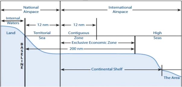
YAMUNA WATER QUALITY IMPROVES DURING LOCKDOWN
22, Apr 2020
Why in News?
- According to a report by the Delhi Pollution Control Committee (DPCC), the quality of water in the river Yamuna has improved along the Delhi stretch, compared to April 2019.
How Data is Analysed?
- DPCC, along with the Central Pollution Control Board (CPCB) carried out the study after being asked by a National Green Tribunal (NGT) appointed monitoring committee. Earlier, less air pollution and improved air quality were also noticed in various cities.
- DPCC collected water samples from nine locations along the Yamuna and twenty locations of drains and compared the different parameters with values from April 2019.
- According to the report, the pollution has reduced between 18% to 21% in various places.
- Five locations have shown 18%-33% reduction in Biochemical Oxygen Demand (BOD) The rest of the locations have shown slight to considerable increase in BOD levels.
- Four of the nine locations where dissolved oxygen (DO)was nil in 2019 showed DO levels of 2.3-4.8 mg/l in 2020.
- However, the Yamuna has still not met the “water quality criteria”.
What are the Reasons for the Improvement?
- Lockdown: Earlier, a Delhi Jal Board (DJB) report had also highlighted the improved quality of water due to the lockdown (to curb the COVID-19).
- Increased Flow: Haryana has increased the discharge of water which has also contributed to less Pollution due to Dilution of Fresh Water.
What is Biochemical Oxygen Demand?
- It is the amount of dissolved oxygen needed by microorganisms to decompose organic matter (waste or pollutants) under aerobic reaction (in the presence of oxygen).
- The more organic matter there is (e.g., in sewage and polluted bodies of water), the greater is the BOD; and the greater the BOD, the lower the amount of dissolved oxygen available for higher animals such as fishes.
- A higher BOD level means that more oxygen is needed to decompose a large quantity of organic matter present in the water.
- So, a higher value of BOD means that the water is more polluted.
- The BOD is therefore a reliable gauge of the organic pollution of a water body.
- One of the main reasons for treating wastewater prior to its discharge into a water resource is to lower its BOD i.e. to reduce its need of oxygen and thereby lessen its demand from the streams, lakes, rivers, or estuaries into which it is released.
- Dissolved Oxygen is the amount of oxygen dissolved and present in the water which is needed for aquatic life to survive. The quality of water increases with an increase in DO levels.
- A DO level of 5 mg/l or above is the recommended level for bathing in a river.
About River Yamuna:
- The river Yamuna, a major tributary of river Ganges, originates from the Yamunotri glacier near Bandarpoonch peaks in the Mussoorie range of the lower Himalayas at an elevation of about 6387 meters above mean sea level in Uttarkashi district of Uttarakhand.
- It meets the Ganges at the Sangam (where Kumbh mela is held) in Prayagraj, Uttar Pradesh after flowing through Uttarakhand, Himachal Pradesh, Haryana and Delhi.
- Important Dams are Lakhwar-Vyasi Dam (Uttarakhand), Tajewala Barrage Dam (Haryana) etc.
- Important Tributaries are Chambal, Sindh, Betwa and Ken.
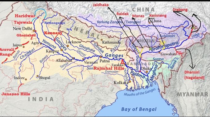
CAUVERY BECOMES CLEAN DUE TO COVD-19 LOCKDOWN
01, Apr 2020
Why in News?
- According to the Karnataka State Pollution Control Board (KSPCB), the strict enforcement of 21-day lockdown due to the COVID-19 pandemic has reduced the pollution in Cauvery River and its Tributaries.
Key Points:
- Untreated sewage from residential areas; pollutants from industries; religious waste material from pilgrims, and construction debris had been polluting the rivers.
- These rivers were flowing with hazardous elements such as lead, fluoride, faecal coliform, and some suspended solids in highly dangerous quantities.
- The prohibition of industrial and religious activities has helped in reducing pollution levels in the rivers.
- However, the Board will test the water samples at the regional laboratory in Mysore under the national programme ‘Monitoring of Indian National Aquatic Resources’and Global Environmental Monitoring Scheme.
About Global Environment Monitoring System (GEMS):
- It was introduced in 1975 at the United Nations Conference on the Human Environment.
- It is a global operation that collects information to better understand and protect the Earth’s environment.
- This effort is made with the cooperation of other countries, who contribute data to the GEMS.
About Monitoring of Indian National Aquatic Resources (MINARS):
- MINARS is a National Programme of monitoring national aquatic resources.
- It was started in 1984, with a total of 113 stations spread over 10 river basins.
- The present network comprises 870 stations on rivers, lentic water bodies and subsurface waters.
About Cauvery River:
- Cauvery is a sacred river of southern India. It rises in the Brahmagiri range of the Western Ghats and falls in the Bay of Bengal south of Cuddalore, in Tamil Nadu.
- It forms the sacred islands of Srirangapatna and Shivanasamudra and Shivanasamudra falls and also a wide delta.
- Total Length of the river is about 760 km.
- Its main tributaries are Amravati, Bhavani, Hemavati, Kabini, Shimsha, and Lakshmana Tirtha.
- Its basin drains parts of Karnataka, Kerala and Tamil Nadu.

KURIL ISLANDS
27, Mar 2020
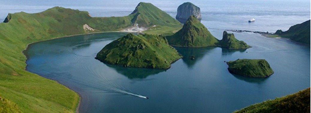
Why in News?
- Recently, an earthquake of magnitude 7.5, struck in the northern Pacific, the closest shores on Russia’s far eastern Kuril Islands.
About Kuril Islands:
- It is stretched from the Japanese island of Hokkaido to the southern tip of Russia’s Kamchatka Peninsula separating Okhotsk Sea from the North Pacific Ocean.
- It consists of 56 islands and minor rocks. The chain is part of the belt of geologic instability circling the Pacific and contains at least 100 volcanoes, of which 35 are still active, and many hot springs.
- It is surrounded by rich fishing grounds and are thought to have offshore reserves of oil and gas. The Rare rhenium deposits have been found on the Kudriavy volcano on Iturup.
- It consists Nickel-based superalloys of rhenium which is used in the combustion chambers, turbine blades, and exhaust nozzles of jet engines.
- Tourism is also a potential source of income, as the islands have several volcanoes and a variety of birdlife.
- Strategic Importance: Russia has deployed missile systems in the region. It also plans a submarine project and intends to prevent any American military use of the islands.
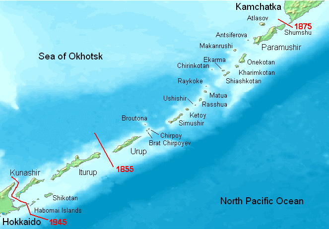
About Sovereignty – Kuril Islands:
- The Islands dispute between Japan and Russia is over the sovereignty of South Kuril Islands.The South Kuril Islands comprises Etorofu island, Kunashiri island, Shikotan island and the Habomai island. These islands are claimed by Japan but occupied by Russia as successor state of the Soviet Union.
- These islands are known as Southern Kurils by Russia whereas Japan calls them Northern Territories.
About Ainu People:
- It was originally inhabited by the Ainu people, and they were later settled by the Russians and Japanese, following several waves of exploration in the 17th and 18th centuries.
- The Ainu or the Aynu, also known as the Ezo in the historical Japanese texts, are an indigenous people of Japan and Russia.
- Treaty of Shimoda (1855): It is concluded between Japan and Russia, which gave control of the four southernmost islands to Japan and the remainder of the chain to Russia.
- Treaty of Saint Petersburg (1875): It is signed between two countries, Russia ceded possession of the Kurils to Japan in exchange for uncontested control of Sakhalin Island.
- Yalta Agreement (1945): As part of the Yalta agreements the islands were ceded to the Soviet Union, and the Japanese population was repatriated and replaced by Soviets.
- San Francisco Peace Treaty (1951): It is signed between the Allies and Japan, states that Japan must give up “all right, title and claim to the Kuril Islands”, but it also does not recognize the Soviet Union’s sovereignty over them.
- Japan-Soviet Joint Declaration (1956): It restored diplomatic ties between Japan and Russia by Japan-Soviet Joint Declaration. During that time, Russia offered to give away the two islands closest to Japan. But the offer was rejected by Japan as the two islands constituted only 7% of the land in question.
- However, Russia indicated that the joint declaration signed by Japan and the Soviet Union in 1956 neither mentions a basis for returning Habomai and Shikotan nor clarifies which country has sovereignty over the islands. Further, in 2019, Japanese PM made it clear that the country is not in the favour of withdrawing control over the Islands. Japan also believes that the islands are the inherent part of the nation’s territory. Therefore, Japan mentioned that it aims to sign the peace treaty after the territorial issue is resolved.
MINES AND MINERAL LAWS (AMENDMENT) BILL
09, Mar 2020
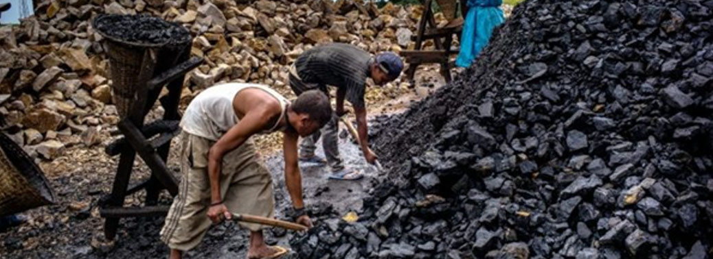
Why in News?
- The Lok Sabha has recently passed the Mineral Laws (Amendment) Bill which amends the Mines and Minerals (Development and Regulation) Act, 1957 (MMDR Act) and the Coal Mines (Special Provisions) Act, 2015 (CMSP Act).
Who Grants Permission for Mining?
- The state governments grant permission for mining, known as mineral concessions, for all the minerals located within the boundary of the state, under the provisions of the Mines and Minerals (Development and Regulation) Act, 1957 and Mineral Concession Rules, 1960.
- However, for minerals specified in the First Schedule to the Mines and Minerals (Development and Regulation) Act, 1957, Central government approval is necessary before granting the mineral concession.
- Minerals specified under the First Schedule include hydrocarbons, atomic minerals and metallic minerals such as iron ore, bauxite copper ore, lead precious stones, zinc and gold.
Key Features of the Bill:
- Allocation of coal/lignite blocks for composite prospecting licence cum mining lease has been provided.
- Requirement of previous approval in cases where allocation of blocks was made by Central Government has been dispensed with.
- Removal of restriction on end-use of coal: Companies will be allowed to carry on coal mining operation for own consumption, sale or for any other purposes, as may be specified by the Central Government.
- Transfer of statutory clearances to New Bidders:The Bill provides that the various approvals, licenses, and clearances given to the previous lessee will be extended to the successful bidder for a period of two years. During this period, the new lessee will be allowed to continue mining operations.
- Advance Action for Auction:Under the MMDR Act, mining leases for specified minerals (minerals other than coal, lignite, and atomic minerals) are auctioned on the expiry of the lease period. The Bill provides that state governments can take advance action for auction of a mining lease before its expiry.
What are its Significance?
- This will speed up the process of implementation of projects, ease of doing business, simplification of procedure and benefit all the parties in areas where minerals are located.
What are its Implications?
- This opens up the sector to players outside steel and power as well as removes end-use restrictions.
- It will create an efficient energy market and bring in more competition as well as reduce coal imports. India imported 235 million tonnes (mt) of coal last year, of which 135 mt valued at Rs 171,000 crore could have been met from domestic reserves.
- It might also put an end to Coal India Ltd’s monopoly in the sector.
- It would also help India gain access to high-end technology for underground mining used by miners across the globe.
What is the Target for New Mining?
- In 2018, the government allowed commercial mining by private entities and set a mining target of 1.5 billion tonnes by 2020. Out of this, 1 billion tonnes was set to be from Coal India, while 500 million tonnes was to be from non-Coal India entities. This target has now been revised to 1 billion tonnes by 2023-24.
VISIT OF UN DELEGATION ON PALESTINE TO INDIA
06, Mar 2020
Why in News?
- Recently, a UN delegation on Palestine visited New Delhi to seek India’s political and diplomatic support for a peaceful resolution to the long-standing conflict between Israel and Palestine.
About Two-State Solution:
- The “two-state solution” is based on a UN resolution of 1947 which proposed two states – one would be a state where Zionist Jews constituted a majority, the other where the Palestinian Arabs would be a majority of the population. The idea was however rejected by the Arabs.
- For decades, it has been held by the international community as the only realistic deal to end the Israeli-Palestinian conflict.
- India has consistently voted in favour of those resolutions that promote the two-state solution with a Palestinian claim to East Jerusalem
What is India’s Stand on Israel-Palestine Issue?
- In June 2019, India voted in favour of a decision introduced by Israel in the UN Economic and Social Council(ECOSOC) that objected to granting consultative status to a Palestinian non-governmental organization.
- In June 2018, India had voted in favour of Palestine on the UN General Assembly (UNGA)resolution to investigate an indiscriminate force usage by Israeli forces against Palestinian civilians.
- As a part of Link West Policy, India has de-hyphenated its relationship with Israel and Palestine in 2018 to treat both the countries mutually independent and exclusive.
- In December 2017, India had criticised the United States vote for recognising Jerusalem as the Israeli capital at the UNGA vote.
- In 2014, India favoured UNHRC’s resolution to probe Israel’s human rights violations in Gaza. Despite supporting the probe, India abstained from voting against Israel in UNHRC in 2015.
What are the Key Points of their Visit?
- The delegation of the United Nations Committee on the Exercise of the Inalienable Rights of the Palestinian People (CEIRPP)intends to engage India in the settling of the question of Palestine.
- United Nations Committee on the Exercise of the Inalienable Rights of the Palestinian People (CEIRPP)was founded in 1975 by the United Nations General Assembly.
- It aims to formulate a programme to enable the Palestinian people to exercise their right to self-determination, to national independence and sovereignty, and the right of Palestine refugees to return.
- During the visit of the UN delegation on Palestine, India has reiterated its stand and supported the Two-State solution for the Israel-Palestine issue.
- The visit aimed to enhance the political and diplomatic support of India for a peaceful solution to the Israel-Palestine conflict and engaging Indian counterparts on synergies in capacity building for staff and institutions of Palestine.
- The delegation intends to involve countries like India as it shares good relations with both Israel and Palestine, and is also attached to multilateral principles, to play a bigger role in the resolution of the issue.
GODAVARI CAUVERY INTERLINKING PROJECT
05, Mar 2020
Why in News?
- A day after the National Interlinking of River Authority (NIRA) was proposed, the CM of Tamil Nadu has sought discussion on implementation of the Cauvery Godavari river interlinking project with his counterpart CM of Andhra Pradesh.
About Godavari Cauvery Interlinking Project:
- The project envisages the diversion of 247 thousand million cubic feet (tmcft) of unutilised water in the Indravati sub-basin of the Godavari basin to meet the requirements between the Godavari and the Cauvery rivers.
- Water will be diverted from Godavari River to Nagarjuna Sagar dam (through lifting) and further south to meet the demands of Krishna, Pennar and Cauvery basins.
- The Godavari – Cauvery link comprises three components namely,
- the Godavari (Inchampalli/Janampet) – Krishna (Nagarjunasagar),
- the Krishna (Nagarjunasagar) – Pennar (Somasila) and
- the Pennar (Somasila)–Cauvery.
- The project will provide irrigation facilities to 3.45 to 5.04 lakh hectares in Prakasam, Nellore, Krishna, Guntur, and Chittoor districts of Andhra Pradesh.
About the Rivers:
1. Godavari River
- Source: Godavari River rises from Trimbakeshwar near Nasik in Maharashtra and flows for a length of about 1465 km before out falling into the Bay of Bengal.
- Drainage Basin: The Godavari basin extends over states of Maharashtra, Andhra Pradesh, Chhattisgarh and Odisha in addition to smaller parts in Madhya Pradesh, Karnataka and Yanam (Union territory of Puducherry in East Godavari district of Andhra Pradesh).
- Tributaries: Pravara, Purna, Manjra, Penganga, Wardha, Wainganga, Pranhita (combined flow of Wainganga, Penganga, Wardha), Indravati, Maner and the Sabri.
2. Krishna River
- Source: It originates near Mahabaleshwar (Satara) in Maharashtra.
- Drainage Basin: It runs from four states namely, Maharashtra, Karnataka, Telangana and Andhra Pradesh before emptying into the Bay of Bengal.
- Tributaries: Tungabhadra, Mallaprabha, Koyna, Bhima, Ghataprabha, Yerla, Warna, Dindi, Musi and Dudhganga.
- Nagarjunasagar dam is on the river Krishna.
3. Pennar River
- Source: It rises in Nandi Hills in Chikballapur District of Karnataka and runs north and east before emptying into the Bay of Bengal.
- Drainage Basin: It is 597 kilometres long, with a drainage basin covering 55,213 km2 in Karnataka and Andhra Pradesh.
- Tributaries: Jayamangali, Kunderu, Sagileru, Chitravathi, Papagni and Cheyyeru.
4. Cauvery River
-
- Source: The River rises on Brahmagiri Hill of the Western Ghats in south western Karnataka.
- Drainage Basin: It flows in a south easterly direction through the states of Karnataka and Tamil Nadu, and descends the Eastern Ghats in a series of great falls. Before emptying into the Bay of Bengal south of Cuddalore, Tamil Nadu, the river breaks into a large number of distributaries forming a wide delta called the “garden of southern India.”
- Tributaries: Arkavathi, Hemavathi, Lakshmana Theertha, Shimsa, Kabini and Harangi.

What are the benefits of the Project?
- The backwaters will be carried through Krishna and Pennar using steel pipes instead of developing canals en route as suggested by a non-resident engineer from Andhra Pradesh.
- By doing so, wastage of water from canals through vaporisation could be prevented and overall cost reduced.
INDIAN SCIENTIFIC EXPEDITION TO THE SOUTHERN OCEAN 2020
19, Feb 2020
Why in News?
- On January, the South African oceanographic research vessel SA Agulhas set off from Port Louise in Mauritius, on a two-month Indian Scientific Expedition to the Southern Ocean 2020.
- On 14thFeb the vessel was at Prydz Bay, in the coastal waters of “Bharati”, India’s third station in Antarctica.
Highlights:
- On board the vessel are 34 scientific staff from India, apart from technical hands, seamen and a chef who are all from South Africa.
- This is the 11thexpedition of an Indian mission to the Southern Ocean, or Antarctic Ocean. The first mission took place between January and March 2004.
Objectives:
- The 18-institution team, led by Dr.Anoop Mahajan from the Indian Institute of Tropical Meteorology, Pune, are collecting air and water samples from around 60 stations along the cruise track.
- These will give valuable information on the state of the ocean and atmosphere in this remote environment and will help to understand its impacts on the climate
- A key objective of the mission is to quantify changes that are occurring and the impact of these changes on large-scale weather phenomenon, like the Indian monsoon, through tele-connection,
- Study mainly aims to understand the influence of the Southern Ocean across eco-system and atmospheric changes and how it affects the tropical climate and weather conditions.
Main Objectives:
- Carbon dioxide is getting emitted into the atmosphere, and through atmospheric circulation goes to the Antarctic and Polar Regions.
- Since the temperature is very low there, these gases are getting absorbed and converted into dissolved inorganic carbon or organic carbon, and through water masses and circulation it is coming back to tropical regions. Since it is warmer in these areas, it re-enters the atmosphere
- It is this cycle that the mission will help understand better. “How much carbon dioxide is going to those regions, and how much is coming back. That is the main objective.”
Six Core Projects:
- Study hydrodynamics and biogeochemistry of the Indian Ocean sector of the Southern Ocean; involves sampling sea water at different depths. This will help understand the formation of Antarctic bottom water.
- Observations of trace gases in the atmosphere, such as halogens and dimethyl sulphur from the ocean to the atmosphere. Will help improve parameterisations that are used in global models.
- Study of organisms called coccolithophores that have existed in the oceans for several million years; their concentrations in sediments will create a picture of past climate.
- Investigate atmospheric aerosols and their optical and radiative properties. Continuous measurements will quantify impact on Earth’s climate.
- Study the Southern Ocean’s impact on Indian monsoons. Look for signs in sediment core taken from the bottom of the ocean.
- Dynamics of the food web in the Southern Ocean; important for safeguarding catch and planning sustainable fishing.
WORLD WETLANDS DAY
04, Feb 2020
Why in News?
- World Wetlands Day was recently celebrated worldwide with the theme of ‘Wetlands and Biodiversity’.
About World Wetlands Day:
- World Wetlands Day is celebrated every year on the 2nd of February.
- This day marks the date of the adoption of the Convention on Wetlands on 2 February 1971 in the Iranian city of Ramsar.
- The theme for 2020 is ‘Wetlands and Biodiversity’.
- It was first celebrated in 1997.
What is a Wetland?
- Wetlands are Ecosystems Saturated With Water, either seasonally or permanently.
- They include mangroves, marshes, rivers, lakes, deltas, floodplains and flooded forests, rice-fields, coral reefs, marine areas no deeper than 6 metres at low tide, as well as human-made wetlands such as waste-water treatment ponds and reservoirs.
- Though they cover only around 6% of the Earth’s land surface, 40% of all plant and animal species live or breed in wetlands.
Why Wetlands are Important?
- Wetlands are a critical part of our natural environment. They mitigate floods, protect coastlines and build community resilience to disasters, reduce the impacts of floods, absorb pollutants and improve water quality.
- Wetlands are critical to human and planet life. More than 1 billion people depend on them for a living and 40% of the world’s species live and breed in wetlands.
- They are a vital source for food, raw materials, genetic resources for medicines, and Hydropower.
- 30% of land-based carbon is stored in Peat land. Peat also known as turf is an accumulation of partially decayed vegetation ororganic matter.
- They play an important role in Transport, Tourism and the Cultural and Spiritualwell-being of people.
- Many wetlands are areas of natural beauty and many are important to Aboriginal people.
What are the Threats Faced?
- As per the IPBES (Intergovernmental Science-Policy Platform on Biodiversity and Ecosystem Services)’sGlobal Assessment wetlands are the most threatened ecosystem.
- Wetlands are disappearing 3 times faster than forests due toHuman Activities and global warming.
- According to UNESCO, the threat to wetlands will have an adverse impact on world’s flora and fauna that live or breed in wetlands.
- Major threats are Agriculture activities, development, pollution and climate change.
About IPBES:
- IPBES is an independent intergovernmental body established to strengthen the science-policy interface for biodiversity and ecosystem services for the conservation and sustainable use of biodiversity, long-term human well-being and sustainable development.
- It was established in Panama City (US), in April 2012.
- It is not a United Nations body.
What is the status of Wetlands in India?
- Recently, the Ramsar Convention declared 10 wetlands from India as Ramsar sites taking the total number of Ramsar Sites in the country to 37.
- Wetlands declared as Ramsar sites are protected under strict guidelines of the convention.
- There are currently over 2,300 Ramsar Sites around the world.
- India has over 7 lakh wetlands, covering 4.5% of the country’s area, yet none of the wetlands has been notified under domestic laws.
- Wetlands are regulated under the Wetlands (Conservation and Management) Rules, 2017.
- The 2010 version of the Rules provided for a Central Wetland Regulatory Authority, but new Rules of 2017 replaced it with state-level bodies and created a National Wetland Committee, which functions in an Advisory Role.
- The newer regulations removed some items from the definition of “wetlands” including backwaters, lagoons, creeks, and estuaries.
- Under the 2017 regulations process to identify the wetlands has been delegated to the States.
VIOLATION OF GANGA FLOW NORMS
01, Feb 2020
Why in News?
- A recent report by Central Water Commission(CWC) says that few hydro power projects on the upper reaches of the river Ganga’s tributaries are violating Ganga Ecological Flow (e-flow) Norms.
About Ganga River System:
- The Ganga is the most important river of India both from the point of view of its basin and cultural significance.
- It rises from the Gangotri glacier near Gaumukh (3,900 m) in the Uttarkashi district of Uttarakhand. Here, it is known as the Bhagirathi.
- The important tributaries of Ganga are the Ramganga, the Gomati, the Ghaghara, the Gandak, the Kosi and the Mahanada.
- The river finally discharges itself into the Bay of Bengal near the Sagar Island

What is Ecological – Flow Norms?
- The Central Government under the Environment (Protection) Act, 1986has notified the minimum environmental flows for the River Ganga that has to be maintained at various locations on the river.
- This is to ensure that the river has at least the minimum required environmental flow of watereven after the river flow gets diverted by projects and structures for purposes like irrigation, hydropower, domestic and industrial use etc.
- This is an important step taken towards maintaining the uninterrupted or Aviral Dhara(continuous flow) of the river.
- Environmental flows are the Acceptable Flow Regimes that are required to maintain a river in the Desired Environmental Stateor predetermined state.
- The Central Water Commission is the designated authority and will be responsible for supervision, monitoring, regulation of flows and reporting of necessary information to the appropriate authority as and when required and also take emergent decisions about the water storage norms in case of any emergency.
Which are the Non-Compliant Ones?
- The non-compliant ones are: Vishnuprayag Hydroelectric project– Alaknanda, Srinagar Hydroelectric project – Alaknanda, Maneri Bhali Phase 2 – Bhagirathi and Pashulok – Ganga Mainstream.
- Violating the e-flow norms can mean closure of the project or a hefty fine.
Tussle between Power Companies and E-flow Norms:
- The Centre’s e-flow notification came into effect in October 2018 and gave companies three years to modify their design plans, if required, to ensure that a minimum amount of water flowed during all seasons.
- Power producers generally hoard water to create reserves to increase power production.
- In September 2019, the government advanced this deadline, from October 2021 to December 2019.
- This was after the CWC undertook field visits to hydropower sites and reported that most of the power projects could begin implementing the norms right away and didn’t need three years.
About Central Water Commission:
- CWC is a premier technical organization of India in the field of water resources and is presently functioning as an attached office of the Ministry of Jal Shakti.
- It was formed in 1974-1975 via a notification.
- The Commission is entrusted with the general responsibilities of initiating, coordinating and furthering in consultation of the State Governments concerned, schemes for control, conservation and utilization of water resources throughout the country, for the purpose of flood control, irrigation, navigation, drinking water supply and Water Power Development.
GUIDELINES – SAND MINING
30, Jan 2020
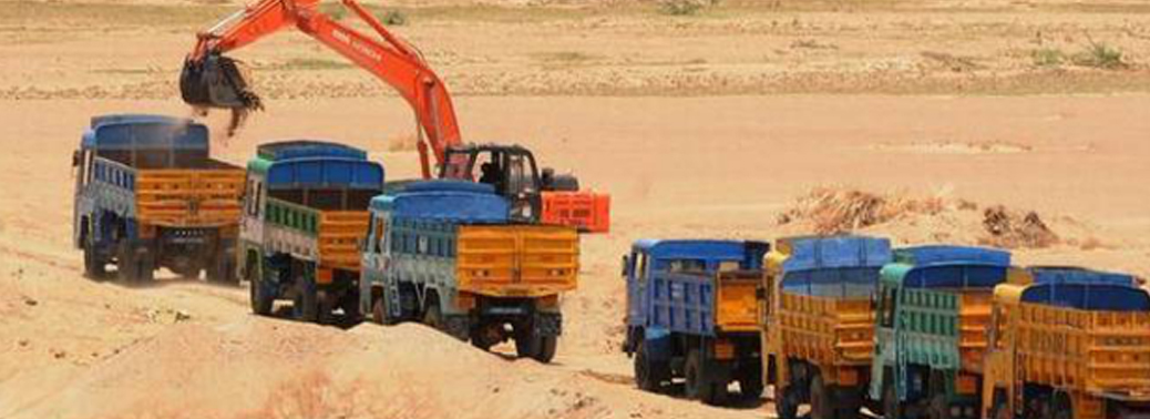
Why in News?
- Recently, the Ministry of Environment, Forests and Climate Change (MoEFCC) has released guidelines to monitor and check Illegal Sand Mining in the country.
The Constitutional Framework of Mining Sector in India:
- The State List, mandates the state government to own the minerals located within their boundaries.
- The Central List, mandates the central government to own the minerals within the exclusive economic zone of India (EEZ). In pursuance to this Mines & Minerals (Development and Regulation) (MMDR) Act of 1957 was framed.
- The Central Government notifies certain minerals as ‘minor’ minerals from time to time for which the absolute powers for deciding on procedures of seeking applications for and granting mineral concessions, fixing rates of royalty, dead rent, and power to revise orders rest only with the State Government. For Example, building stones, gravel, ordinary clay, ordinary sand are few Minor Minerals.
The Mines and Minerals (Development and Regulation) Act, 1957:
- The Mines and Minerals (Development and Regulation) Act, 1957 has empowered state governments to make rules to prevent illegal mining, transportation and storage of minerals.
- For minerals specified in the First Schedule to the Mines and Minerals (Development and Regulation) Act, 1957approval of the Central Government is necessary.
- It contains minerals such as coal and lignite, minerals of the “rare earths” group containing Uranium and Thorium.
Enforcement and Monitoring Guidelines for Sand Mining 2020
- END to END Monitoring:The new set of guidelines focuses on the effective monitoring of sand mining from the identification of sand mineral sources to its dispatch and end-use by consumers and the general public and look at a uniform protocol for the whole country.
- Constantly monitor mining with drones and night surveillance of mining activity through night-vision drones.
- Audits in Sand Mining: States to carry out river audits, put detailed survey reports of all mining areas in the public domain.
- Transparency in Purchasing: Online sales and purchase of sand and other riverbed materials (RBM) for transparency in the process.
- Enforcement of the Rules: It gives directions to states to set up dedicated task forces at district levels.
- In cases where rivers become district boundaries or state boundaries, the districts or states sharing the boundary shall constitute the combined task force for monitoring of mined materials, mining activity and participate in the preparation of District Survey Reports (DSR) by providing appropriate inputs.
- Sustainability of Mineral Resource:Conduct replenishment study for river bed sand in order to nullify the adverse impacts arising due to excessive sand extraction.
- No riverbed mining will be allowed during the monsoon.
- The government has found that the DSRs carried out by state and district administrations are often not comprehensive enough, allowing space for illegal mining.
- The new guidelines, includes the development of an inventory, for the first time, of river bed material and other sand sources in the district.
What is Sand Mining?
- Sand Mining is an activity referring to the process of the actual removal of sand from the foreshore including rivers, streams and lakes. Sand is mined from beaches and inland dunes and dredged from ocean beds and river beds.
Impacts of Excess Sand Mining:
- River sand is preferred for construction because it requires less processing and has better quality than other sources.
- But it comes at a huge cost to the river and those living around it. Excessive sand mining can alter the river bed, force the river to change course, erode banks and lead to Flooding.
- It also destroys the habitat of aquatic animals and micro-organisms besides affecting groundwater recharge.
RARE EARTH ELEMENTS
14, Dec 2019
Why in News?
- U.S.A has been planning to fund the construction of a Rare Earths processing facility in order to secure the domestic supply of minerals that are used to make Military Weapons and Electronics.
Why U.S.A needs such a Facility?
- The decision of U.S.A arrived when China threatened to stop exporting Rare Earth materials to them amid the ongoing trade war between the countries.
- At present, China refines approximately 80%-90% of the world’s Rare Earths, thereby having substantial control over their supply.
- It has be noted that this will be the first financial investment by the USA into commercial-scale Rare Earths production since the Manhattan Project to build the first atomic bomb during World War II.
About Rare Earths Minerals (REM):
- The rare earths minerals (REM) are a set of seventeen metallic elements. These include the fifteen lanthanides on the periodic table in addition to scandium and yttrium that show similar physical and chemical properties to the lanthanides.
- The REMs have unique catalytic, metallurgical, nuclear, electrical, magnetic and luminescent properties.
- Even though it has been named as ‘rare earth minerals’, they are in fact not that rare and are relatively abundant in the Earth’s crust.
Applications of REMs:
- Due to their unique magnetic, luminescent, and electrochemical properties, they help in technologies perform with reduced weight, reduced emissions, and energy consumption; therefore give them greater efficiency, performance, miniaturization, speed, durability, and thermal stability.
- Its usage range from daily use (e.g., lighter flints, glass polishing mediums, car alternators) to high-end technology (lasers, magnets, batteries, fibre-optic telecommunication cables).
- Even futuristic technologies involve the usage of these REMs.
- For Example: High-temperature superconductivity, safe storage and transport of hydrogen for a post-hydrocarbon economy, environmental global warming and energy efficiency issues.
16 SEISMOMETERS DEFUNCT IN EARTHQUAKE-PRONE ZONES
04, Dec 2019
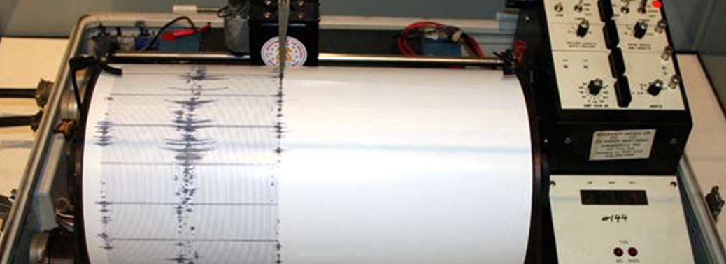
Why in News?
- At least 20 out of 35 seismometers in Maharashtra are lying in a state of disrepair, and 16 of these are located in seismic zones III and IV.
Seismometers:
- A seismometer is an instrument used to measure and record earthquakes.
Seismic Zones in India:
- Over 59 % of India’s land area is under threat of moderate to severe earthquakes.
- The zones are divided on the basis of Modified Mercalli (MM) intensity, which measures the impact of earthquakes.
Earthquake-Prone-Zones-in-India-2:
- The bureau of Indian standards is the official agency for publishing the seismic hazard maps and codes. Bureau of Indian Standards grouped India into four seismic zones, viz. Zone II, III, IV and V.
- Zone – V (highest seismic activity zone): Entire north-eastern India, parts of Jammu and Kashmir, Himachal Pradesh, Uttaranchal, Rann of Kutch, part of North Bihar and Andaman & Nicobar Islands.
- Zone – IV (high seismic zone): Parts of Jammu and Kashmir and Himachal Pradesh, Delhi, Sikkim, Northern Parts of Uttar Pradesh, Bihar and West Bengal, parts of Gujarat and small portions of Maharashtra near the west coast and Rajasthan.
- Zone – III (moderate seismic zone.): Kerala, Goa, Lakshadweep islands, remaining parts of Uttar Pradesh, Gujarat and West Bengal, Parts of Punjab, Rajasthan, Madhya Pradesh, Bihar, Jharkhand, Chhattisgarh, Maharashtra, Orissa, Andhra Pradesh, TamilNadu and Karnataka.
- Zone – II (least active seismic zone): Remaining parts of India.
Significance of India’s Seismic Zoning Map:
- It is mainly used by the Department of Disaster Management of the different state governments. It also helps them in planning for a natural disaster like earthquake.
- An Indian seismic zoning map assists one in identifying the lowest, moderate as well as highest hazardous or earthquake prone areas in India. Even such maps are looked into before constructing any high rise building so as to check the level of seismology in any particular area.
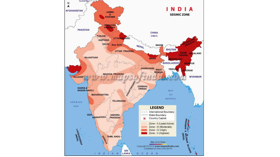
North Indian Plate:
- Indian tectonic plate broke off from an ancient supercontinent called Gondwana 100 million years ago.
- The Indian plate skewed north and slammed into the Eurasian plate, creating the Himalayas.
- India still moves northeast into Eurasian plate at roughly 5 cm every year. About 60% of India is vulnerable to earthquakes caused by northward grind of the Indian subcontinental landmass.
INDIA ONE OF THE LARGEST GOLD SMUGGLING HUBS IN THE WORLD
29, Nov 2019

Why in News?
- International Non-Government Organisation IMPACT, in its latest report, has said that India has become one of the largest gold smuggling hubs in the world. It is headquartered in Canada.
Highlights:
- Gold possibly tied to conflict, human rights abuses and corruption in Africa and South America is entering legal international markets through India, said IMPACT, in a statement.
- Actors across India’s gold industry are failing to do proper checks on where gold comes from to ensure it’s not financing conflict and human rights violations.
- The report said that one-third of the world’s gold passed through India, identifying three primary factors for smuggling: tax breaks, falsified origin documents and complicit allies.
- To boost India’s refinery sector, the government had introduced tax breaks in 2013 for unrefined gold. According to the report, this led to traders covering up questionable provenance claims by falsifying documentation to take advantage of lower taxes. The import of unrefined gold shot from 23 tonnes in 2012 to over 229 tonnes in 2015.
- Analysis of trade data reveals more declared gold imports to India than some countries are capable of producing, such as in the Dominican Republic and Tanzania, as well as instances of paperwork fraud like in Ghana.
- In the case of the Dominican Republic, as much as 100.63 tonnes of gold dore [unrefined gold] imported to India between 2014 and 2017 cannot be accounted for in the country’s gold production.
- The report said that refined gold was being smuggled into India primarily from the United Arab Emirates, while key traders and refiners in Africa’s Great Lakes region with links to India were identified as being part of the illicit gold trade.
Way Forward:
- IMPACT recommended harmonising of taxes and enhanced regulatory controls with additional valid information for all imports to discourage smuggling.
- With India at the heart of a web of the illicit trade of gold, and threads spanning the globe and almost certainly financing conflict and corruption, it is said that the authorities must take action to remove incentives for gold smuggling and ensure the gold industry implements due diligence.
- IMPACT has also called on those associated with India’s gold industry to implement due diligence on their gold supply chains.
ROHTANG TUNNEL
28, Nov 2019
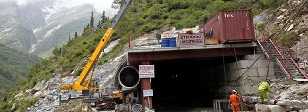
Why in News?
- The Rohtang Tunnel will become the world’s longest highway tunnel above 10,000 feet, after its inauguration in September
Rohtang Tunnel:
- Rohtang Tunnel is a highway tunnel being built under the Rohtang Pass in the eastern Pir Panjal range of the Himalayas on the Leh-Manali Highway.
- At 8.8 km length, the tunnel will be one of the longest road tunnels in India and is expected to reduce the distance between Manali and Keylong by about 46 km.
- For now, the tunnel provides a temporary winter link to the outside world not only to residents of Lahaul and Spiti but also to those living in Zanskar Valley of Ladakh.
- While Rohtang Pass is at a height of 13,050 feet, the pass on the road to Leh is Baralacha La at 16,040 feet.
- An alternate road link to Ladakh has also been developed by BRO on the Darcha-Padam-Nimu axis, but here again a 4.15-km long tunnel at Sinka La Pass (16,703 feet) would be required for all-weather access.
Significance:
- The project also has significant strategic implications for the military as it will allow access beyond Rohtang Pass even in peak winters.
- All-winter connectivity to Ladakh, however, is still some time away as more tunnels will have to be built to tackle the high passes which fall beyond Rohtang.
Why Delay?
- It would have been completed at least four years earlier, but for a massive torrent of water encountered inside the tunnel.
- The Seri Nullah, which flows on top of the tunnel, almost threatened to derail the project and it took several years to devise ways to tackle the massive flow of water that often went up to 140 litres per second.
ACCOUNTING FOR EVERY DROP OF WATER
16, Nov 2019
Context:
- The Recent Push under the Jal Shakti Abhiyan has finally set the wheels turning to counter depleting levels of available water resources.
Today’s Water Scenario:
- Despite the implementation of the Jal Shakti Abhiyan, there is a need for a long-term scientific approach to the water scarcity issue.
- Institutional changes are the need of the hour if we wish to sustain the future benefits of Jal Shakti Abhiyan and go beyond reactionary policy.
- Groundwater accounts for only 433 billion cubic metres (BCM) of the total 1,123 BCM of available water, yet dependence on groundwater remains disproportionately high.
- Irrigation is currently the biggest consumer as it uses 89% of all groundwater extracted; the 9% extracted for domestic use accounts for 50% of urban water usage and 85% of rural water usage.
- Despite this there is a lack of concerted action to address the extraordinarily high consumption by the agriculture sector.
What does Government Reports Say?
- The NITI Aayog’s Composite Water Management Index Report, 2019, highlighted the potential consequences of not addressing the issue by 2030 or at least of not forestalling it.
- It projected, inter alia, that 6% of the GDP will be lost by 2050 at the current rate, the MSME sector will be affected both directly and indirectly, and 70% of thermal power plants will face a water crisis—in fact it has already started.
- Moreover other indirect effects of water scarcity such as desertification and land degradation will lead to the creation of a vicious cycle.
Problems Prevailing in India:
- The colonial vestige in the form of the Indian Easements Act, 1882, which prevents the creation of easementry rights over ground water, and allows for the easement for a polluting activity that has been done so for 20 years or more.
- The lack of prescription, i.e. private rights over ground water in practical application allows for industries to drain water greater than their rightful share due to the fluid nature of water.
- The case of Plachimada in Kerala is one such instance which led to a David versus Goliath confrontation between the people and Coca Cola.
- This is despite the fact that in M C Mehta vs. Kamal Nath, the apex court first invoked the Public Trust Doctrine (PTD) and declared it to be part of the law of the land.
- However, largely, the principle is echoed only in courtrooms. Lack of application of PTD has meant that water resources have not been democratised and decentralised.
What can be Done?
- The government should focus on providing elasticity in the variety of low-water-consumption crops that farmers can opt to grow while simultaneously disincentivising water-intensive crops like sugarcane.
- Basmati rice especially has resulted in India becoming the biggest virtual exporter of water; on the contrary, China has transformed itself into one of the top virtual importers of water by resorting to the import of water-intensive crops like soya.
- The government must also consider incentivising scientific methods to grow water-intensive crops sustainably as was done with the use of direct seeded rice in Punjab that resulted in water savings of up to 30% as it did not require puddling.
- Providing millets, which requires less water and other inputs, in mid-day meals will promote its cultivation and ensure better nutrition; while more expensive than rice there are long-term benefits to be gained.
- Furthermore, encroachments on river banks and flood plains must be strictly dealt with to ensure that they can be rejuvenated and thereby reduce the stress on groundwater reserves.
- On the contrary, electricity and fertiliser subsidies have incentivised farmers to grow water-intensive crops.
- Cheap access to electricity and other inputs have allowed for the cultivation of crops in areas having low productivity, requiring even greater amounts of water as pointed out in the Economic Survey 2018-2019.
- Similarly smaller landholdings that cannot sustain an economy of scale require a disproportionate amount of water.
- Further, considering that water conservation fee may be levied on agriculture, such a move may become yet another subsidy to be shouldered by the state in line with previous trends.
- But such subsidies remain one of the few ways to financially incentivise agriculture especially in light of depreciating prices fostered by a pro-consumer approach.
UNESCO CREATIVE CITIES NETWORK (UCCN)
02, Nov 2019
Why in News?
- UNESCO has designated Mumbai as a member of UNESCO Creative Cities Network (UCCN) in the field of FILM and Hyderabad in the field of GASTRONOMY, on the occasion of World Cities Day 2019.
Highlights:
- By joining the UNESCO Creative Cities Network (UCCN), the cities pledge to share their best practices and develop partnerships involving public and private sectors as well as civil society to strengthen creation, production, distribution and dissemination of cultural activities, goods and services.
- The network covers seven creative fields: crafts and folk arts, media arts, film, design, gastronomy, literature and music.
- Previously, 3 Indian cities were recognized as members of UCCN, namely- Jaipur-Crafts and Folk Arts (2015), Varanasi-Creative city of Music (2015), Chennai-Creative city of Music(2017).
- Ministry of Culture is the nodal Ministry of Government of India for all matters in UNESCO relating to culture.
UNESCO Creative Cities Network (UCCN):
- The UCCN, created in 2004, is a network of cities which are thriving, active centres of cultural activities in their respective countries.
- The UNESCO Creative Cities Network now counts a total of 246 cities.
- The member cities that form part of the Network come from all continents and regions with different income levels and populations.
SURVEY OF INDIA TO DEPLOY 300 DRONES FOR MAPPING COUNTRY
16, Sep 2019

Why in News?
- India’s oldest scientific department, the Survey of India (SoI), historically tasked with mapping the country will for the first time rely on drones to map the country.
About the Mapping Exercise:
- The main aim of the exercise is to provide good high-resolution foundation maps. This involves mapping of 75% of India’s geography, about 2.4 million sq km of the 3.2 million sq km within the next two years. However, forests, hills and deserts are likely to be left out.
- Currently the best SoI maps have a resolution of 1:250000, meaning a 1 cm on the map represents 2500 cm on the ground.
- The maps that are being planned to produce will be of 1:500 resolution, meaning 1 cm will represent 500 cm.SOI has been using aerial photography for mapping purposes (taking pictures from planes) but it has been expensive and has its own limitations. So the organisation aims to procure about 300 drones to accomplish this task and so far about 30 have been sourced for the gargantuan exercise.
- Every square kilometre mapped by drones will be encapsulated in 2500 pictures and thus be a trove of digital data.
Advantages of the Mapping Exercise:
- The mapping will create high resolution maps of land in villages which will also facilitate in the digitisation of land titles in villages.
- It also involves mapping of settled habitations in villages and based on the availability of accurate maps, residents will be finally able to get property cards as well as proper legal titles to their lands.
About Survey of India (SOI):
- Survey of India, The National Survey and Mapping Organisation of the country functions under the Department of Science & Technology.
- The Survey of India is India’s central engineering agency in charge of mapping and surveying. It was set up in the year 1767 to help consolidate the territories of the British East India Company. It is one of the oldest Engineering Departments of the Government of India.
- Its members are from Survey of India Service cadre of Civil Services of India and Army Officers from the Indian Army Corps of Engineers. It is headed by the Surveyor General of India.
MAHARASHTRA GOVT. TO CHANNEL SURPLUS WATER FROM WESTERN FLOWING RIVERS TO GODAVARI BASIN
09, Sep 2019
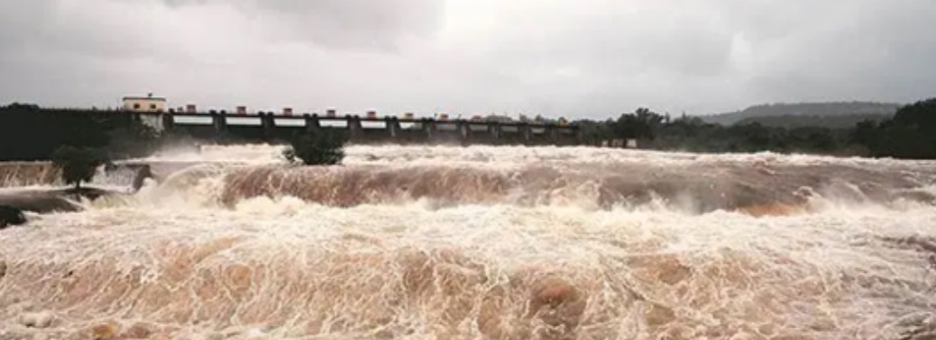
Context:
- The Maharashtra government has decided to channelise surplus water from western flowing rivers to the Godavari basin to tackle the drought in the Vidarbha and Marathwada Regions.
What is Project:
- The project is part of the interlinking of six major river basins under the Integrated State Water Plan.
- The plan entails interlinking the river basins using advanced technology to facilitate transfer and equitable distribution of water to overcome the challenges of water scarcity in drought-prone Marathwada, Vidarbha, parts of North Maharashtra and Western Maharashtra.
- There is 300 TMC surplus water from the western flowing rivers, which goes into the Arabian Sea.
- The plan is to tap 167 TMC water from Ulhas river, which would be channelised to the Godavari basin. There will be several tunnels built to lift the water.
Concern:
- In the last five years, Maharashtra has faced recurring drought for four consecutive years.
- Climate change makes it necessary to look beyond traditional methods of water conservation to tackle the drought
Integrated State Water Plan:
- The plan shall include structural measures, operational measures, water-shed management measures and demand management measures such as water conservation, scarcity scheduling and efficient technologies.
- The plan will also cover water pollution control measures and monitoring measures that will assure comprehensive sustainable management of the water resources and equity in water distribution for the benefit for the state and its people.
Drought in Maharashtra:
- The situation is equally grim across half of the state, which reels from the fourth drought in the past six years.
- Southwest summer monsoon, which brings almost 80 per cent of the annual rainfall, was woefully inadequate last year.
- Marathwada region that falls in the rain shadow area and largely depends on monsoon rains was the worst hit.
- It received 36 per cent less rains than normal, according to the India Meteo-rological Department (IMD). Beed, for instance, received 50 per cent of the meagre 500-600 mm rainfall that the district receives in a normal monsoon year; Aurangabad and Osmanabad districts received 47 and 42 per cent less rainfall; a number of talukas in the region recorded over 60 per cent less rainfall.
- While the region pinned its hope on the winter showers between November and February to tide over the crisis, that too ditched the region.
- According to IMD, Marathwada faced rainfall deficit of 47 per cent in 2014 and 44 per cent in 2015. Yet, some 2.58 million ha was under coarse grains in January 2015 compared to 1.37 million ha this year.
- Jayakwadi dam, dubbed the lifeline of Marath wada, usually remains 33 per cent full around this time of the year; this year, it is just 11 per cent full.
Maharashtra government plan to make Drought free State.
- In December 2014, when Maharashtra launched Jalyukt Shivar Abhiyan (JSA) amid much fanfare, it was proje cted as a panacea to the state that has a long history of drought.
- “Nearly 82 per cent area of the state falls in rainfed sector and 52 per cent area is drought prone due to uncertain, insufficient and irregular rainfall which adversely affects agriculture.
- JSA thus aims to make 5,000 villages free of water scarcity every year and bring water empowerment to 25,000 drought-hit villages over the next five years.
Why drought in Maharashtra:
- Some blame it on erratic rainfall, while others on flawed implementation of the scheme.
- Though Marathwada recorded severe rainfall deficit in 2014 and 2015, drought intensity remained low as the rain was evenly distributed.
- Longer dry Spells
- In 2018, the state experienced longer dry spells. Barring Nanded, all seven districts of Marathwada faced over 100 days of dry spell in the 153-day rainy season. Osmanabad, Beed, Jalna and Aurangabad recorded the longest dry spells, extending up to 117, 114, 111 and 110 days.
- These longer dry spells have had a direct impact on soil moisture and water storage level in medium and minor irrigation projects.
- longer dry spells also encourage more people to extract groundwater, perpetuating water scarcity
- Issue with Jalyukta shivar
- JSA was launched to make people water secure during such dry spells.
- It found that barely 15 per cent of the structures were functional.
- “Structures like contour bunds, built across a slope to prevent soil erosion, have collapsed.
- At places, streams have been dredged and deepened to the extent that aquifers lie exposed.
- Wells have become dry because of the stream deepening works downstream,
- Issue with Check Dam
- In theory, check dam is a small barrier constructed across a stream or rivulet to reduce the effective slope of the channel, thereby slowing down the water flow, reducing soil erosion and at the same time replenishing aquifers.
- Groundwater Colonised
- Desperate for water and a good income, farmers find solace in sugarcane, borewells.
- Obsession of farmers with borewells have been touching new heights every drought season.
- There are 2,200 borewells in village Mane Rajuri in Sangli district, which is famous for grapes.
- People are now extracting water from 490 m below the ground.
- The obsession for borewells is particularly high among sugarcane farmers, and for a reason.
Major Rivers of Maharashtra
Godavari River:
- India’s second largest river
- originates near Trimbak in Nashik District
- known as Dakshin Ganga and Gautami
- Nasik are major pilgrimage sites where one of the four Sinhastha Kumbh Mela takes place
- flows in Maharashtra, Telengana, Andhra Pradesh
- A barrage was built on the river at Dowleswaram by Sir Arthur Cotton in 1852
- The Jayakwadi dam near Paithan is one of the largest earthen dam in India
- Havelock bridge is on Godavari River link enabling trains to run between Chennai and
- Coringa mangrove forests in the Godavari delta are the second largest mangrove formation in the country
- Nesting sites of the endangered Olive Ridley turtle.
- Nanded: Nanded is famous for the Sikh gurudwara – Takhat Sachkhand Shri Hazur Abchalnagar Sahib
Tributaries of Godavari
Indravati River
- Rises in the Eastern Ghats in Kalahandi Orissa
Pranahita River
- Flows on the border of Gadchiroli district in Maharashtra and Adilabad district in Andhra Pradesh
Penganga River
Manjra River
Krishna River
- It is the fourth largest river in India after the Ganga, Godavari and the Narmada
- Krishna River rises at Mahabaleswar in district Satara
- It flows through Maharastra, Andhra Pradesh, Telangana and Karnataka.
- home to ancient Satavahana and Ikshvaku Dynasty kings. Vijayawada is the largest city
Tributaries of Krishna:
- Major Tributaries of Krishna River are as follows:
- Left: Bhima, Dindi, Peddavagu, Halia, Musi, Paleru, Munneru
- Right: Venna, Koyna, Panchganga, Dudhganga, Ghataprabha, Malaprabha, Tungabhadra
Tungabhadra River:
- Originate in the Western Ghats
- Famous tourist spot Hampi, Vijayanagara Empire’s
- Bhadravthi, Hospet, Hampi, Mantralayam, Kurnool are located on its bank.
Bhima River:
- Bhima River originates in Bhimashankar hills near Karjat in Maharashtra
- holy city of Pandharpur is on the bank of Bhima River
- Bhimashankar is one of the twelve esteemed Jyotirlinga shrines
Malaprabha River:
- Flows in Karnataka
- Rises at Kanakumbi in the Belgaum district
Ghataprabha River:
- Flows in Karnataka
- Ghataprabha Project at Hidkal is a hydroelectric and irrigational dam across the river.
MAHARASHTRA TO SET UP TASK FORCE ON CLIMATE CHANGE
09, Aug 2019
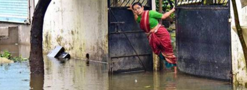
- Context: In the wake an unprecedented flood like situation and record rainfall this season, the State government will constitute a task force of local and global experts to study impact of climate change on Mumbai.
What the Task Force Will Do?
- The task force will study measures taken against flood and unplanned reclamation in cities such as Venice, Geneva and London, and coordinate with the European Climate Change Programme of the European Union to prepare a blueprint.
- The task force will be set up by the Environment Department in coordination with Mumbai First, a not-for-profit policy influencing think tank.
What is Urban Flooding?
- Flooding is an accumulation of water in an area either by direct rainfall irresistible to the volume of drainage systems or a spill of huge amount of water from water bodies beyond normal limits.
- It could be localized, impacting a small area or could be vast or massive, impacting very large area. Urban flooding is caused by heavy rainfall overwhelming drainage capacity.
- Urban flooding is one of the types of flood.
- Urban flooding is the inundation of property in more densely populated areas caused by rainfall and sometimes triggered by events such as flash flooding or snowmelt.
Impacts of Flood:
- It already has large economic and social impacts.
- These are very likely to increase if no changes are made to the unplanned development of buildings and infrastructure and poor management of urban drainage.
- Urban floods are a great disturbance of daily life in the city.
- Urban flooding is a condition that has repetitive impacts on communities. Urban areas are densely populated and people living in vulnerable areas suffer due to flooding. It is not only the event of flooding but the secondary effect of exposure to infection also has its toll in terms of human suffering.
- Damage to vital infrastructure, loss of life and property.
- Disruption in transport and power and incidence of epidemics, loss of livelihood.
- Urban flooding cause localized incidents to major incidents, resulting in cities being inundated from hours to several days.
- Deterioration of water quality and risk of epidemics.
- Temporary relocation of people, damage to civic amenities.
Natural causes:
- Meteorological Phenomenon: Cyclone like Ockhi, Roanu, Vardah making landfalls in coastal areas induce heavy rainfall finally leading to flooding.
- Excessive rainfall in some cases.
- Change in course of river: Eg: Kosi in Bihar
Man-Made Causes are as Follows:
- More migration causes reduced availability of land and it finally leads to more encroachment of water bodies.
- Disposal of waste results in waste clogging the natural channels and stormwater drains.
- Encroachment:
- More migration -reduced availability of land – higher economic value of land – more encroachment of water bodies – reduced economical services from water bodies.
- Eg-Charkop Lake in Maharashtra, Ousteri Lake in Puducherry, Deeporbeel in Guwahati are well known examples of encroachment.
- Illegal mining activities and Illegal construction have an extremely damaging impact on the water body.
- Sudden release or failure to release water from dams can also have a severe impact.
- The badly planned construction of bridges, roads, railway tracts causes drainage congestion.
- Unplanned release of water from dams and unplanned tourism activities
- Absence of drainage and stormwater network in many places.
- Rapid urbanization causes permeable soil surfaces being replaced by impermeable concrete floors leads to urban flooding.
- Increase in urban rainfall extremes and temperature.
Action That Needs To Be Taken:
- Create flood plains and overflow areas for rivers and separating rainwater from the sewer system.
- Install water infiltration and attenuation systems, Sustainable drainage: permeable pavement, sidewalks, and gardens.
- Strong laws should be in place to protect urban lakes the water bodies.
- The catchment and feeder channels need to be protected.
- There is a need to set up an umbrella authority to protect and conserve the water bodies.
- Funds should be provided for water supply to only those cities that have brought their own water sources under protection.
Conclusion:
- Floods in India are an outcome of both natural and man-made changes.
- However, the latter has been more responsible for floods in the current age of Anthropocene.
- Thus, a comprehensive urban planning which reconciles both environment and economic needs is required.
KOSI-MECHI RIVER INTERLINKING PROJECT
08, Aug 2019
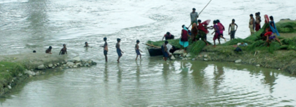
Why in News?
- The Centre has approved the Rs 4,900 crore project for interlinking of Kosi and Mechi rivers of Bihar.
- This is the second major river interlinking project in the country to be approved after the Ken-Betwa project in Madhya Pradesh.
Kosi-Mechi River Interlining Project:
- Bihar has got the final remaining mandatory techno- administrative approval for the project from the MoEFCC.
- The central government has approved construction of 76.20 km canals on eastern bank of Kosi for irrigation purpose, the minister said.
- Being a green project, it will not displace people nor require acquisition of forest land.
- The total land requirement is about 1,396.81 hectares.
Benefits of the project:
- The project will not only prevent recurring floods in north Bihar, but also irrigate over 2.14 lakh hectares of cultivable land in Araria, Purnea, Kishanganj and Katihar districts, collectively called Seemanchal region.
- The project is aimed at alleviating hardships of the people resulting from the floods and has the potential to usher in a green revolution in Seemanchal region.
- This project will provide a diversion to the surplus water of Kosi River through existing Hanuman Nagar barrage to Mechi River of Mahananda basin.
- Mechi River will get water from another source and it will become a vast natural resource of irrigation.
- There are no national parks, wildlife sanctuaries or eco-sensitive zones within 10 km radius of the project.
Move for a National Project:
- Bihar is pitching the river interlinking project for the national project & status and in that case the majority funding of the project will be borne by the Centre.
- The fact that the entire command area is contiguous to Indo-Nepal international boundary is a critical aspect that the Government of India would likely take special note.
EUROPE HEATWAVE
02, Jul 2019
- Context: A massive heatwave has gripped Western European countries and caused severe heat warnings in several parts of Europe.
What is a Heatwave?
- A heat wave is a period of Unusually Hot Weather that typically lasts two or more days. To be considered a heat wave, the temperatures have to be outside the historical averages for a given area.
- Classifying a heat wave varies from country to country, because what is seen as extremely hot in one place may seem within normal range in another.
- WMO listed several factors to be considered while analysing heatwave. These include defining a specific threshold for variables such as temperature to be considered extreme, as well as a human perspective of extremes.
How India Meteorological Department Declares Heatwave?
- The India Meteorological Department does not consider a heatwave unless the maximum temperature crosses 40°C in the plains and 30°C in the hills.
- Where the normal maximum is 40°C or less, the heatwave departure from normal is 5°C to 6°C and the severe heatwave departure is 7°C or more.
- Where the normal maximum is more than 40°C, the heatwave departure from normal is 4°C to 5°C while the severe heatwave departure is 6°C or more.
- In places where the maximum temperature reaches 45°C or more, the IMD declares a heatwave irrespective of the normal.
What are the health hazards of heatwave?
- The heat poses a risk to people’s health, agriculture and the environment. It is the departure from normal — or what people are used to — that makes heatwaves dangerous.
- Babies and older people are particularly vulnerable because their bodies are not as well able to regulate their own temperatures as those of young adults.
- High temperatures can cause exhaustion, heat stroke, organ failure, and breathing problems.
The European Heatwave:
- According to the World Meteorological Organization (WMO) the heatwave in Europe is a result of Warm Air Masses from Africa and more such events are expected to follow during this northern hemisphere summer.
- The heatwave in Europe follows extreme heat episodes in India, Pakistan, parts of the Middle East and Australia.
- According to WMO its too early to blame Climate Change for these trends. However, the WMO agreed that the heatwave is consistent with climate scenarios which predict more frequent, drawn out and intense heat events as greenhouse gas concentrations lead to a rise in global temperatures.
- Apart from heatwaves, various climate models have predicted alternating periods of prolonged droughts and heavy flooding in some areas.
Central Equipment Identity Register (CEIR)
23, Jun 2019

Why in News?
- In a bid to curtail the rampant cloning and theft of mobile phones across the country, the Telecom Ministry is ready to roll out a Central Equipment Identity Register (CEIR) — a database of IMEIs, the 15-digit numbers that uniquely identify each mobile device.
Central Equipment Identity Register:
- The concept of a central identity register is advocated by the GSM Association (GSMA), a body representing mobile operators, equipment manufacturers, and software and internet companies, among other stakeholders in the telecom ecosystem.
- In India, the plan to prepare the registry of mobile identification numbers was first conceived in the National Telecom Policy-2012.
- A pilot for the project was developed and conducted by state-owned BSNL’s IT Project Service unit in Pune. In the interim budget for 2019-20, the government allocated Rs 15 crore to the DoT for the CEIR project.
Significance:
- The theft and cloning of mobile phones have become a serious problem.
- The theft of mobile phones is not just a financial loss but also a threat to personal life of the citizens as well as national security.
How will Database work?
- In line with global practices, DoT’s identity register will be a database of IMEI numbers that will consist of three lists – white, grey and black.
- Mobile phones with IMEI numbers in the white list will be permitted for use, while those in the blacklist will be the ones that are reported stolen or lost and will not be allowed to access the network.
- Devices with IMEI numbers in the grey list will be the ones that do not conform to standards but will be permitted to connect under supervision.
Utility of CEIR:
- Once implemented in the coming weeks, consumers in India whose mobile phones are lost or stolen can inform the Department of Telecom (DoT) via a helpline number after filing a report with police. The DoT can then blacklist the IMEI number, effectively blocking the mobile device from accessing any cellular network in the future.
- The CEIR will have access to GSMA’s global IMEI database, allowing comparison of IMEI numbers to identify counterfeit devices.
IMEI:
- The International Mobile Equipment Identity or IMEI is a number, usually unique to identify 3GPP and mobile phones, as well as some satellite phones.
- GSM networks use the IMEI number to identify valid devices, and can stop a stolen phone from accessing the network.
- For example, if a mobile phone is stolen, the owner can have their network provider use the IMEI number to blacklist the phone.
- This renders the phone useless on that network and sometimes other networks, even if the thief changes the phone’s subscriber identity module (SIM).
- The IMEI only identifies the device and has no particular relationship to the subscriber. The phone identifies the subscriber by transmitting the International mobile subscriber identity (IMSI) number, which it stores on a SIM card that can, in theory, be transferred to any handset. However, the network’s ability to know a subscriber’s current, individual device enables many network and security features.
INDIA’S FOREST COVER INCREASED
22, Jun 2019

Context:
- Forest cover of India increased by 2%
State of Forests Report:
- Is a biennial publication of FSI, an organization under MoEFCC, GoI. ISFR 2017 is the 15th in the series since 1987
- Forest cover of the country is mapped through indigenous RESOURCESAT -2 satellite
- data with a LISS III sensor.
- The LISS-III (Linear Imaging Self Scanning Sensor) sensor is an optical sensor working in four spectral bands (Green, Red, near Infrared and short-wave infrared). It covers a 141km-wide swath with a resolution of 23 metres in all spectral bands.
- It provides the estimates of
-
- Growing stock within and outside the forest areas
- Special thematic information on forest cover in hill,
- tribal and north eastern states
- Carbon Sink
- Bamboo
- Mangrove cover
Recorded Forest Area and Forest Blank
- The area recorded as “forests” in the Government records is called Forest Area or Recorded Forest Area.
- The patches within the forest area which have little or no trees are called “Forest Blank”
The report for the First Time Contains:
- Information on decadal change in water bodies in forest during 2005-2015
- Forest fire
- Production of timber from outside forest
- State wise carbon stock in different forest types and density classes
Classification of Forest Cover into density classes
- Very Dense (Canopy Density > 70%)
- Moderate Dense (Canopy Density 40% to 70%)
- Open Forest (Canopy Density 10% to 40%)
- Scrub: Degraded forest lands (Canopy density <10%) Non-forest: Lands not included in above classes
Top Five States / UTs that have shown the maximum increase in forest cover are:
- Andhra Pradesh (2141 sq.km)
- Karnataka (1101 sq.km)
- Kerala (1043 sq.km)
- Odisha (885 sq.km)
- Telangana (565 sq.km)
Top 5 States where Forest cover has Decreased are:
- Mizoram (531 sq.km)
- Nagaland (450 sq.km)
- Arunachal Pradesh (190 sq.km)
- Tripura (164 sq.km)
- Meghalaya (116 sq.km)
Top three states/UTs having the largest forest cover in terms of area are:
- Madhya Pradesh (77414 sq.km)
- Arunachal Pradesh (66964 sq.km)
- Chhattisgarh (55547 sq.km)
Important Terms: / Canopy and Canopy Density:
The cover of branches and Foliage formed by the crown of trees is called Canopy. The percentage area of land covered by the canopy of trees is called Canopy density.
Forest Cover:
- All lands which are More Than 1 Hectare in Area and with a Canopy density of more than 10% irrespective of the ownership and legal status is called Forest Cover.
- Also, it does not make any distinction whether the forest is natural or manmade forest, government or private, recorded or not recorded. It includes bamboo, orchards, palm etc.
Carbon Stock:
- It is defined as the amount of carbon stored in the ecosystem of the forest especially in living biomass and soil
INDRAYANI RIVER
17, Jun 2019
- UPSC Questions Related to rivers -cultural place associated, historic place associated, tributaries, National parks, wild Sanctuary, Biosphere.
- UPSC Question on Rivers- Chandrabhaga 2019, Cauvery 2019, Yammuna 2016, Bhramaputra 2017,
Context:
- Incident in which around 4,000 fishes died in Indrayani River, Maharashtra.
About:
- Indrayani river is one of the important place where holy Pandarpur with cultural significance is located. Indrayani river joins Bhima River, which is tributary of Krishna River
Bhima River:
- Bhima River originates in Bhimashankar hills near Karjat in Maharashtra Holy City of Pandharpur is on the bank of Bhima River
- Bhimashankar is one of the twelve esteemed Jyotirlinga shrines
Krishna River:
- It is the fourth largest river in India after the Ganga, Godavari and the Narmada Krishna River rises at Mahabaleswar in district Satara
- It flows through Maharastra, Andhra Pradesh, Telangana and Karnataka.
- Home to Ancient Satavahana and Ikshvaku Dynasty kings. Vijayawada is the largest city
Narmada:
- Krishna River rises at Mahabaleswar in district Satara
- It flows through Maharastra, Andhra Pradesh, Telangana and Karnataka.
- Home to ancient Satavahana and Ikshvaku Dynasty kings. Vijayawada is the largest city
Places Associated with Indrayani River:
- Bhaja & Kanheri Caves
- Rock cut architecture in India
- Bhaja Caves located at the Valley of Indrayani River, near Lonavala Approximately 2,200 years ago, circa 200 BC
- Chaitya and Viharas
TANKER ATTACKS IN GULF OF OMAN
15, Jun 2019
- Gulf of Oman: Connects Arabian Sea to the Persian Gulf. One of the main trade routes for the oil producing countries such as Saudi Arabia, Iran, Bahrain, Qatar etc.
- Neighboring countries: Oman, UAE, Pakistan and Iran.
- Strait of Hormuz: Connects Gulf of Oman to the Persian Gulf.
- Background of the attacks: Ongoing sanctions on Iran by the U.S due to the withdrawal of U.S from the JCPOA. Also, the escalating tension in the Persian Gulf between the Saudi Arabia (backed by US and other western nations) and Iran (backed by Russia and China).
- CENTCOM: U.S central command, which is its premiere warfighting combat command. It is deployed in the Central region of Asia to protect the interests of U.S allies and to check the growth of extremist organisations from the region.
GOVT MAKES FULL-BODY SCANNERS MANDATORY AT 84 AIRPORTS IN NATION TO SCREEN AIR TRAVELLERS
02, Jun 2019

Why in News:
- The government has made it mandatory for 84 airports in the country to install full-body scanners to screen air travellers within a year and issued a standard operating procedure for their use.
Background: / Global standard:
- This equipment will replace walk-through metal detectors and passengers will have to
remove shoes, belts, jackets, thick clothing and be “divested” of all metallic items. - As a matter of fact, this is a practice at most prominent airports across the world.
- However, 10% of passengers will also be subjected to full pat-down searches at random.
Advantages of body scanners:
- It is important to note that walk-through metal detectors and hand-held metal detectors cannot detect non-metallic weapons and explosives. On the other hand, body scanners detect both metallic and non-metallic items concealed on the body.
A Safeguard towards ensuring Privacy:
- Following concerns over these machines generating naked images of passengers, the Bureau of Civil Aviation Security (BCAS) has mandated privacy filters.
- As a result, these scanners will produce only an outline or a mannequin-like image, which is the same for all genders. A yellow box appears on the body image to highlight areas that may need further screening.
- The scanner shall provide image-free solution using a generic mannequin. Threats shall be graphically presented.
Technology which these scanners will use:
- These scanners use millimetre wave technology, which means passengers will not be subjected to harmful X-ray radiation, and the machine is safe for use by all, including pregnant women.
- These scanners will help airports improve passenger throughput as they are required to screen a passenger in eight seconds and 300 passengers per hour, according to the technical specifications spelt out by the BCAS.
Jal Shakti’ Ministry to deal with integrated water issues
01, Jun 2019
Why in News:
- A new ‘Jal Shakti’ Ministry, in which the erstwhile Ministries of Water Resources and Drinking Water and Sanitation will be merged, has been formed
Details:
- Mr. Shekhawat took charge of the Ministry
- The remit of the Ministry will encompass issues ranging from international and inter-State water disputes, the Namami Gange project, the flagship initiative to clean the Ganga, its tributaries and sub-tributaries and the provision of clean drinking water.
- Mr. Shekhawat said that the priority would be to provide clean drinking water to everyone.
REGISTRATION SOFTWARE HELPS UNEARTH ILLEGAL ABORTIONS IN TIRUVANNAMALAI
30, May 2019

Why in News:
- Every pregnant woman has to register on a software, PICME (Pregnancy and Infant Cohort Monitoring and Evaluation), in Tamil Nadu.
Background: / Pregnancy and Infant Cohort Monitoring and Evaluation:
- PICME or Pregnancy and Infant Cohort Monitoring and Evaluation (PICME) is a system deployed by the Tamil Nadu government to track all pregnant women. Pregnant women can register on https://picme.tn.gov.in/ right from inception of pregnancy until obtaining birth certificate for the new born. Persons registered under PICME are provided with a 12 digit RCH ID, which is be used to track all aspects of the pregnancy by the Public Health Department.
PICME Registration
- Expectant mothers can get PICME registration through the nearest government health care centers, hospitals and primary health care centers. Expectant mothers can also contact the local nurses or Aanganwadi center workers for collecting the 12-digit registration code. Finally, the application is also available at all village level CSC (Common Service Centers).
- Once, registered on the system, the expectant mothers can also avail benefits under the RCH scheme. Further, mothers registered on PICME will be monitored by local nurses during ante-natal stage. The nurse can also help you upload the document details on the official (Pregnant and Infant Cohort Monitoring and Evaluation) software.
Birth Certificates:
- Obtaining birth certificate for any child born from a mother having PICME registration is simple. After birth, the expectant mother can provide the RCH ID to easily obtain birth certificate for the new born.
Dr. Muthulakshmi Reddy Maternity Benefit Scheme
- In addition to providing access to good healthcare during pregnancy, expectant mother registered under PICME having financial requirement can avail benefits under the Dr. Muthulakshmi Reddy Maternity Benefit Scheme. Under the scheme, financial assistance of upto Rs.12,000 is provided by the Tamil Nadu government for expectant mothers as under:
- The first instalment of Rs.4000 will be given to every pregnant woman, who avails all required health services during 7th month of pregnancy.
- The second instalment of Rs.4000 will be given to the mother after delivery who delivers in Government / Local Body Institutions.
- The third instalment of Rs.4000 will be given to the mother on completion of third dose of DPT, Hepatitis and Polio vaccine for the child.
- PICME registration is mandatory for obtaining the above benefits and financial assistanceunder the Dr. Muthulakshmi Reddy Maternity Benefit Scheme.
EYE ON THE MONSOON
21, May 2019
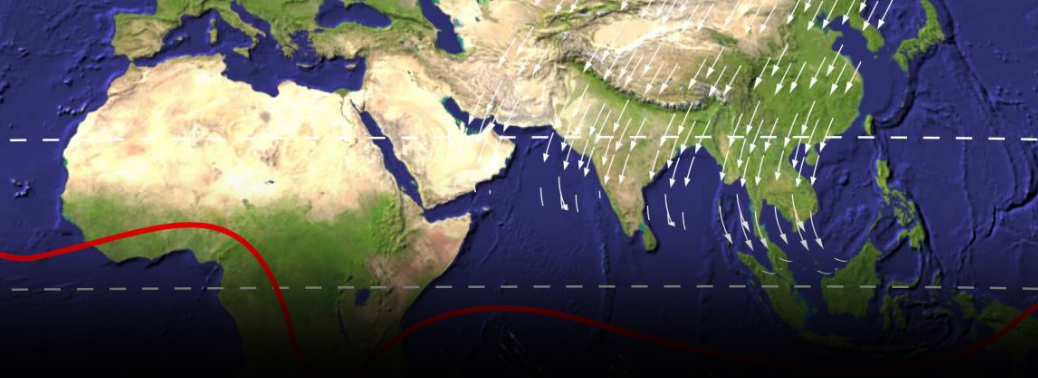
Why in News:
- The India Meteorological Department has forecast normal rainfall of 96% of the long period average of 89 cm rain in Kerala. It has also signalled a significant possibility of a deficit.
Details:
- India waits for the arrival of the annual summer monsoon, hopes are high for normal rainfall that is so vital for agriculture, the health of forests, rivers and wetlands.
- The monsoon is crucial for the 60% of gross cropped area in farming that is rain-fed and in the assessment of the National Commission on Farmers which has 45% of agricultural output. Some aerosols suppress the rainfall and disperse it across the land, causing long breaks in precipitation, while others absorb heat and lead to a convection phenomenon that increases rainfall in some places.
Way forward:
-
The southwest monsoon is a determinant of India’s overall prosperity, and sustained efforts
to make the best use of rainfall are absolutely important for farms, cities and industry. - There has been a 52% decline in groundwater levels. State governments should have pursued the setting up of new recharging wells and made improvements to existing ones on a war footing.
- There is a lag in building structures to harvest surface water and helping farmers raise the efficiency of irrigation.
- India needs to clean up its act on rising industrial emissions, and burning of fossil fuels and biomass in order to improve the stability of the monsoon.
-
NITI Aayog says that freshwater availability for households, account for 4% of available supplies, besides 12% used by industry.
Urbanisation trends and the severe water stress that residents experience underscore the need for mandatory rainwater harvesting policies and augmented efforts by States to preserve surface water by building new reservoirs.
Monsoon:
- Monsoon is the lifeline of Indian economy as 2/3rd of it depends on farm income and rain is the only source of irrigation for over 40% of the country’s cropped area.
- Over 70% of India’s annual rainfall occurs in July-September monsoon season.
- A good monsoon increases crop productivity, raises farm income and drives the economy while, a weak monsoon inflates food prices and harms the economy.
- Monsoon refers to the seasonal reversing wind accompanied by precipitation.
- It occurs due to a difference in temperature between the landmass and the ocean. Major monsoon of the world are West African and Asian-Australian monsoons.
- Southwest monsoon accounts for over 80% of rainfall in India. Monsoon impacts Indian economy- agriculture, industry and society as a whole. It brings respite from heat and transforms large part of semi-desert areas into green land.
- Crops specially like cotton, rice, oilseeds, and coarse grains depends heavily on rains.
- Monsoons are often associated with conditions like ‘El Nino’ (Spanish for ‘Little Boy’) that occurs every 2 to 7 years and La Nina. It is caused by unusual warming in Eastern tropical Pacific Ocean and reversal of prevailing winds in the region. El Nino can trigger above average rains in northern Peru & draught in Southeast Asia, Australia and India.
Southwest monsoon/ Indian monsoon:
- Indian subcontinent has a large heated landmass during the summer months (April to September), and a cooler water mass in the form of Indian Ocean.
- This causes a temperature difference, which creates a pressure gradient and drives moisture laden winds over Indian subcontinent. Impact of this monsoon is felt in India, Sri Lanka, Bangladesh and Myanmar and as far north as in China’s Xinjiang.
- It has two branches:
The Arabian Sea branch:
- It first hits the Western Ghats and Kerala gets the first rain in India. It causes rain in the coastal areas of Konkan and Goa
As it moves northwards, but eastern part of the Western Ghats do not receive much precipitation.
The Bay of Bengal Branch:
- It picks up moisture-laden winds from Bay of Bengal and moves towards North-East India and Bengal. The Himalayas act as a barrier for them and thus, rain occurs in Indo- Gangetic plains, Meghalaya, etc.
Northeast monsoon/ Retreating monsoon:
- The cycle is reversed during colder months (October to April). Wind blows from cooler landmass (Himalayas and Indo-Gangetic plain) towards Indian ocean (south of Deccan). This causes precipitation over the oceans and in regions like Tamil Nadu.
HIT BY CYCLONES, SALT FARMERS LOOK TO GOVT. FOR HELP TILL MAY 30
15, May 2019
Why in News?
- Several salt farmers have been facing untold miseries with about 600 manufacturing units suffering damage due to cyclonic storms Titli and Fani.
Details:
- The authorities concerned have not taken up enumeration of the losses.
- Around 250 farmers lost their livelihood and urged the State and Central governments to come to their rescue.
- The government has assured that a delegation of the association would go to New Delhi very soon to explain their grievances and fixation of compensation for the units which were damaged during the two cyclones.
Fani Cyclone:
Tropical Cyclones:
- Cyclones are formed over slightly warm ocean waters.
- It depends on the temperature of the top layer of the sea, up to a depth of about 60 metres. This has to be at least 28°C to support the formation of a cyclone.
- This explains why the April-May and October-December periods are conducive for cyclones. Secondly, the low level of air above the waters needs to have an ‘anticlockwise’ rotation in the northern hemisphere and vice versa.
- During these periods, there lies the Inter-Tropical Convergence Zone (ITCZ) (a low pressure zone) in the Bay of Bengal region, which shifts with seasons.
- The southern boundary of the zone experiences winds from west to east and the northern boundary from east to west. The ITCZ and the resultant wind pattern induce the anticlockwise rotation of air.
- Once formed, cyclones in this area usually move northwest.
- As it travels over the sea, the cyclone gathers more moist air from the warm sea, and adds to its strength.
How and why is Fani different?
Tropical cyclones in the Bay of Bengal are graded according to maximum wind
speeds at their centre as follows:
- 1.Depressions – 30 to 60 km per hour (kph)
- 2. Cyclonic storms – 61 to 88 kph
- 3. Severe cyclonic storms – 89 to 117 kph
- 4. Very severe cyclonic storms – 118 to 166 kph
- 5. Extremely severe cyclonic storms – 167 to 221 kph
- 6. Super cyclones – 222 kph or higher
- Fani is now categorised as an “extremely severe cyclone”.
- It is expected to generate storms with wind speeds as high as 200 km per hour.
- It has the potential to cause widespread damage in Odisha and neighbouring states.
- Given the above discussed reasons, a cyclone of this nature is unusual for April-May cyclones in India.
- Fani is different mainly on account of its place of origin, and the route it has taken.
- Origin – The in situ cyclonic systems in the Bay of Bengal usually originate around latitude 10° N (in line with Chennai).
- But Fani originated quite close to the Equator, around latitude 2° N, well below the Sri Lankan landmass.
- The forecast landfall on the Odisha coast is at a latitude of almost 20°N.
- As it has originated very close to the Equator, it has taken a long route to reach the landmass.
- Resultantly, it has traversed a long way on the sea, and thus gained more strength. Route – Fani was initially headed north-westwards, towards the Tamil Nadu coast.
- But it changed its course midway and moved northeast away from the coastline to reach Odisha.
- The recurve it has taken gave it more time over the sea and has ensured that it has gathered unusual strength.
INFOSYS FOUNDATION’S FCRA LICENCE CANCELLED
14, May 2019

Why in News:
- The Home Ministry has cancelled the FCRA licence of Infosys Foundation after a request was made by the not-for-profit initiative of the IT major.
background:
- The Foreign Contribution Regulation Act (FCRA) enables an association or an NGO to receive foreign funds, and they have to mandatorily register under it to receive such funds.
FCRA license:
- Foreign Contribution Regulation Act (FCRA) is a consolidating act passed by the Government of India in the year 2010. It seeks to regulate the foreign contributions or donations and hospitality (air travel, hotel accommodation etc) to Indian organizations and individuals and to stop such contributions which might damage the national interest. It is an act passed for regulating and prohibiting the acceptance and utilization of foreign contribution or foreign hospitality by companies, associations or individuals for such activities that could prove to be detrimental to the national interest and for matters connected therewith or incidental thereto.
- Since the Act is internal security legislation, despite being a law related to financial legislation, it falls into the purview of Home Ministry and not the Reserve Bank of India (RBI).
Need for FCRA:
- The act aims at keeping a check on foreigners influencing the Indian electoral politics, journalists, public servants etc. for wrong purposes or activities detrimental to the public interest. Those violating the provisions of FCRA can be jailed up to a term of 5 years.
Salient features of FCRA 2010:
- The FCRA was enacted in 1976 in order to maintain strict control over voluntary organisations and political associations that received foreign fundings. In the year 1984, an amendment was made to the act requiring all the Non-Governmental Organisations to register themselves with the Home Ministry. In 2010, the act was repealed and a new act with strict provisions was enacted.
- Here is a brief introduction to the provisions of the FCRA 2010:
- A provision was made for the cancellation of registrations of NGOs if the Home Ministry believes that the organisation is political and not neutral.
- The registration certificate granted to the NGOs under the 2010 act came with a five-year validity.
- A provision was inserted stating that the assets of the person who has become defunct needs to be disposed of in a manner stated by the government.
- A separate account needs to be maintained by the organisations to deposit the Foreign Contributions received and no other funds except for Foreign Contributions shall be deposited in that account.
- Every bank would be obligated to report to the prescribed authority, the amount of foreign remittances received and other related details such as the source, manner of receipt etc.
- Who can accept Foreign Contribution?
- Organizations working for definite cultural, social, economic, educational or religious programs, if and only if they are
Registered with the Home Ministry - Maintaining a separate account listing the donations received from foreigners, getting it audited by a Chartered Accountant and submitting it to the Home Ministry, every year.
Who are debarred from receiving Foreign Contribution?
- Candidate contesting an election
- Cartoonist, editor, publishers of registered newspaper
- Judge
- Government servants or employee of any corporation
- Member of any legislature
- Political parties


